Human History X: The Mapmakers
There are known knowns, there are things that we know we know. We also know there are known unknowns; that is to say, we know there are some things we do not know.
But there are also unknown unknowns, the ones we don't know we don't know.
hic sunt dracones

Once there was a emperor who sought a perfect map of his empire. The best cartographers in all of the empire were summoned and commanded to produce their finest work. Yet no matter how detailed, how precise, how elaborate, the Emperor remained unsatisfied. He demanded better maps, bigger maps, more accurate maps. His obsession grew. He hired platoons of explorers to delve into every nook and cranny of his empire, every cave, every hamlet, every forest, every tree. It was still not enough. Soon, he had an entire island set aside to recreate a map of his empire -- but even that was not enough. The Imperial sorcerers were commanded to follow the designs of the cartographers and recreate every detail of his empire in every detail, truly perfect, accurate to the nearest pebble, the nearest hut, to the nearest woman and man and child.
At length, the emperor had his perfect map. It was as vast and as complex as the empire itself -- which would have been a very fine thing indeed if what he had wanted was a second identical empire. Unfortunately for the emperor, what he wanted was a map.
Moral of the story? Mad emperors shouldn't get whatever they want -- but alas, they do.
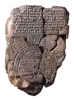
What is a map? If you've been reading my Human History X posts, you might notice that I have adopted (or at least aspired to adopt) Venkatesh Rao's trick of redefining a long-established term to make people look at it from a new angle. Thus, this is the part of the proceedings where I don't go to the the Oxford Dictionary to grab the definition of "map."
No, this is the part where I say something like "Maps are really just physical representations of how our brains understand geography" or "Maps are useful abstractions of physical space" or if I wanted to get real fancy, I'd say something like: "Yeah, so, like, you know how human intelligence is a brittle collection of imperfect hacks that together mimic a surface understanding of physical reality? Yeah, maps are like taking a pencil rubbing of that." and then I'd make a really smug facial expression and then you'd rightly punch me in the face.
That said, if you do want to use any of the above definitions, I won't stop you 😄
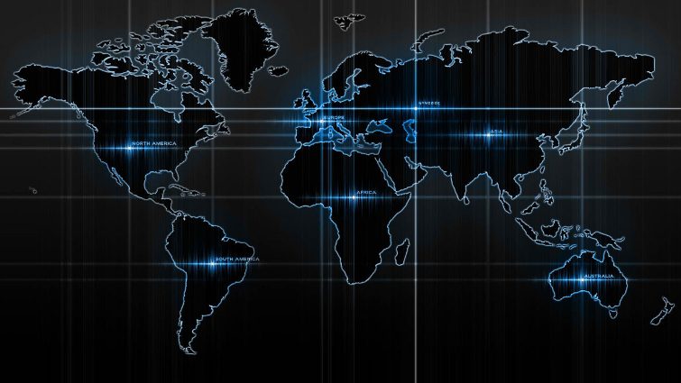
If you've been so kind as to read my Magic of Maps and Money post, then you know something of the use to which maps (or rather, mapping) is being put today. For our purposes today, we're starting a little further back, working our way forward and then climbing high to get a look at it from above.
Like, you know, a map 😄
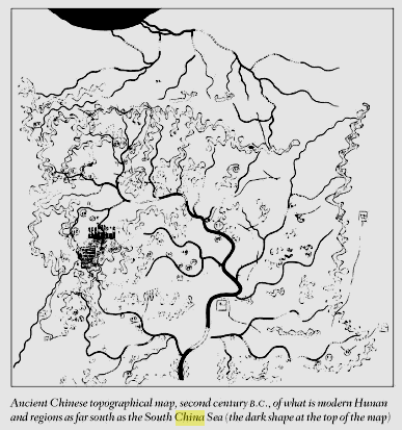
I have said before that humans are the storytelling animal and that remains true here because the urge to make maps comes from the same place as the urge to make stories. The storytelling impulse comes from the need to frame events into narrative and narrative into meaning, strung along in order through time in order to understand ourselves and thus the past. "Who were my foremothers? Why am I here?" In a narrative, we follow the story through the eyes of mortals.
The mapmaking impulse emerges from the need to frame the known in space in order to better advance into the unknown. Maps are always about the vast horizon of the future and questions like: "Where am I going? Where do I go next?"
Those latter questions are in turn framed by the map's delineation of the space between known knowns and the boundaries of the known unknowns. These can only be seen from above through the eyes of the gods.
No wonder maps have so long been the province of those who thought so of themselves.
The history of map-making -- or rather our present-day best guess -- begins as far back as 2300 BC in ancient Babylonian clay tablets. The Greeks, the Mesopotamians, Romans, Egyptians and others all made attempts at mapping the world as they understood at the time. The parts they could infer but had yet to visit were referred to as terra incognita which I have always assumed translates as "unknown territory" or something like that.
Of course, given that the oldest cave art dates back to forty thousand years ago, I find it very hard to believe that our ancestors of that time didn't draw maps of some sort, even if just with sticks sketching in the mud as they calculated how to take down mastodons and mammoths. My subjective belief is that, by that token, maps are older than written language, possibly even older than spoken language. They could very well have been part and parcel of how both got started.
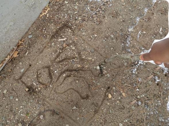
Cartography is the art and science of map-making. Unlike most uses of the term "art and science," for cartography that is literally true. It is a specialist field that combines a finely-tuned sense of aesthetics with all the iron precision of any engineer or architect. Also as with any engineer or architect, the project is invariably done in the service of conquerors.
Yes, you heard me.
The history of maps is the history of human exploration. A map is both the starting point for exploration and the record of it, thus explorers and cartographers were joined at the hip for much of human history. Juan de la Cosa for example was the owner and captain of one of the ships that took Christopher Columbus to the West Indies (and the history behind that name is in and of itself ... deeply annoying. My hatred for Christopher Columbus is unseemly considering that he is centuries dead but it remains strong nonetheless, fodder for another post)
Juan de la Cosa was also one of the finest cartographers of the 15th century. Among other things, his mappa mundi ("world map") was the first that we know of to depict the Americas after Columbus and co stumbled onto it.
I said earlier that cartography was necessarily a craft done in the service of conquerors. This much is true; their legacy is that of dominion; a brief glance at history will reveal that exploration has ever been followed by exploitation. The adventurers and explorers rarely stopped at pure observation and, even were they so inclined, the engines of opportunistic imperialism that followed in their wake most certainly were not. Push back the borders of the known and grind the unknown to dust before the crushing Sisyphean edge of the horizon.
Cartography is dominion.
NOPICTURES
Even well into the 20th century, almost every country's mapmakers drew their maps with their own country at the center, making themselves the hub of the wheel of the world. Now in the modern day that we have aircraft and satellites and lidar and drones, it's no longer about exploration but about profit and profit in this instance requires precision. The hairs get split thinner and thinner, the dragons (as in "here there be ...") are rooted out, floodlights of progress are shone upon the shadowed corners of the planet. The personality got taken out of it and the brute clarity of science brings the purity of truth.
Yet, maps remain maps, that is to say deeply limited Cliff's Notes iterations of dirtspace geography. They are reality-adjacent but they are not reality. After all, people get misled by GPS even today and Africa is still depicted much smaller than it actually is. If you have to ask why, consider who drew them and who used them and why. On a practical level, this is because they're still based on the Mercator Projection which was and is the standard for essentially all world maps since 1569. Like legacy code in a computer system, the Mercator Projection is old and established and difficult to replace given how many systems have accreted around it at this point. Not to mention that other projections come with their own inaccuracies due to the technical difficulties of depicting the surface area of a sphere on a flat rectangle.
All of which further proves the point that maps are not the territory.
Ah but forgive me, I have been heavy on the prose quasi-creative non-fiction. Permit me to throw in some of the science.
TYPES OF MAP
There are two main types of map. Well, more exactly there are two main types of cartography - General and Thematic. The former is pretty much exactly what it sounds like, a map for general consumption that depicts the geography of a given region so that the viewer knows what is where and in relation to what.
Thematic on the other hand is the meat of things, the specialist subject. In thematic cartography, a specific aspect of the region under observation is put under the microscope and examined in maximum detail to the exclusion of all else. Population maps, climate maps, transportation infrastructure etc. all fall under the category of thematic maps.
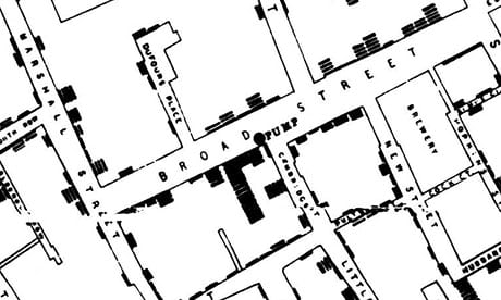
Thematic mapping in fact bridges the gap between data analysis and plain old find-your-way cartography. If general maps are a journey or an itinerary, thematic maps are a story -- a detective story. The map above is from a doctor's epidemiological study of how cholera spread through a neighbourhood population and it enabled him to discover the starting point of the plague - a contaminated well. With a thematic map, particular information has been gathered and presented across space and through time as well to reveal patterns and find answers.
I trust I am not boring you yet?
Thematic mapping goes deeper. We start to run into terms like univariate, bivariate and multivariate. The former is when we're just looking at one data type spread across the map. Bivariate is if we're looking at cholera rates and the distribution of, say, black people in that particular region. Multivariate would be cholera, black folk and, Idunno, rainfall rates or something.
With your permission, I'll also touch on how these maps are used to represent data. One popular kind (which has been essentially reinvented in the digital age as the "heat-map") is the choropleth. You've probably seen thematic maps where the data distribution under study was represented as different parts of the map being shaded in different colours and different shades of the same colour (mortality rates or voter turn-out maps for example?) That's your choropleth.
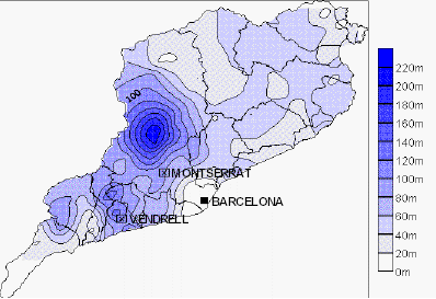
Isopleths by contrast are more about stuff that is continuous in how it increases and decreases across the region. Rainfall distribution is a good one.
There are more of course but this topic is vast and I don't want to turn this post into a tome. I invite you to check out the reference section below for further reading.

Remember that little story at the beginning of this thing (with apologies to Carroll, Borges and Gaiman by the way for my total ripoff of their respective homages?) The real moral of that story is that the world is big and we are small. We often have a hard time comprehending just how big.
References
http://academic.emporia.edu/aberjame/map/h_map/h_map.htm - Brief History of Maps and Cartography - ES 551 -- Haber, J.S. (2008)
https://www.loc.gov/rr/geogmap/guide/gmillint.html - Library of Congress, Geography and Maps
https://books.google.com/books?id=OG98OxaehFkC&dq=imago+mundi+%22the+mapmakers%22&source=gbs_navlinks_s - The Mapmakers - Wilford, J.N. (2001)
https://en.wikipedia.org/wiki/Cartography - The wikipedia entry on Cartography (yes, I know. Look, Wikipedia is fantastic, nothing more need be said)
https://www.theguardian.com/news/datablog/2013/mar/15/john-snow-cholera-map - John Snow's Data Journalism

Human History X: The Forgetful Storytellers
Human History X: The Users and The Used

Like what you just read and/or the seven day upvote window has expired? Donations of any size are always and equally welcome :D Descending order of preference if that matters to you:
Steem/SBD: @edumurphy
Dash: XdCpkRRxejck5tfXumUQKSVeWK8KwJ7YQn
ETH: 0x09fd9fb88f9e524fbc95c12bb612a934f3a37ada
Doge: DNwUsAegdqULTArRdQ8n9mkoKLgs7HWCSX
NKN: NaAKsxh3SycrXNkbJMxYsvfwWbDteBga8w (if you read this, ask me about NKN currency and Encocoin 😄)
BTC (if you really really have to): 1L9foNHqbAbFvmBzfKc5Ut7tBGTqWHgrbi


Wouldn't be surprised if you knew this, given the above, but Peter Thiel on maps is fun. In Zero to One he says that he thinks the absence of terra incognita on maps is harmful. It used to remind us that we didn't know everything about the world, but the absence of geographical frontiers lets us forget how many of the things in the world remain hidden, not merely from a few, but from everyone. So in a chapter about how it's unfortunate for society when people simply exploit existing knowledge rather than seek new knowledge:
Of course, given that this is Thiel, the plea to search for secrets and hidden knowledge is implicitly followed by the command to seek dominion.
Also, Borges is the best.
Interesting. Never really followed Thiel's work, just hearing of him in asides from stuff about other people. It all seems to be negative; like some kind of petty vindictive billionaire supervillain. Interesting parallels on dominion and maps -- and yes, he makes a valid point about us thinking that because we have satellites now that the entire world is mapped and known. For one thing, the entire fricking ocean is still right there but even aside from that, there are many parts of the map that are bigger or smaller or out of position compared to the dirtspace equivalent. Then of course, there's the simple case of being misled by GPS to prove the algorithms are far from perfect.
Maps, much like our own cognition, are an imperfect but fortunately-good-enough hack for navigating reality. Treating them as truly perfect is folly.
You received a 60.0% upvote since you are a member of geopolis.
To read more about us and what we do, click here.
https://steemit.com/geopolis/@geopolis/geopolis-the-community-for-global-sciences-update-2-higher-base-votes-new-logo
If you do not want us to upvote and comment on your posts concerning earth and earth sciences, please reply stop to this comment and we will no longer bother you with our love ❤️
Great article, I enjoyed the nice mix of technical and historical writing. You kept it fresh and interesting all the way through.
I make maps as a GIS tech for the city and this article hit close to home. Enjoyed!
I am very gratified that someone actually in the field thinks my layman flailings were worth reading. Much appreciated 🙌
intresting
Thanks 🤷
Hello! I am Akpan, and I work with a renowned curation guild in this community. Your post received a big upvote from @curie and its trails, because I proposed it for curation. I just featured the same post in my weekly Curator Remark Anthology and I thought you would want to check out why I picked your post among the hundreds I go through on an average week.
Wow! this is a very detailed and cool post. Thanks for posting it
Thanks! It took waaaaay more effort and time than it should have though; need to work on my time-management and organization better.
Good one boss @edumurphy, you write so well that am always eager to read your post..
Keep it up boss.. Resteeming all the way✊
Ndewo, meeehn. Thanks for the read and resteem!
Nice post really educative
Appreciate the upvote! 👍
Great one. You are one of a kind @edumurphy
I am very flattered at the notion. I hope not though; I need more people who like the exact same stuff that I like 😂
Now, this is a quintessential quality content.
I cut cap for u boss.
I appreciate your approval. We will all get there #missiontowhale2018 🙌