North, north, until the northernmost point: Ussuri Shoal
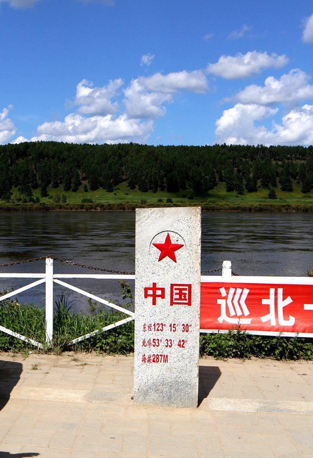
For a long time, I thought that the Arctic Village was the northernmost in China. Until 2016, the Ussuri shoal was built with a monument, engraved with a latitude of 53°33′42′′, while the latitude of the Arctic Village was 53°33′30′′. .
After a period of preparation at the end of July, drive with the old man north, along the northeast border line, all the way north, the purpose: China's northernmost point.
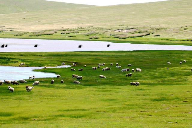
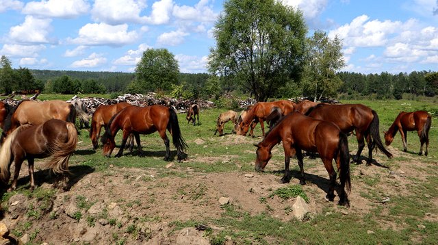
 Hulunbuir Grassland in the territory of Xinbaerhuyouqi
 Daxinganling
Daxinganling, northeast-southwest, is the watershed of the Inner Mongolia Plateau and the Songliao Plain. From the Huma County on the Heilongjiang River to the north, to the Inner Mongolia Keshiketeng. I used to go to Huanggangliang. I went to Huma County again this time. Daxinganling was passed. The key scenic spots are Ashchur Huanggangliang, Daqingshan, Aershan, Honghuaerji, Moerdaoyu and Ludingshan. The deepest part is between Genhe-Olunchun, Mohe-Tahe. Genhe is known as the "China? Cold Pole". There is no summer in the winter, and the spring and autumn are connected. The freezing period is over 210 days, and the extreme minimum temperature is -49.6 °C. Hawthorn is heavily important in Xing'an, and the forest is between the clouds. The air in Daxing'anling is pollution-free, and the mosquito bite is the most powerful. The river is clear, but the riverbed is mostly dark brown.
Aershan has now become a huge scenic spot. The National Forest Park has the Haraha River, Chai River, Yimin River, and many lakes, such as Tianchi, Du Fu Lake, Wusu Langzi Lake, Luming Lake, Songye Lake, etc., there are four major scenic spots: Motianling, Tianchi, Dufu Lake and Shitang Forest. So the forest park ticket of 285 yuan is still "value for money", it depends on whether you have time and interest. The price of accommodation in Aershan City is more than 300 yuan, and the price is high, but the number of people is limited to 7, 8 and 9 months. Under the prestigious name, it is actually difficult. At this point, you need to refer to Jia Pingwa's method: travel to the nameless landscape, save the tickets, do not look at people and are not seen. Where is the foot, where is the road, Xi Xiyan hooks the corner, listening to the sound of the birds before the wind.
The road to the Mohe River is 324 county roads, which pass through the forest. At the junction of Black and Mongolia, the terrain is high, and it is very far-sighted. This went to Dongshan and Beishan, and the mirror was strong and half-baked. The source of the white clouds has never been, and the only ones have been alone. The source of the white clouds is no exception, and the only ones are alone!
"China's northernmost point" is at the top of the Chinese territory "Chicken Crest". A place called Wusuli Shoal has a longitude and longitude on the inscription. There are large stone carvings on the east, west, south and north of China. The most east is in Fuyuan East Pole. The westernmost point is in Uchajal Kashtan, and the southernmost point is rather vague. The Xisha Islands that ordinary tourists can reach are the southernmost point. In fact, to be more realistic, the Sino-Russian border river Heilongjiang is bounded by the centerline of the main channel, and the "north point" should be somewhere in the centerline of the main channel. The westernmost point is not very accurate. The map should be at the junction with Tajikistan, not the current Irkeshtan port on the border with Kyrgyzstan. So the most X point is a rough, a symbol.

@wanwenguo, I gave you a vote!
If you follow me, I will also follow you in return!
Enjoy some !popcorn courtesy of @nextgencrypto!
em~~~~~~~