Trekking From Chamonix To Zermatt - Walkers Haute Route - Bonus Day
Finally we have our big day ahead! We all have waited for it a long time - some of us needed to have a day to rest, others just wanted to enjoy some epic views from highest trekking peak of European Alps!
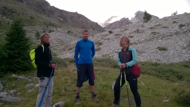
We woke up very early and at 6:27 AM, long before sunrise we were ready for action:
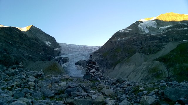
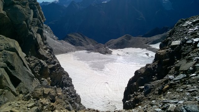
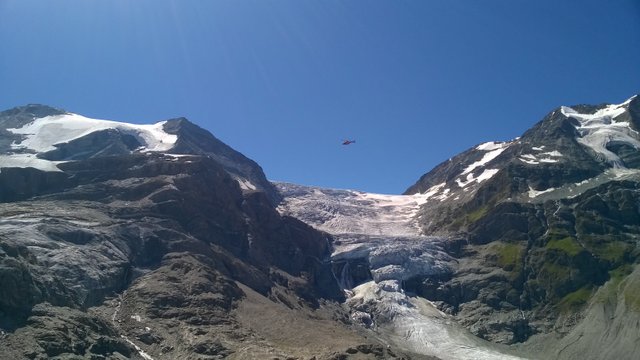
We started with fast pace uphill. Today we had only small bags with some warm clothing, snacks and drinks. 25 minutes later we already passed the glacier and continued uphill:
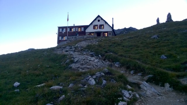
Another 25 minutes later we reached near Turtmannhütte (2519 m asl):
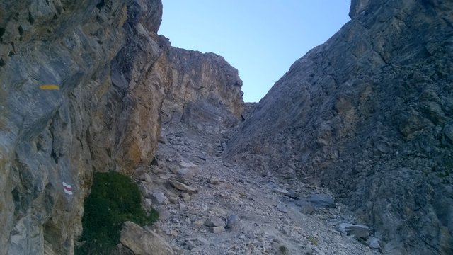
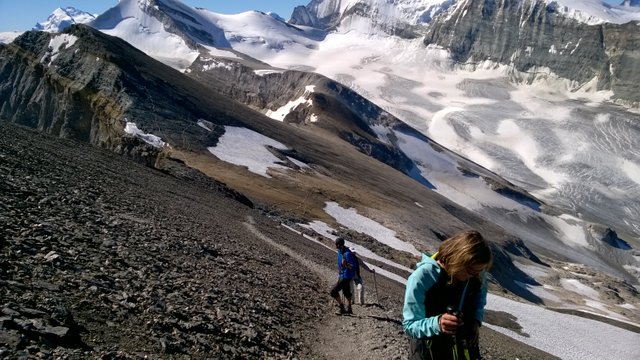
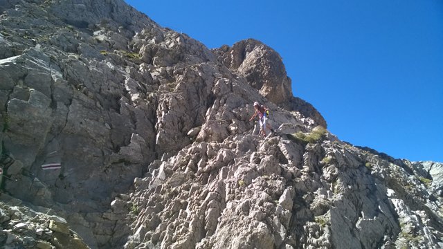
Very soon we met a very steep and serious gully to climb:
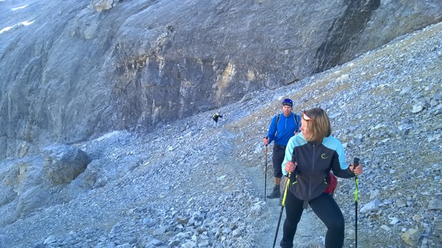
On the upper end of the gully we saw other trekkers to follow our trail:
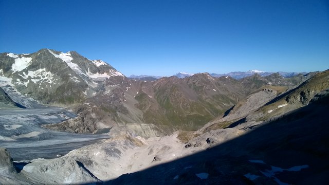
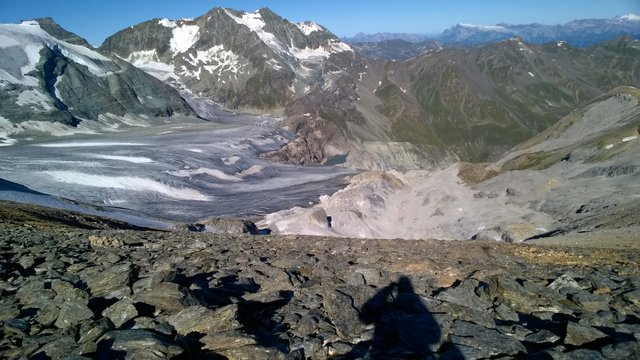
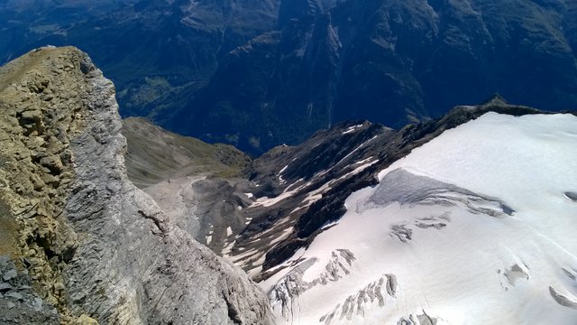
The scenery and views were fantastic on this altitude, but we had much higher to go:
We were still in the shade, but we had much hope to meet sunshine very soon:
And here are our first sunrays over the nearby pass:

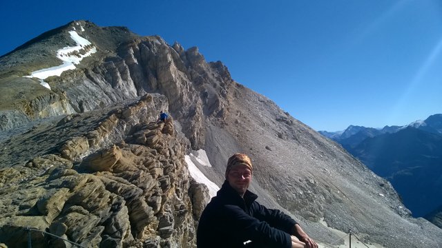
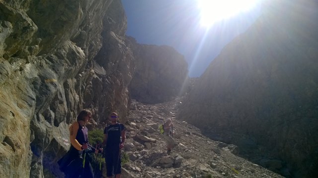
Finally we reached to Schöllijoch pass at altitude 3343 m asl to take a view of next valley:
This was a very nice place to take a breath and enjoy the best views:
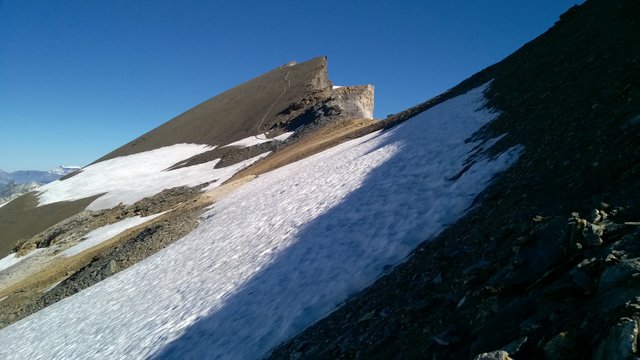
But we still had to continue till summit:
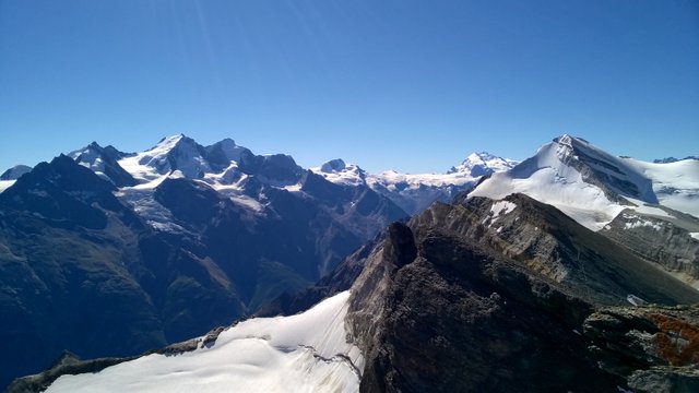
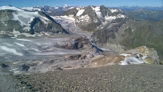
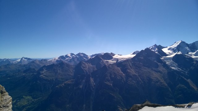
And eventually, after 4 hours of walk, we reached to summit (Üssers Barrhorn 3610 m asl) with fantastic vistas!
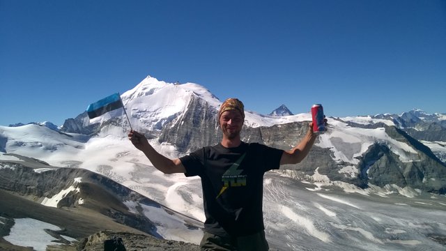
I hope, you don't mind, if I add some pictures with views to many different directions:
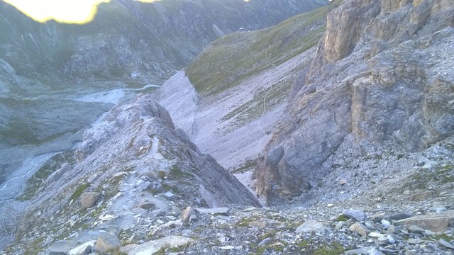
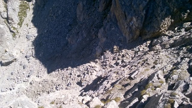
After spending 45 minutes on summit, we started our fast descent to base camp. We returned mostly the same way, so I made just a few pictures on descent. Trail was the same, but light was changed due to sunshine and I got some better pics of the gully on our way:
And once again I got a rescue workers on my pic:
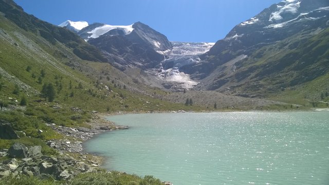
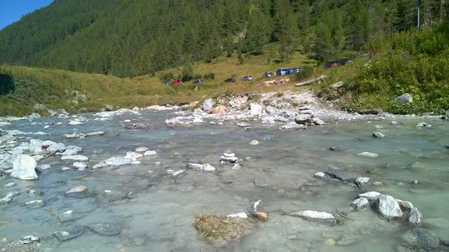
Very soon we were able to see our basecamp next to the lake:
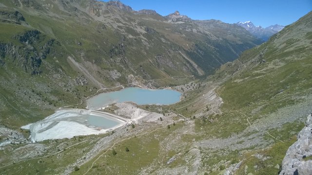
Without wasting too much time, we packed our camp together and continued our journy to meet the rest of our team, 5 km away. This is the last memory from our camp:
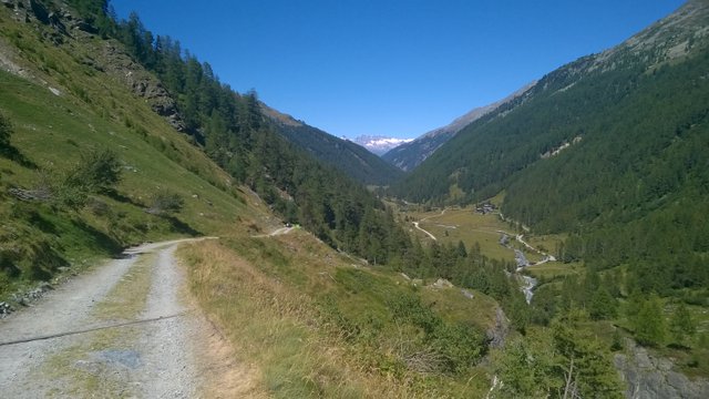
It didn't take a long time to find the fist marks of civilization:
We continued and saw the fist village on the distance:
Twenty minutes later we saw first cars again:
We still had some kilometers to walk and saw a warning sign on river bank:
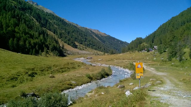
And very soon we had found our other group members on riverside and joined with their camp:
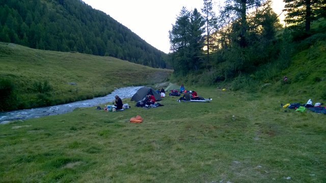
Do you see, how close we are to the river? We were just too tired to care about warning signs, but I don't recommend to use us as role models ;)
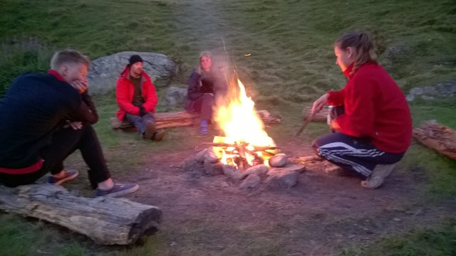
After 1400 meters of ascent and 1800 meters of descent in 9 hours and 20 minutes and 19 kilometers of distance we totally deserved a very nice campfire:
And this is it for now! Everybody got what they needed on our bonus day and we have just three days to complete our trek to Zermatt...
Thanks for your time, I hope you got inspired! And if you like this topic, don't forget to upvote and follow me ;)
Congratulations, Your Post Has Been Added To The Steemit Worldmap!
Author link: http://steemitworldmap.com?author=martinsu
Post link: http://steemitworldmap.com?post=trekking-from-chamonix-to-zermatt-walkers-haute-route-bonus-day
Want to have your post on the map too?
Hiya, just swinging by to let you know that this post made the Honorable Mentions list in our daily Travel Digest. Please drop by to check out all the rest of today's great posts and consider upvoting the Travel Digest if you like what we're doing.
Thank you very much! :)
Wonderful views! Looks like the climb was really worth it, especially that nasty looking gully. This was an extra climb, besides your normal route, on somekind of restingday?
Thanks! We planned one extra day for us in cases of unpredictable delays and obstacles. This was the perfect moment to use it. Some of us were exhausted after 11 days of continuous trek and others could spend it with bonus summit trek. Perfect solution for everyone.
Congratulations! Your high quality-travel content caught our attention and has earned you a partial upvote. We love your hard work and hope to encourage you to continue to publish strong travel-related content. Thank you for using #travelfeed
Learn more about our travel project on Steemit by clicking on the banner above and join our community on Discord.
Cool, thank you! :)
looks like you enjoy this journey very well and uploaded pics was awesome
Yes, this was one of the best days on this trek :)
keep it up and uploaded more like this
Yes, thats my plan. Now I have a week to arrange my next adventure in Great Caucasus, but after a month I'll continue with blog and pictures.
ok i will wait