Khyber Pakhtunkhwa
Khyber Pakhtunkhwa is a province in Pakistan. The capital is Peshawar and it has a population of 14 million people and an area of 28,773 mi² or (74,521 km²). The province was created in 1901 during British rule when it was separated from a Punjab province of the British India Empire.[source?] A referendum was held in the North West Frontier Province on 2 July 1947. The majority of voters wanted to join with Pakistan, with only a very small number voting to join with India. The province became a part of Pakistan, because of this referendum.
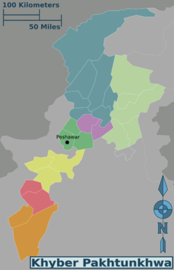
Khyber Pakhtunkhwa is divided into 26 districts. There are 21 Settled Area Districts and 5 Provincially Administered Tribal Areas (PATA) Districts. The administration of the PATA districts is the responsibility the President of Pakistan and the Governor of Khyber Pakhtunkhwa
Geography
Khyber Pakhtunkhwa sits primarily on the Iranian plateau and comprises the junction where the slopes of the Hindu Kush mountains on the Eurasian plate give way to the Indus-watered hills approaching South-central Asia. This situation has led to seismic activity in the past.[4] The famous Khyber Pass links the province to Afghanistan, while the Kohalla Bridge in Circle Bakote Abbottabad is a major crossing point over the Jhelum River in the east.
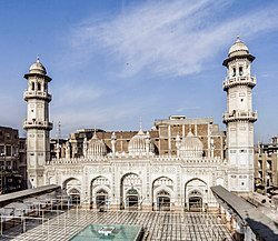
The province has an area of 28,773 mi² or (74,521 km²) — comparable in size to New England in North America.[5] Peshawar, Mardan, Kohat, Abbottabad, Dera Ismail Khan and Hangu are the main cities.
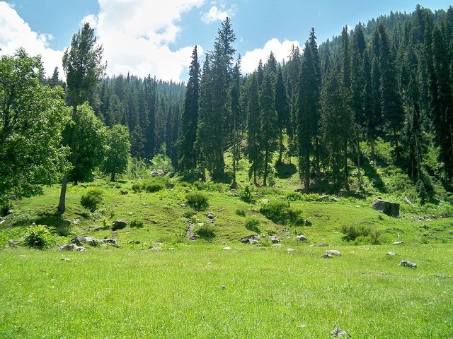
The region varies in topography from dry rocky areas in the south to forests and green plains in the north. The climate can be extreme with intensely hot summers to freezing cold winters. Despite these extremes in weather, agriculture remains important and viable in the area.
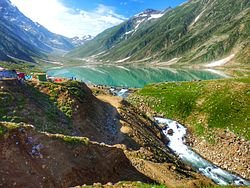
The hilly terrain of Kalam, Upper Dir, Swat, Naran and Kaghan is renowned for its beauty and attracts a great many tourists from neighboring regions and from around the world. Swat is popular among tourists as the "Switzerland of South Asia" as there are many landscape similarities between it and the mountainous terrain of Switzerland.
Geographically the province could be divided into two zones: the northern one extending from the ranges of the Hindu Kush to the borders of Peshawar basin and the southern one extending from Peshawar to the Derajat basin.
The northern zone is cold and snowy in winters with heavy rainfall and pleasant summers with the exception of Peshawar basin, which is hot in summer and cold in winter. It has moderate rainfall. The southern zone is arid with hot summers and relatively cold winters and scanty rainfall.
The major rivers that criss-cross the province are the Kabul, Swat, Chitral, Kunar, Siran, Panjgora, Bara, Kurram, Dor, Haroo, Gomal and Zhob.
Its snow-capped peaks and lush green valleys of unusual beauty have enormous potential for tourism.
Follow Me:@rizvi
support or vote for pakistani
Thank you