A MOUNTAIN SURROUNDED BY BEACHES (PHOTOS + MY EXPERIENCE)
IT'S TIME FOR ADVENTURE!
From the heights. Own photo Samsung Galaxy S5
VISITING LA SIERRA
The reality is that within this small expanse of high temperature land, this incredible place is located, ignored by tourists and locals alike.
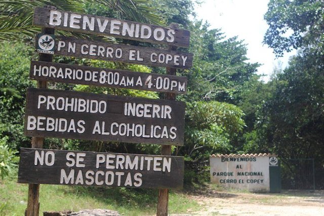
Entrance to the National Park. Own photo Samsung Galaxy S5
A MOUNTAIN SURROUNDED BY BEACHES
A hill more than 800 meters above sea level declared as a national park with the purpose of protecting its ecosystem and because it is the only permanent source of water on the island. Likewise, due to its height, a strategic platform of commercial and military antennas is located on its summit, which serves to transmit the signal of telephone companies and for the protection of the sovereignty of Venezuelan air and maritime space.
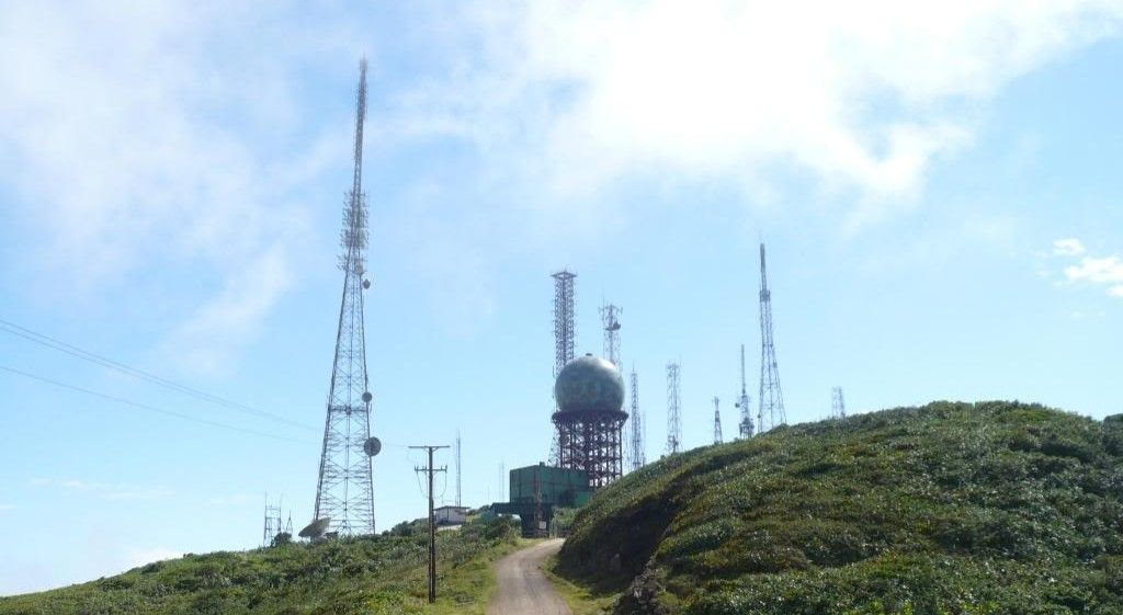
Antennas located on the top of the mountain. Own photo Samsung Galaxy S5
HOW TO GET
To arrive is quite easy, you must go through La Asunción or through El Valle del Espíritu Santo; If you are in your own vehicle, it can be left parked in front of the Inparques headquarters (forest guard) and the rest of the journey must be on foot.
This natural heritage offers the most beautiful panoramic views of all the cardinal points of Margarita, except for the west. In this magical place we can escape to find nature and enjoy a different climate and landscape thanks to its height, the temperature ranges between 18 ° C and 25 ° C during the day and 14 ° C and 18 ° C the nights.
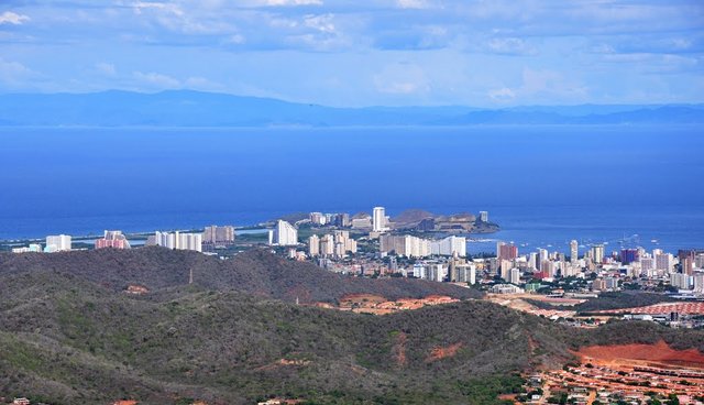
View to Pampatar. Own Samsung Galaxy S5 + lens zoom lens
Without more to say, I leave you with the images that I have taken and I describe the experience.
MY EXPERIENCE AND RECOMMENDATIONS
Upon arrival at the headquarters of Inparques the kindness of the forest rangers will be present; In case we want to complete the route to the antennas (highest point) we must register in a book of arrivals and departures. It does not hurt to have a fun time in the park located next to the parking lot, in the same there are trees where we can climb, lianas to swing, hidden paths and offers a beautiful view of the cities of Porlamar and Pampatar. It should be noted that in this place there are grills and bathrooms in case you just want to spend an afternoon of fun and food, without venturing too much.
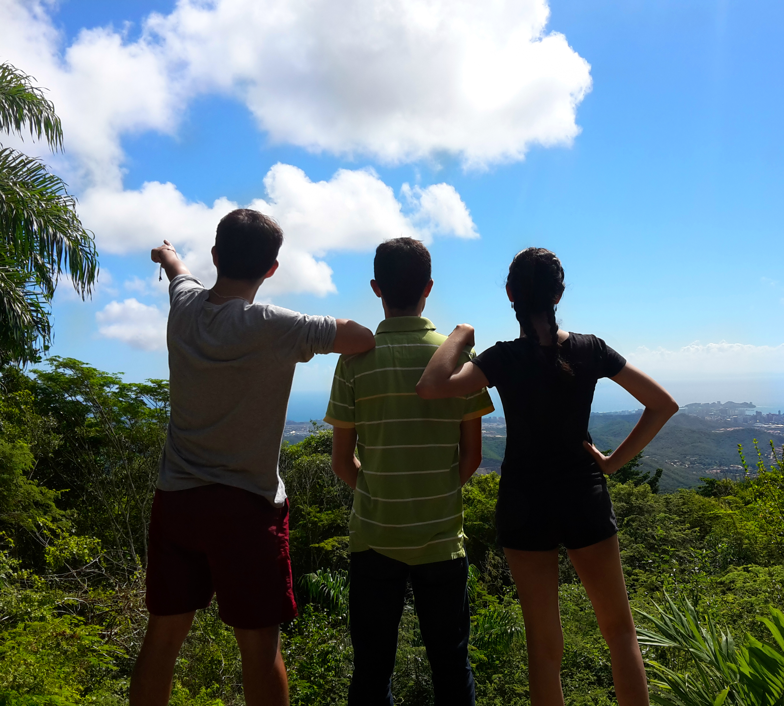
From right to left; my girlfriend, my best friend and me Own photo Samsung Galaxy S5
The best time to start the 4.8 km route to the top is between 7 and 9 o'clock in the morning because starting the ascent you must walk through a wooded path where humidity multiplies as the sun rises and It becomes exhausting. I recommend doing stretching before starting to avoid possible cramps or pulls. It is mandatory to bring hydration and light meals to eat when you reach the antennas.
The walk at the beginning will be somewhat heavy due to the inclined slopes and the sensation of humidity; Even though the route is paved, I always recommend sports shoes. After 20 minutes we will start to move away from a wooded tunnel to find open spaces with panoramic views of El Valle del Espíritu Santo, flat areas to rest and enjoy the water that begins to sprout from the mountain at this point of the route.
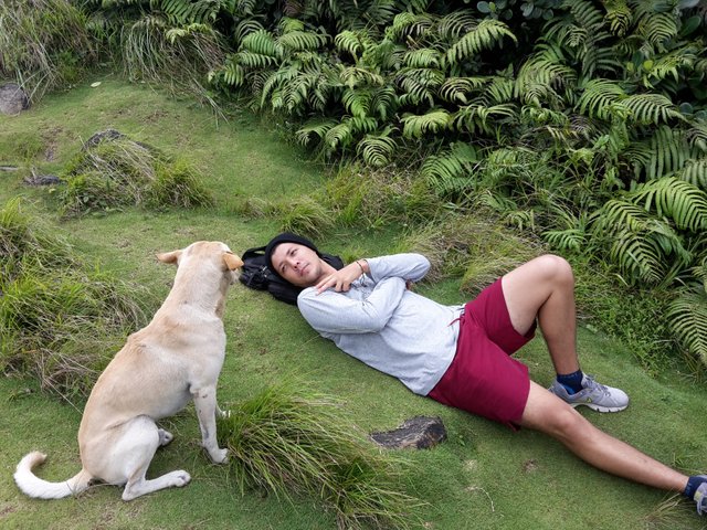
A canine guide who accompanied us from beginning to end. Own photo Samsung Galaxy S5
It is important to always have a camera in hand since, in addition to the landscapes, it has a select variety of colorful butterflies and there is a rumor that on that mountain there are monkeys that are rarely seen. - Can you imagine being able to photograph one of those little monkeys? It would be an achievement.
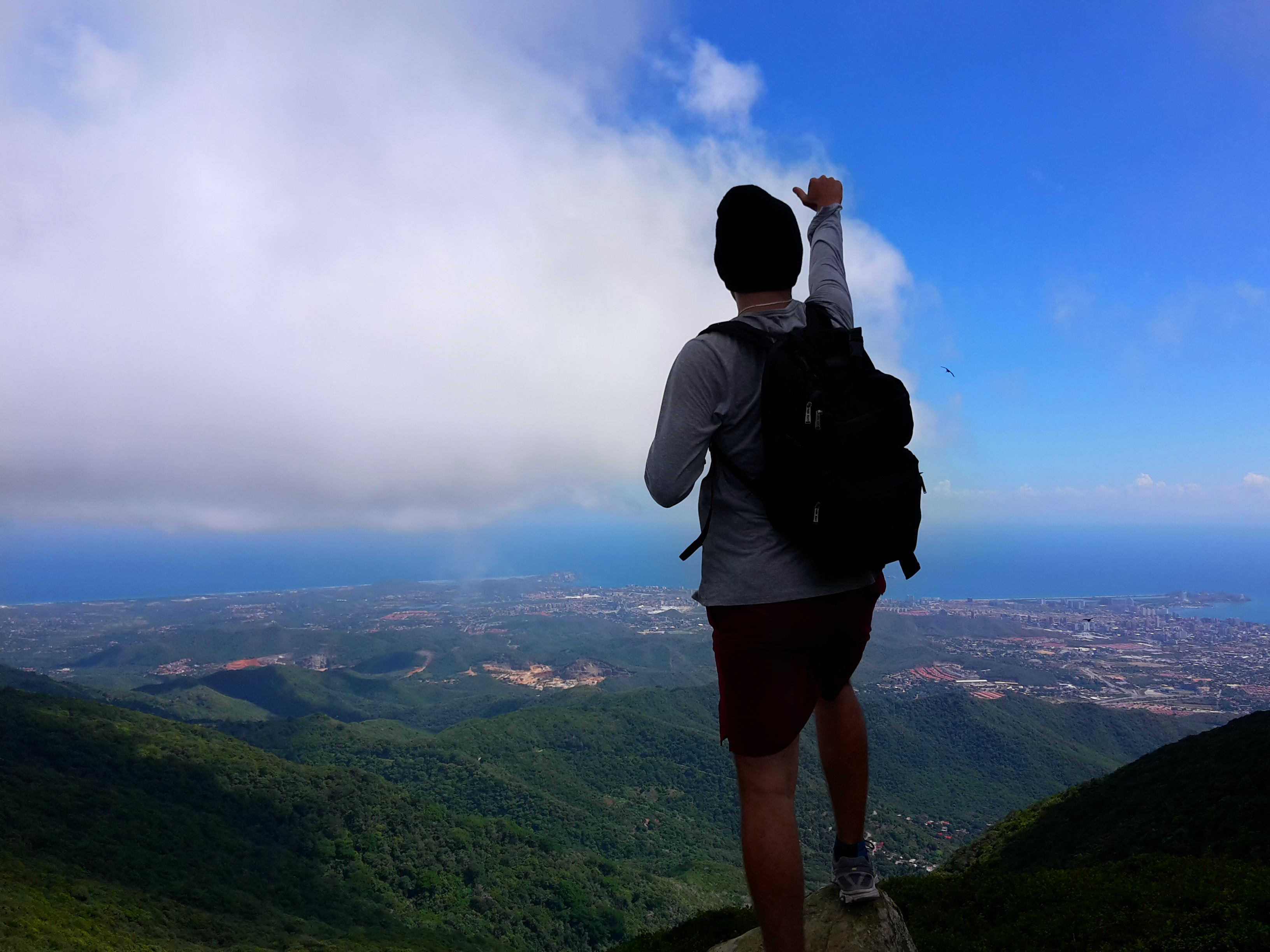
Continuing the ascent we will begin to visualize the antennas, which although they will be relatively close, they are not as the way there is in the form of curves. After about 20 minutes, you will have arrived at the place where you can see the city of Juan Griego and you can take an amazing photo like this one that I leave below.
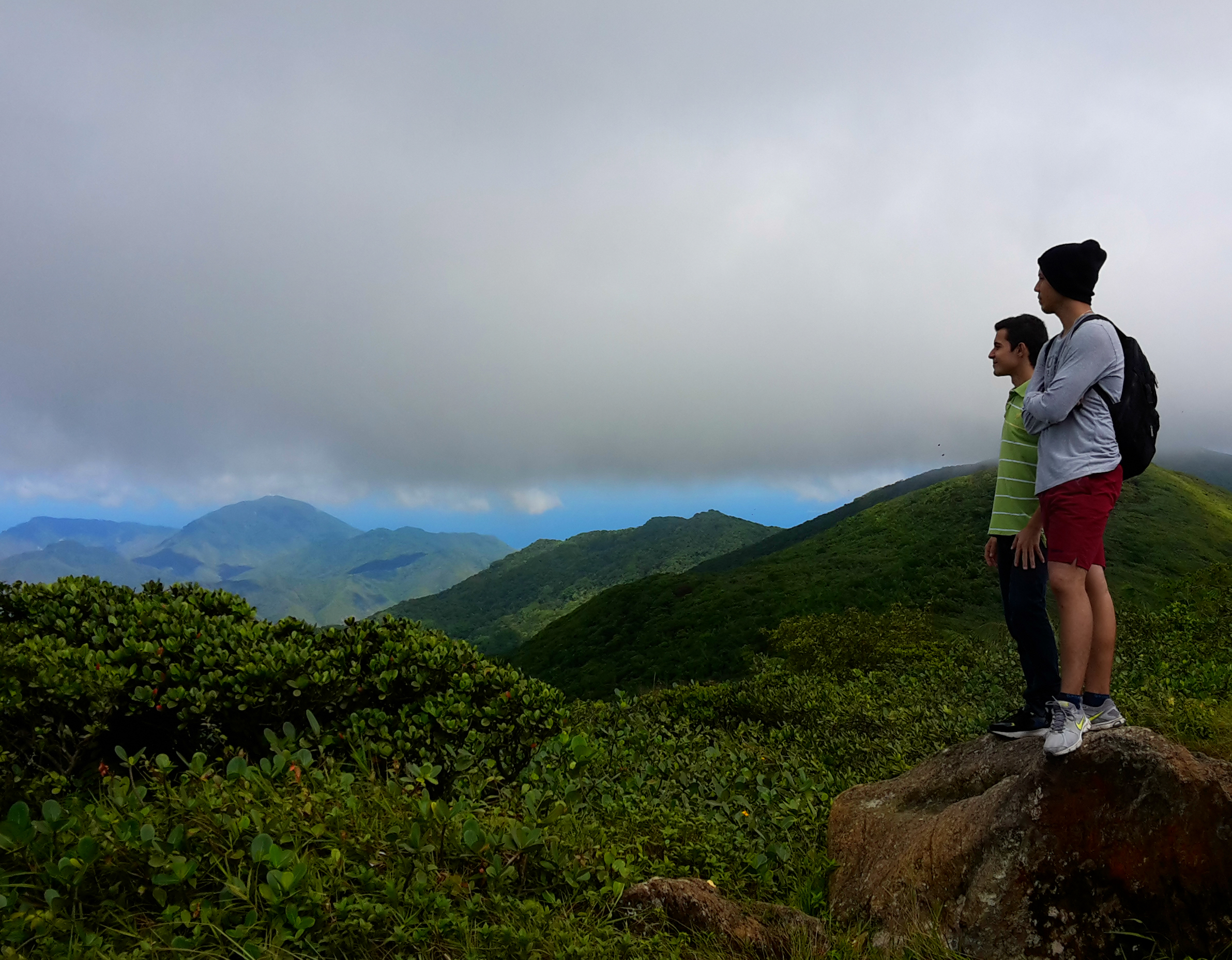
@andresrivas and me, appreciating the view and enjoying the low temperatures. Own photo Samsung Galaxy S5
After the stage mentioned in the previous paragraph, we will be only 15 minutes away from the antennas; place where we will feel proud to have reached the top of the mountain and we can enjoy some appetizer accompanied by the whistle of the breeze and the flight of birds planning.
I recommend lowering before 12 noon at a moderate pace, and conserve water to keep hydrated on our return to the starting point.
Thanks for read my post, it's a beautifull place