The Tetakawi Hiking Adventure
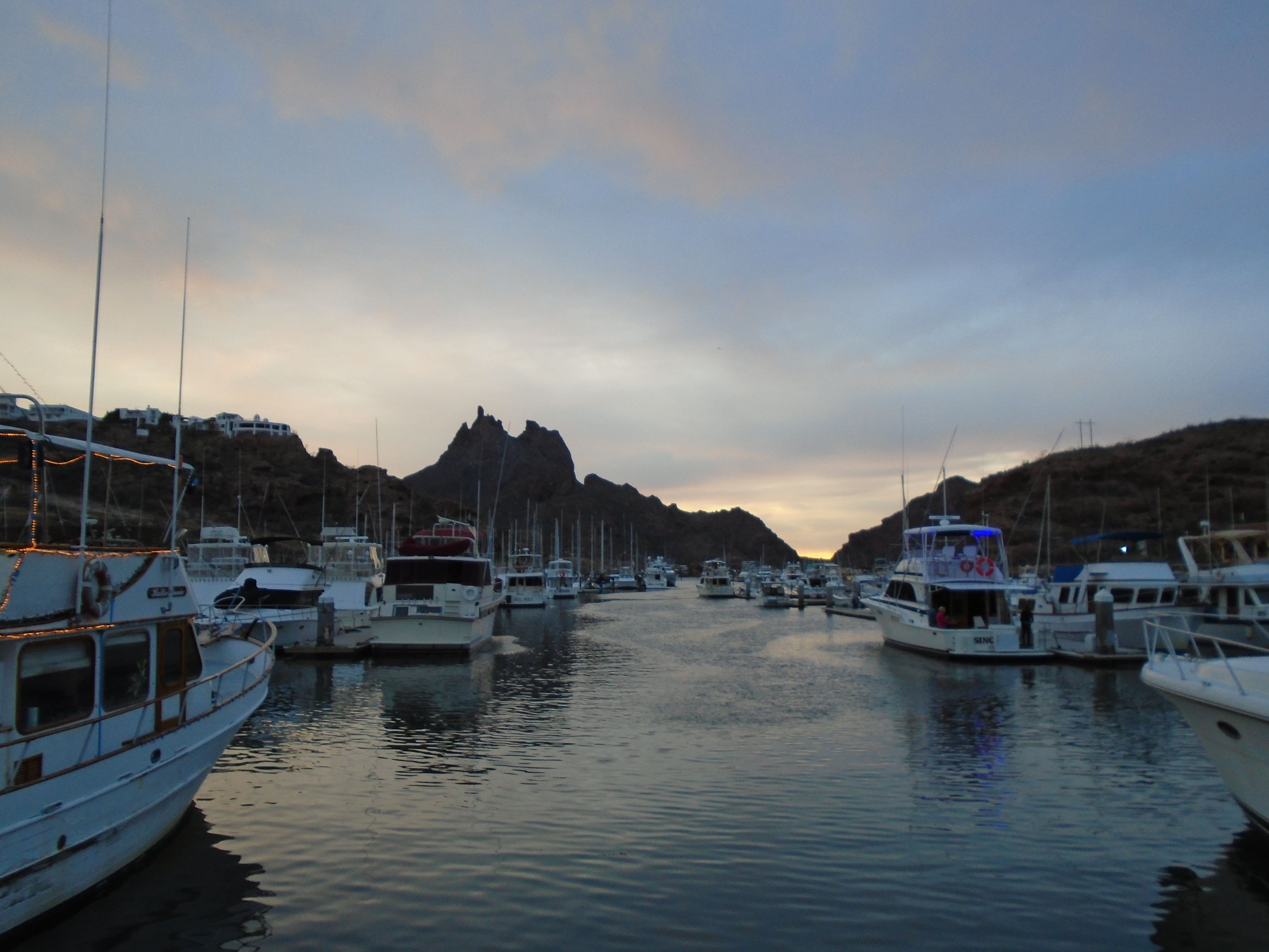
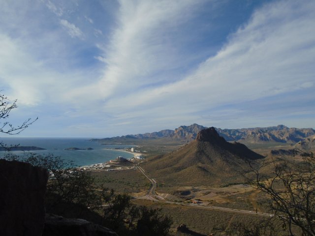
Just before Christmas in 2017 I was in San Carlos Mexico. If you've ever been there, you will notice a geologic edifice it rises up next to the Sea of Cortez known as Tetakawi. While there are many features in the landscape along the Sea of Cortez in this area, Tetakawi is the most predominant. It can be seen from miles away as you approach the town. In the photo above, you can see the twin peaks of Tetakawi from the San Carlos Marina. They are about two miles away.
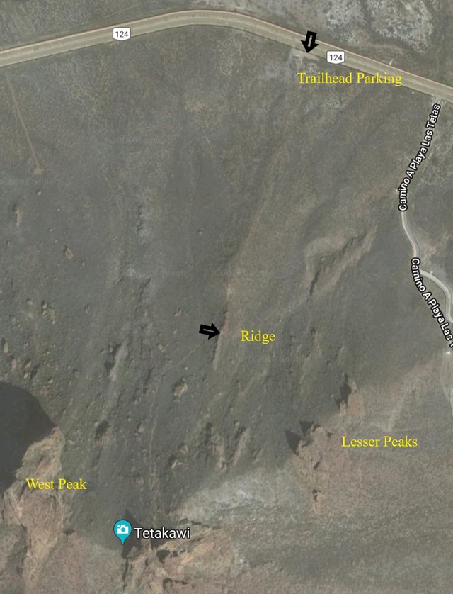
I had been to San Carlos a couple of times before and I'd seen on Google Maps that there appeared to be a trail that went from the highway on the north side of Tetakawi to the top of the eastern peak of the formation. I had decided that I wanted to try to take that trail thinking that it would be fairly easy as I had measured on the map that it was just over 1 km; that is laterally from the highway to the peak of the mountain. Using a bit of geometry I determined that it couldn't be more than 2 km to the top given the estimated slope involved, as the slope would make the distance just a little bit longer.
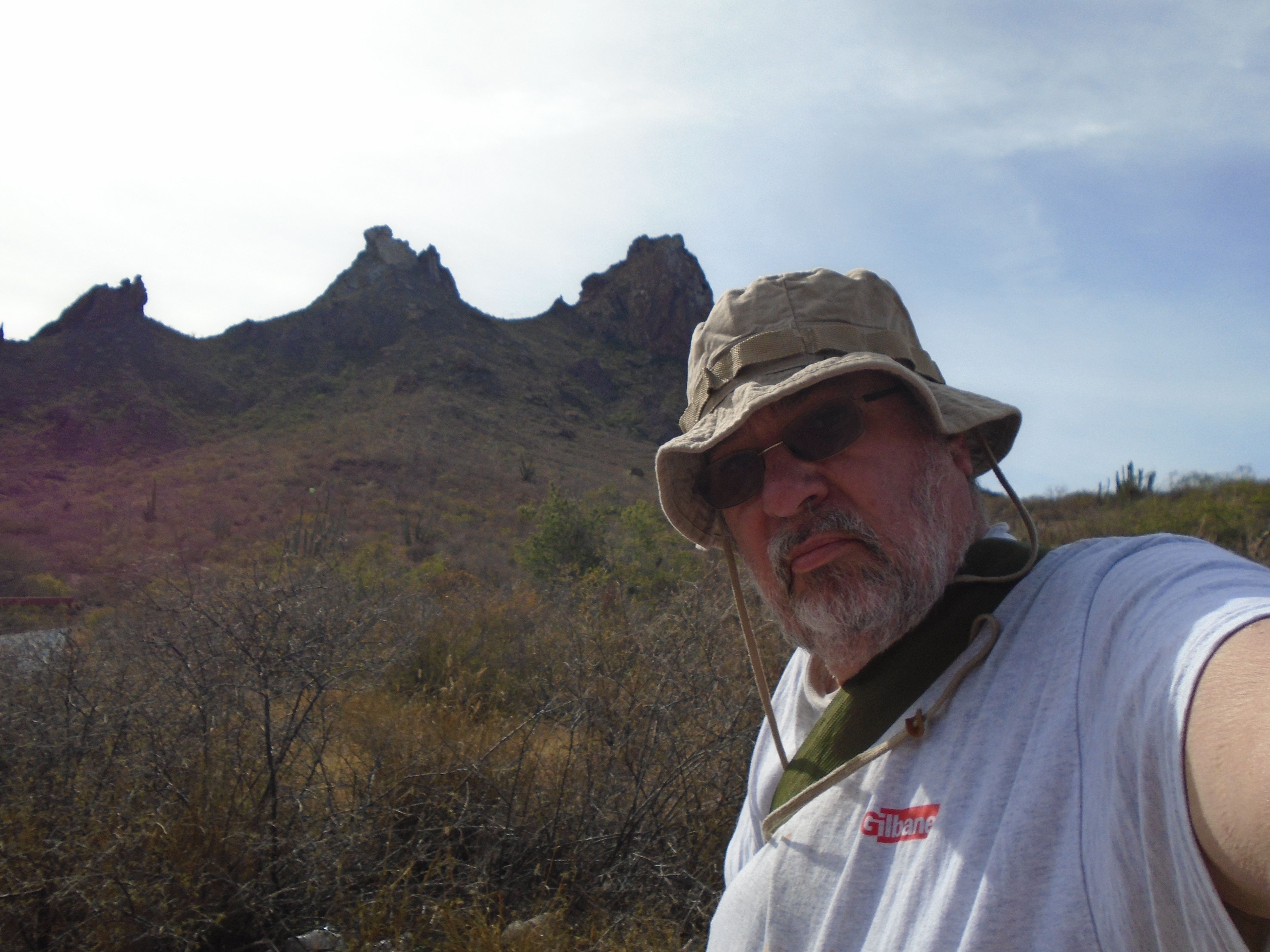
So here I am in this photo above in my boonie cap at 65 years old thinking that I'm 18 and Tetakawi in the background, and I'm all ready to start my hike, or so I thought.
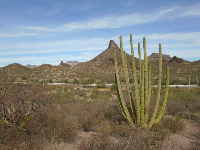
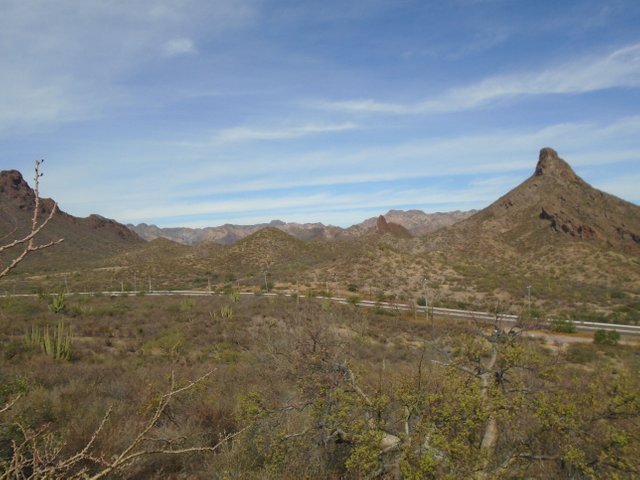
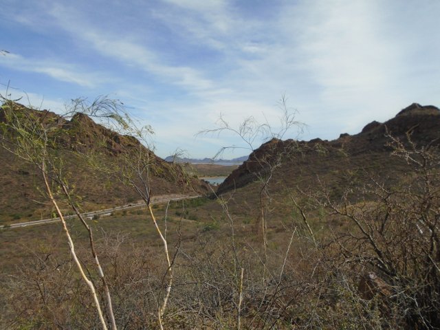
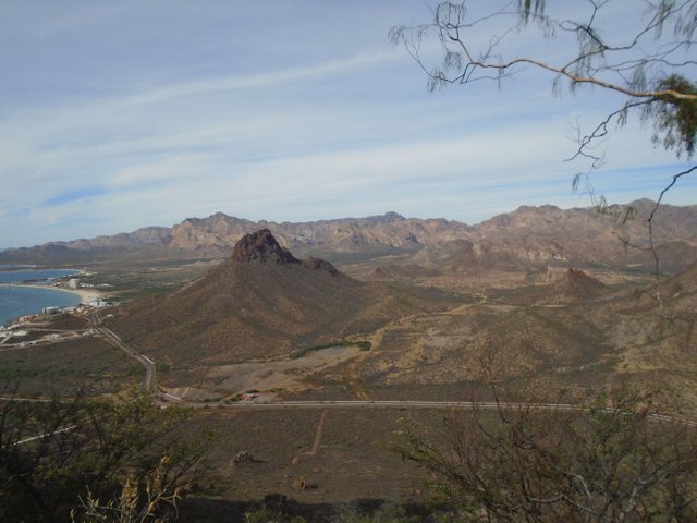
Here is my first photo from the hike only a couple of hundred yards from the trailhead that's next to the highway, looking back and seeing some of the geography and the plant life in the area. The peaks in the background are much lower than Tetakawi as you will see in later photos.

In the photo above you will see to the left two lesser peaks and then on the right the two major peaks of Tetakawi. Because of the perspective the Lesser Peaks appear to be at the same elevation as the two major Peaks but they are not. iI addition, you may notice in the foreground a small ridge that the trail is directed toward. The trail actually goes over the top of that ridge you can also see it from the Google Map photo at the start of this story.
In the photo above I'm looking back again at the peaks to the north and you can see that I'm beginning to rise in elevation.
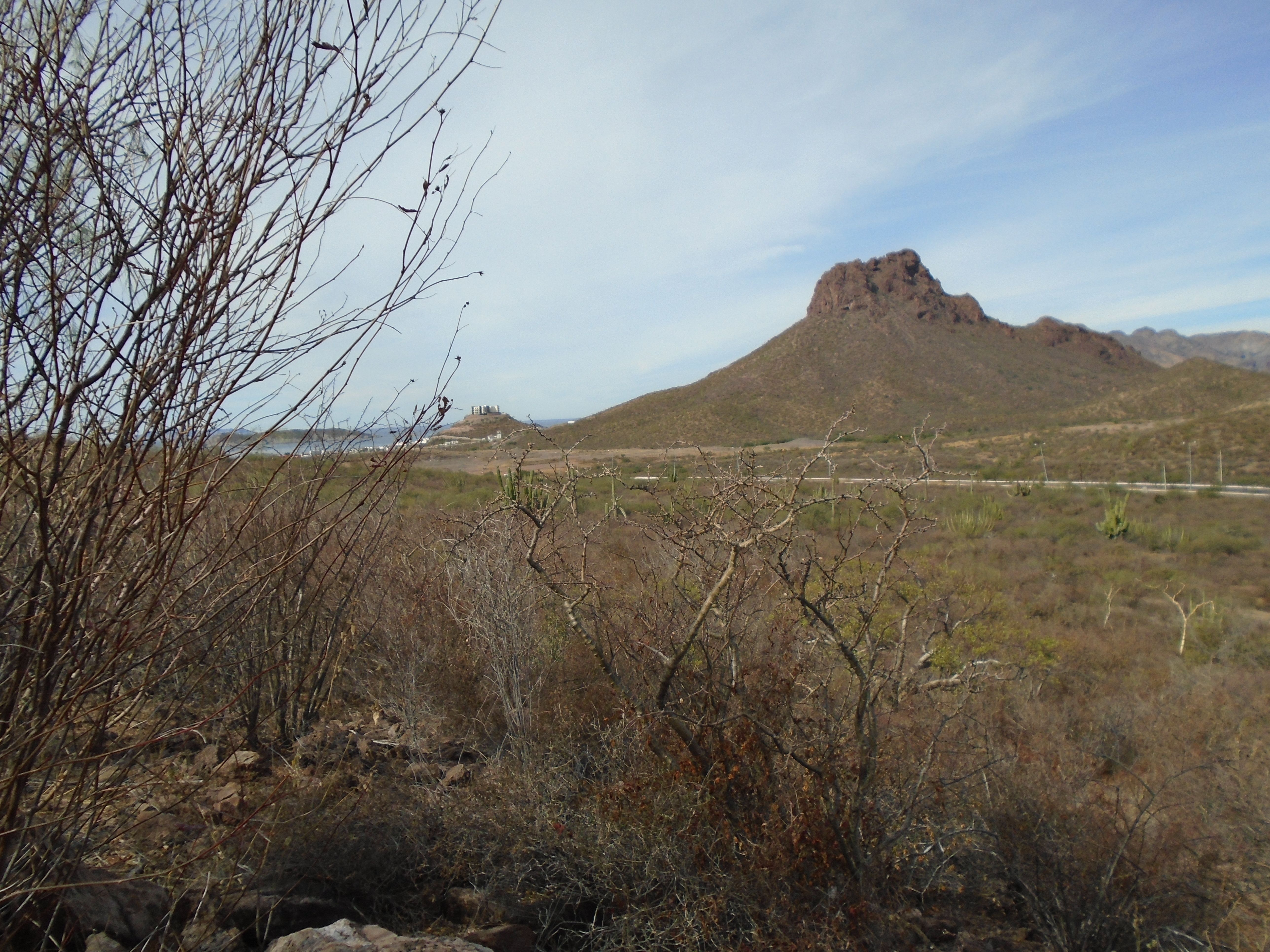
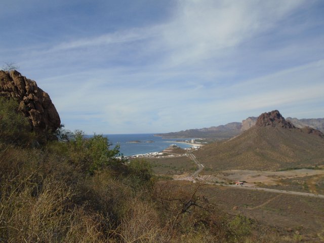
The photo above is probably taken at the same elevation is the previous photo. It is looking West towards the Sea of Cortez and a marina that is west of the main town of San Carlos.
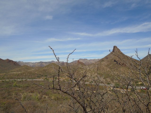
In the photo above I'm looking back to the north again and you can see that I am rising a little bit steeper in elevation. At this point I'm not too concerned, because I've taken hikes on other rocky edifices in the past that were much steeper than where I am now.
The photo above is looking back again to the west and the Sea of Cortez. Notice the gain in elevation from the previous photo that was taken in the same direction.
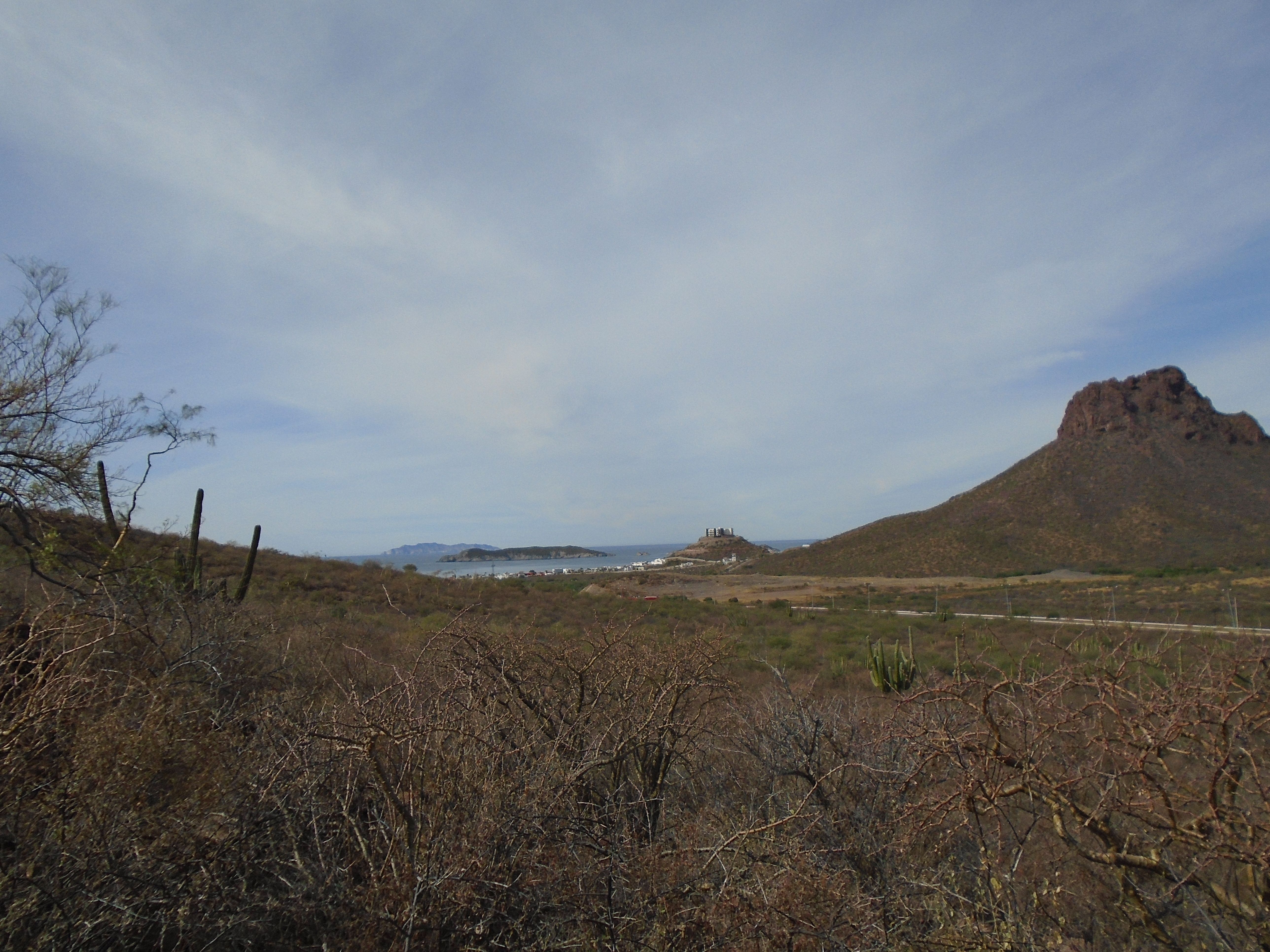
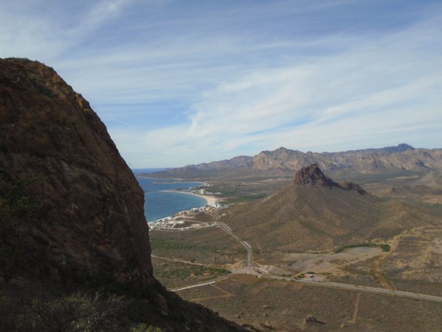
In the photo above I'm looking back to the East and finally starting to get a peek of the Bay of San Carlos, or Bahia San Carlos.
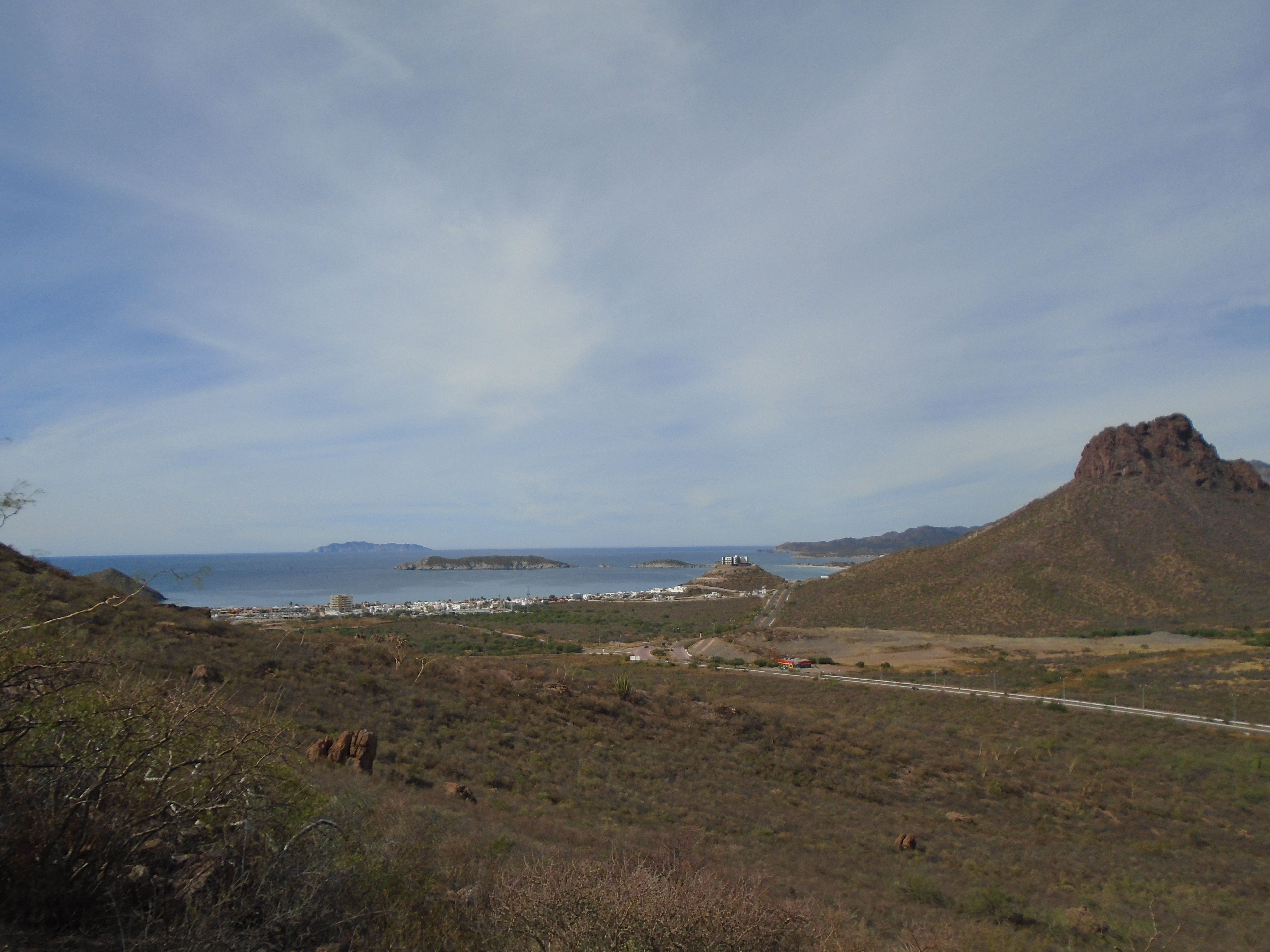
In the photo above I'm looking back West again towards the far West shore of the town of San Carlos. At this elevation of full vista is starting to come into view. I think it was about here that I started getting concerned because while I had made good time so far, The grade was starting to steepen sharply. I had left the parking area at the trailhead about noon and I was making good time and I felt like that I could reach the top with in about an hour but because of the steepness of the grade I was concerned about coming down. I knew that it would take me a lot longer to come down. I also started making a mental inventory of what I had with me. I started out with less than a full bottle of water thinking that the hike would only take a couple of hours and I was realizing that I probably hadn't brought enough water with me.
And then there was a thought of possibly injuring myself while I was up there slipping on some of the loose rock. I had no first aid supplies with me. I had a cell phone with me so I knew that I could call for help if I needed it. However if I had an accident late in the day there was a possibility of having to spend the night on the mountain. While December is a very warm month in the daytime the nights can get fairly cool and I had no way of making a fire and I had no blanket or jacket with me to keep warm.
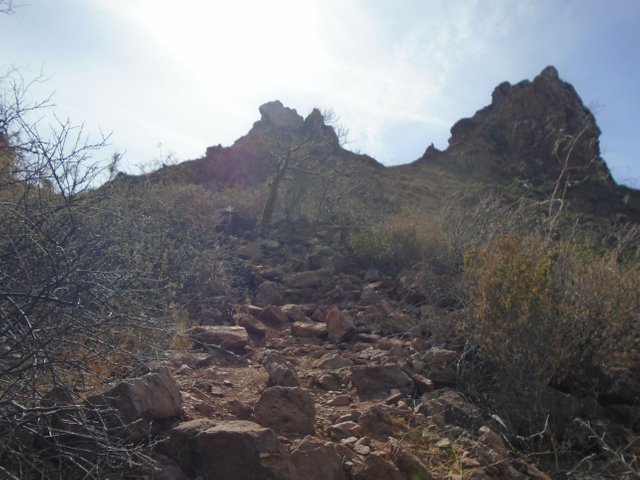
The photo above gives you an idea of how treacherous the trail is becoming. Both peaks of Tetakawi are now in view.
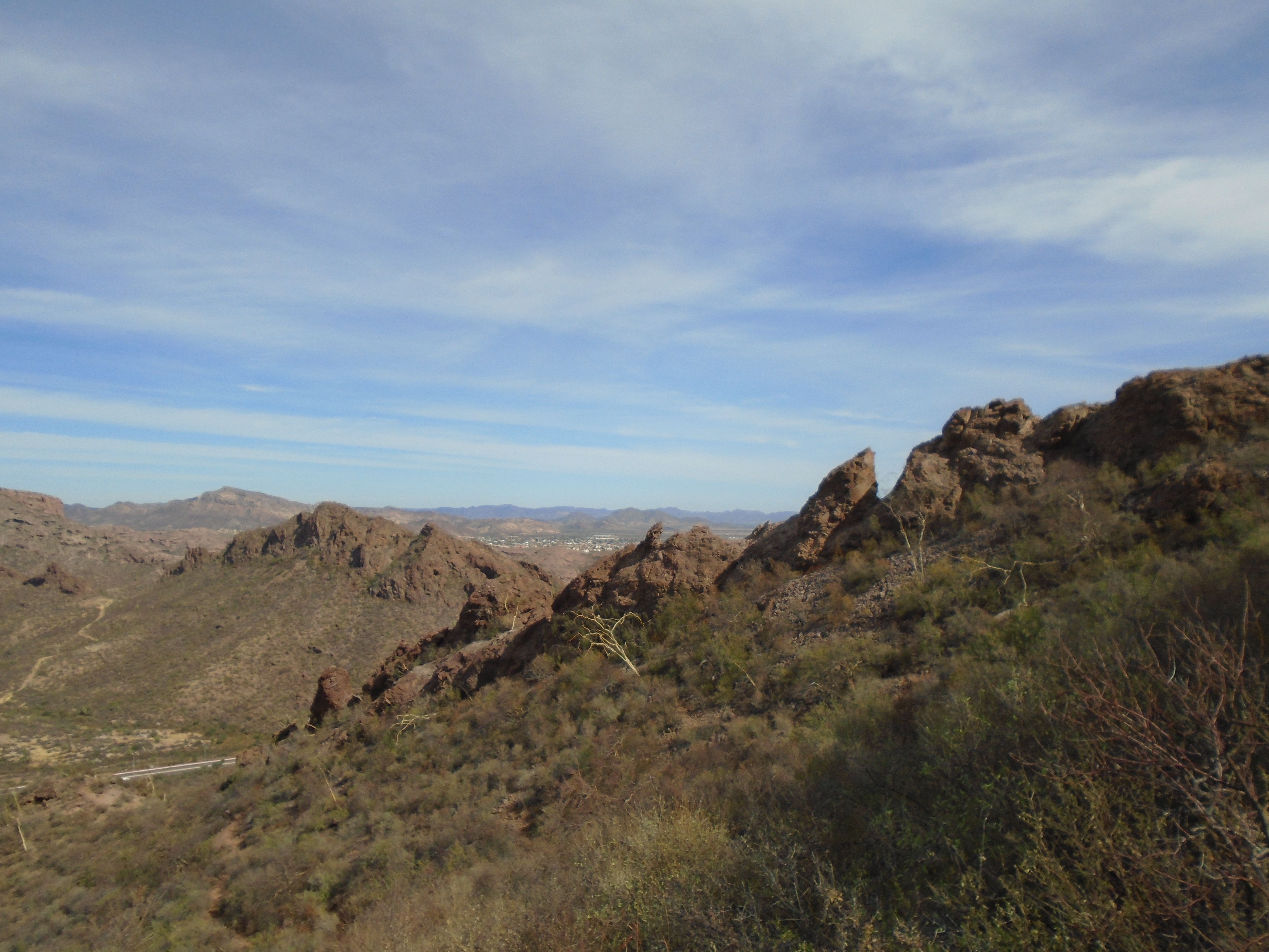
In the photo above I'm looking back east toward Bahia San Carlos and a ridge that runs along the North Face of Tetakawi is blocking the view of the bay. The peaks on this ridge were seen in a previous photo. The ridge can be seen in the Google satellite view that I’ve posted at the first of the article.
Above is a corresponding photo looking back towards the Sea of Cortez to the West. The West peak of Tetakawi is now coming into view, and will eventually block some of the view towards the West.
Having traveled only a couple more more hundred meters from the position that the previous photo was taken, the West peak of Tetakawi is now coming into full view.
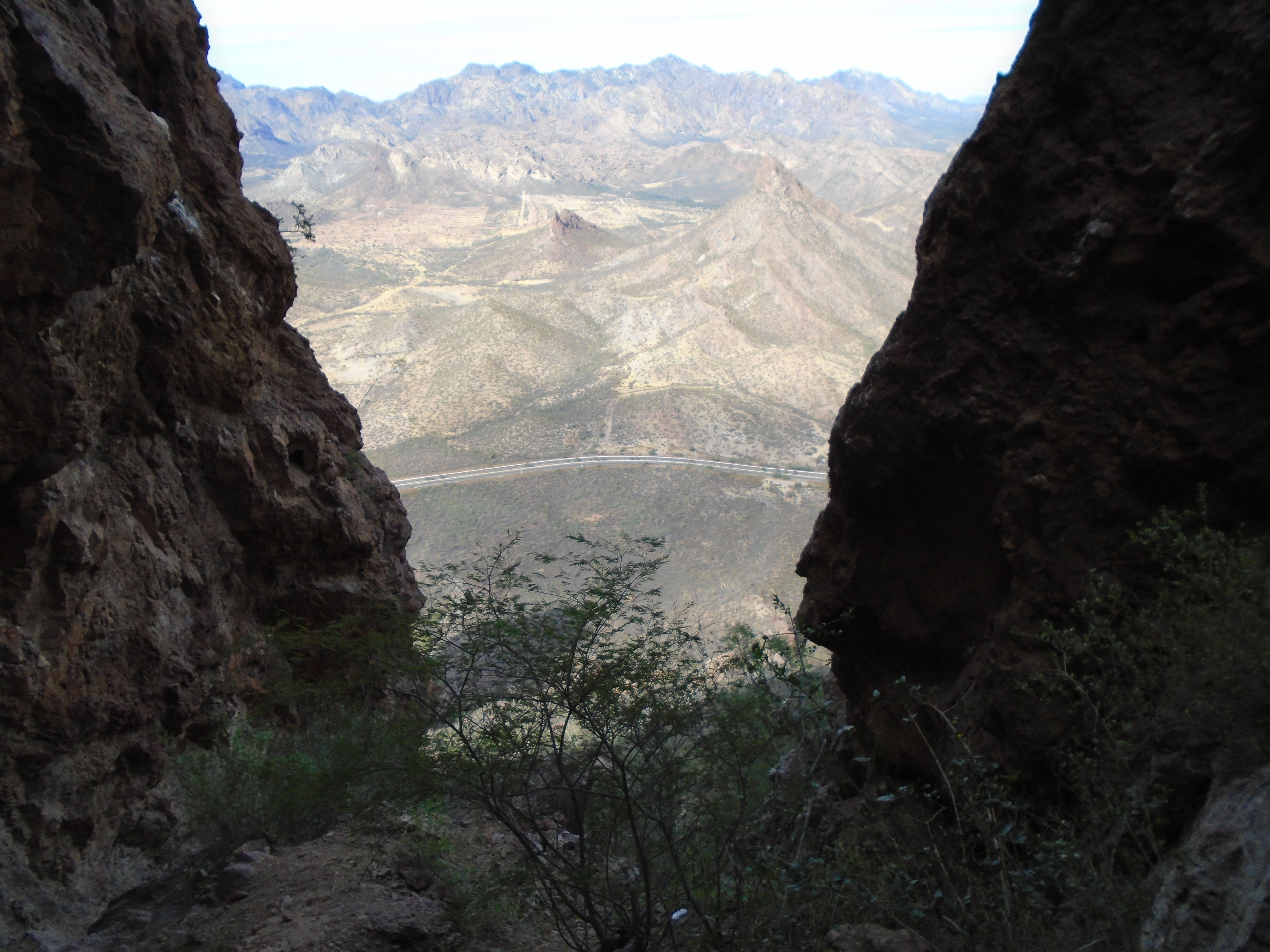
The photo above is looking North again as you can see the horizon line is starting to drop below the peaks of the mountains making my elevation higher than those peaks.
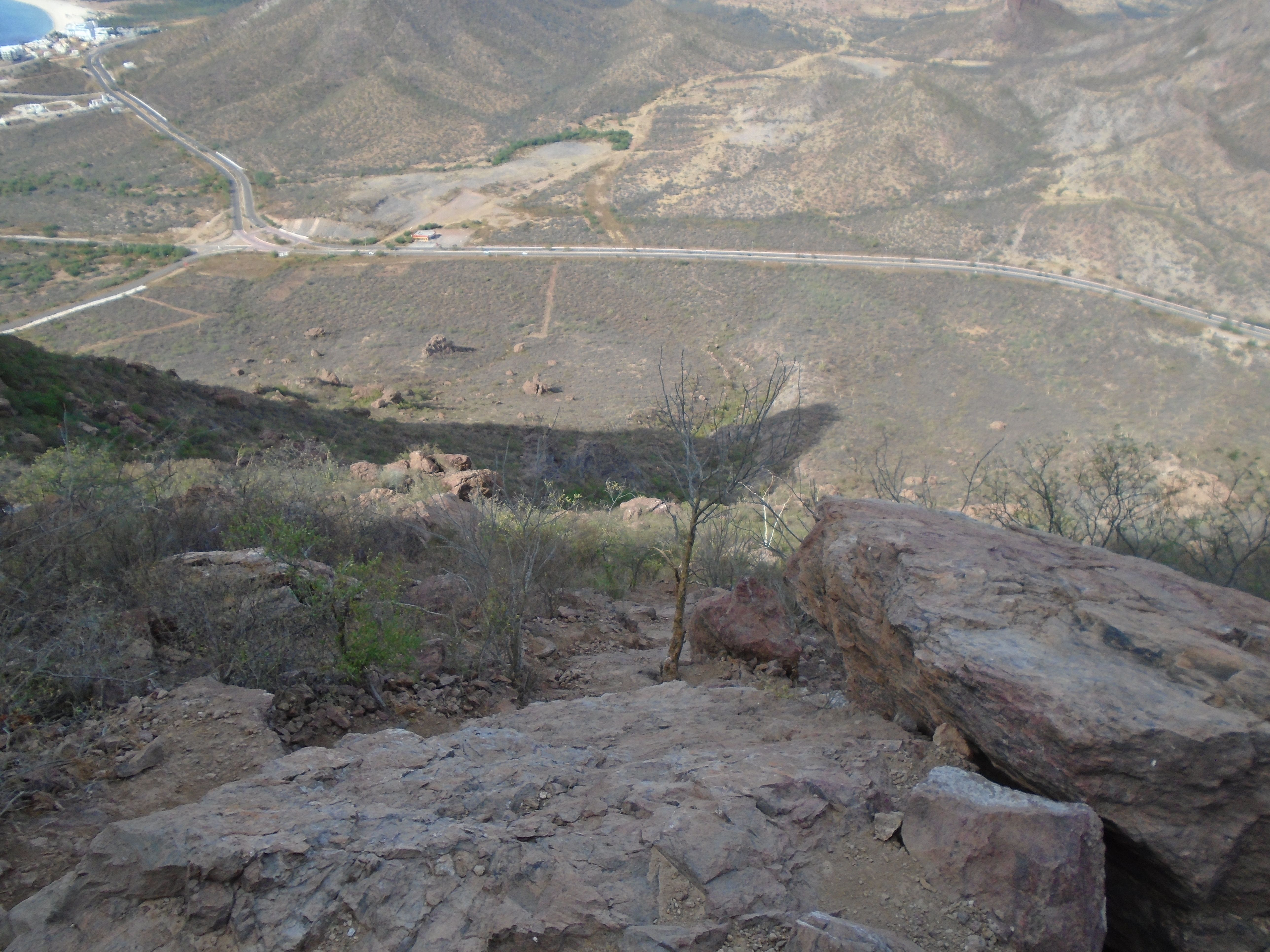
The photo above shows the trail that I will be descending. To the far right at the edge of the photo is the parking lot where the trailhead begins.
In the photo above the West peak of Tetakawi is starting to come into view. This means that I am approaching the top of the East peak. In reality I won't actually get to the top as you will see in subsequent photos.
The East peak of Tetakawi is now starting to envelop me in what maybe be described as a small canyon.
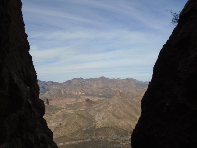
In a photo above I am looking North again as that is the only view available. To the right of the curve in the highway is the parking lot for the trailhead where I started.
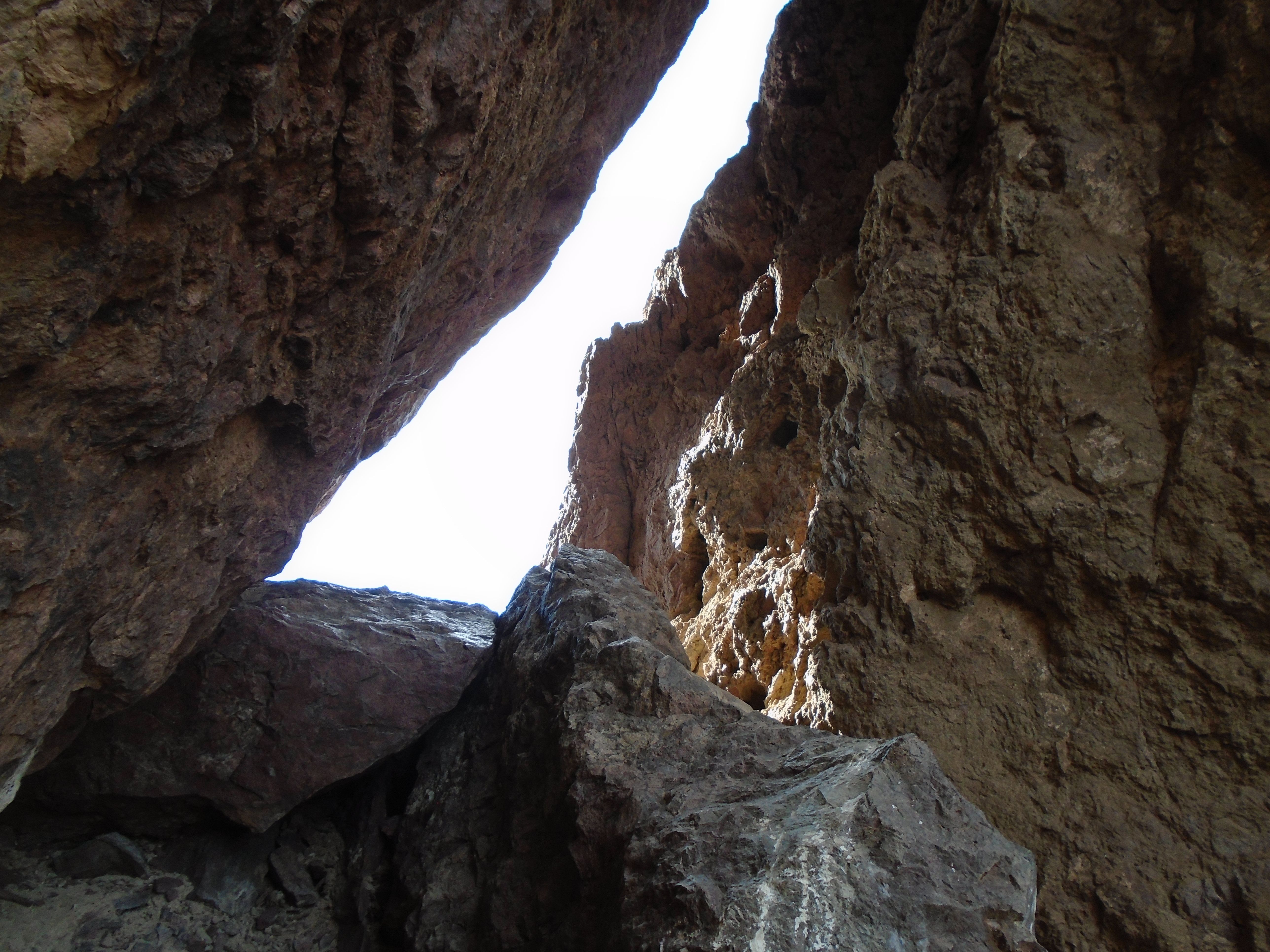
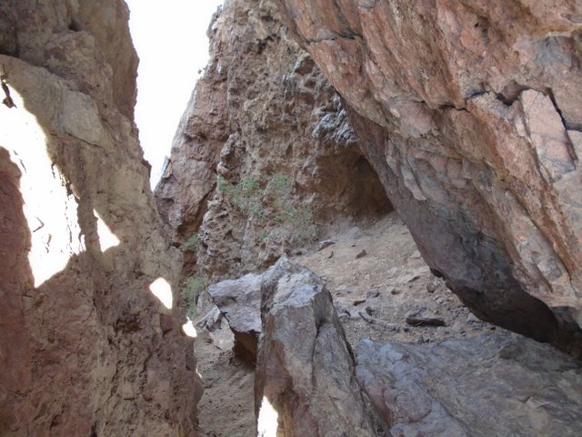
In the photo above you can see that I am approaching a narrow keyhole in the rock that is just beneath the peak of Tetakawi. At this point, I have been crawling on all fours for the past half hour or so, to get up the grade of the mountain since the grade has gotten so steep. In order to get through this keyhole, I must navigate over several boulders that require the use of all my limbs.
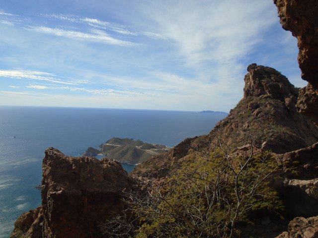
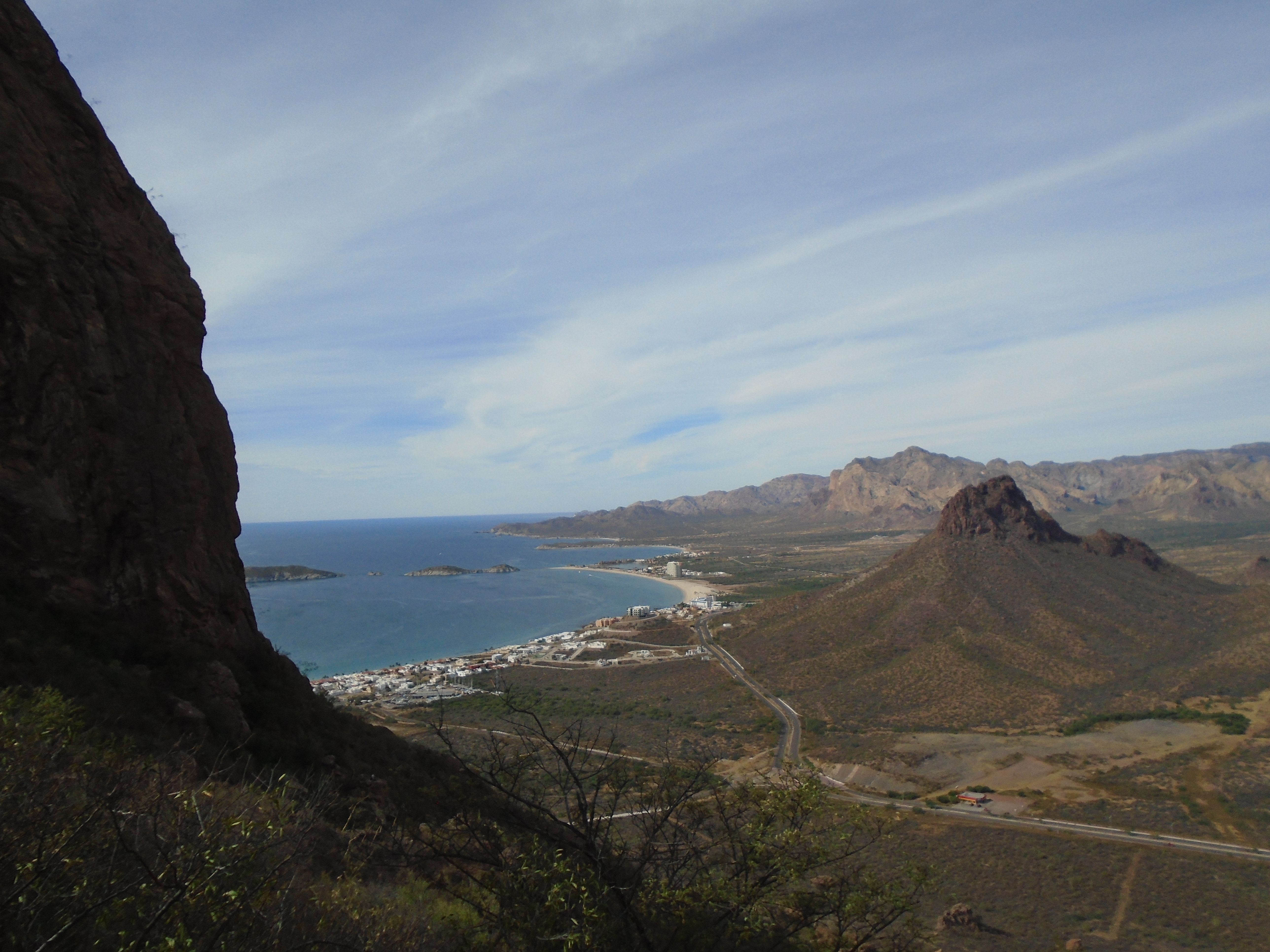
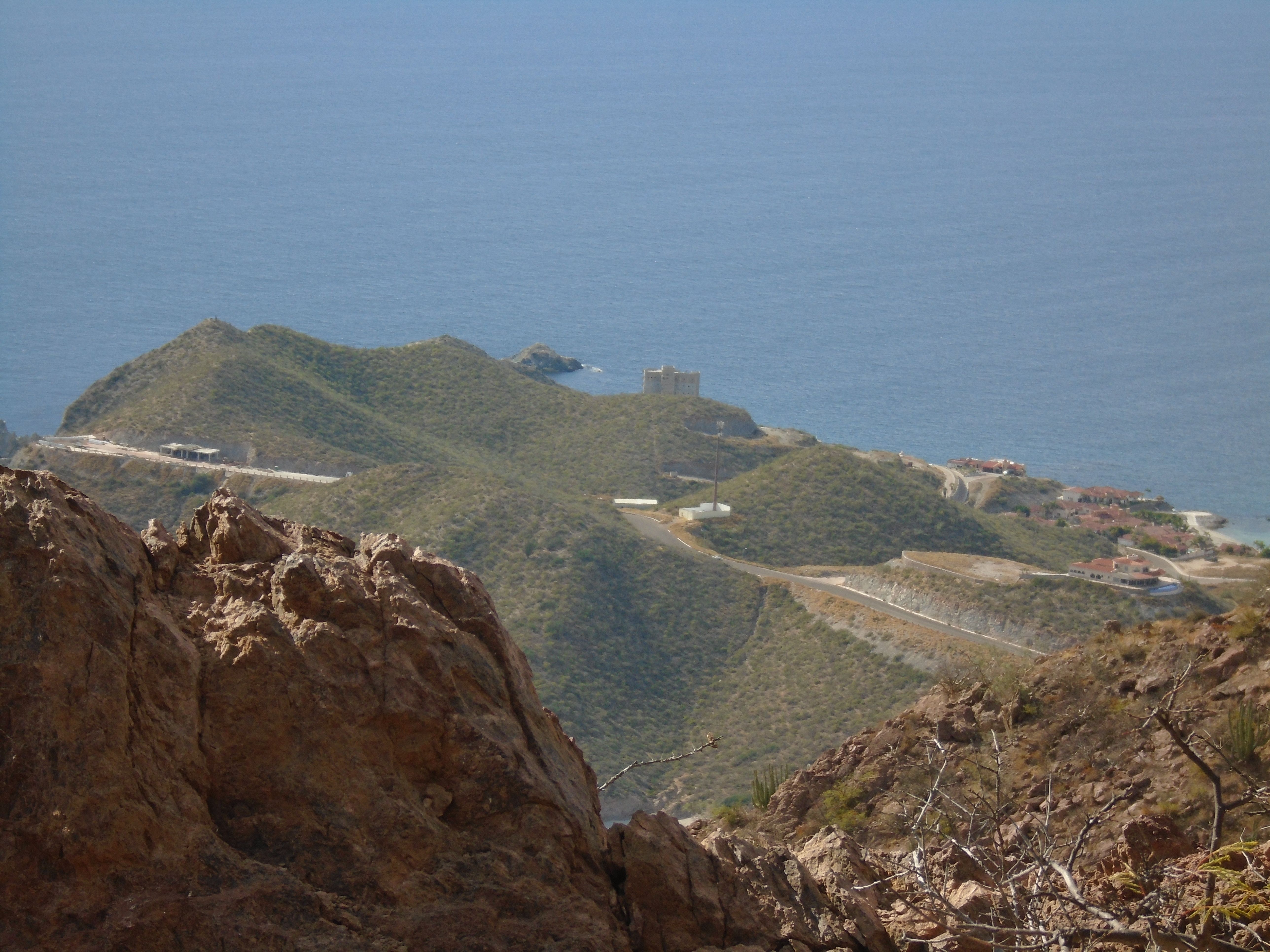
The photo above is the first picture that I took after exiting the keyhole to the south of the east peak of Tetakawi. It is looking to the West towards the Sea of Cortez. The peninsula that is below is an overlook that many of the tourist come to see (an enlargement of this is in a photo that follows). However, at this time it is under construction and not accessible. The photos that follow will pan from West to South to East in sequence.
![DSC00199.JPG]
( )
)
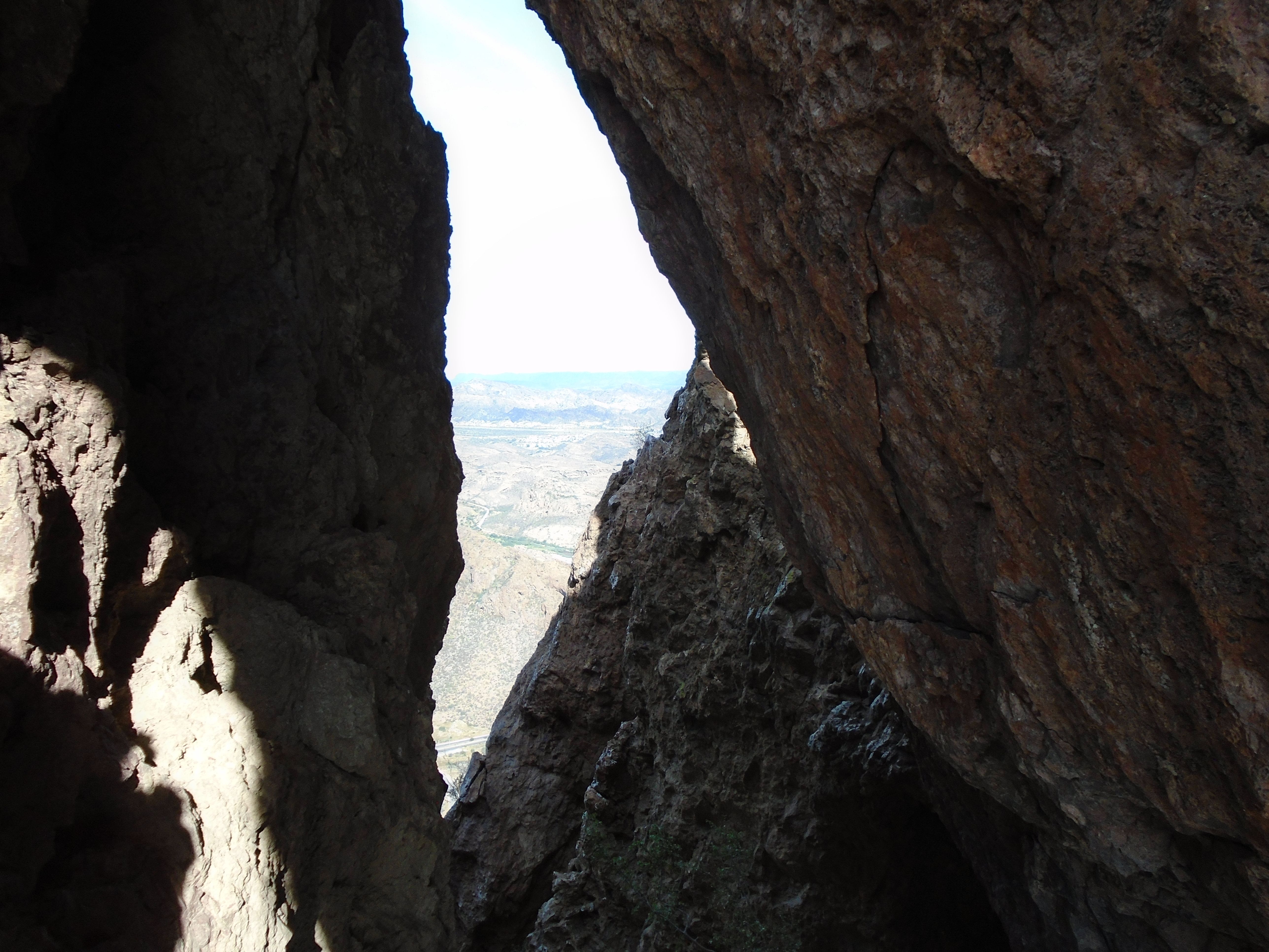
The next 2 photos will be looking back to the north through the Keyhole that is in the top of the East peak of Tetakawi.
And now for a couple of telephoto shots looking to the Southwest.
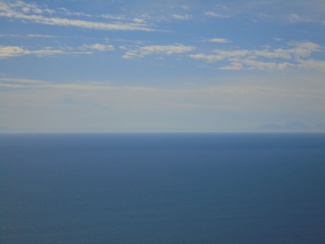
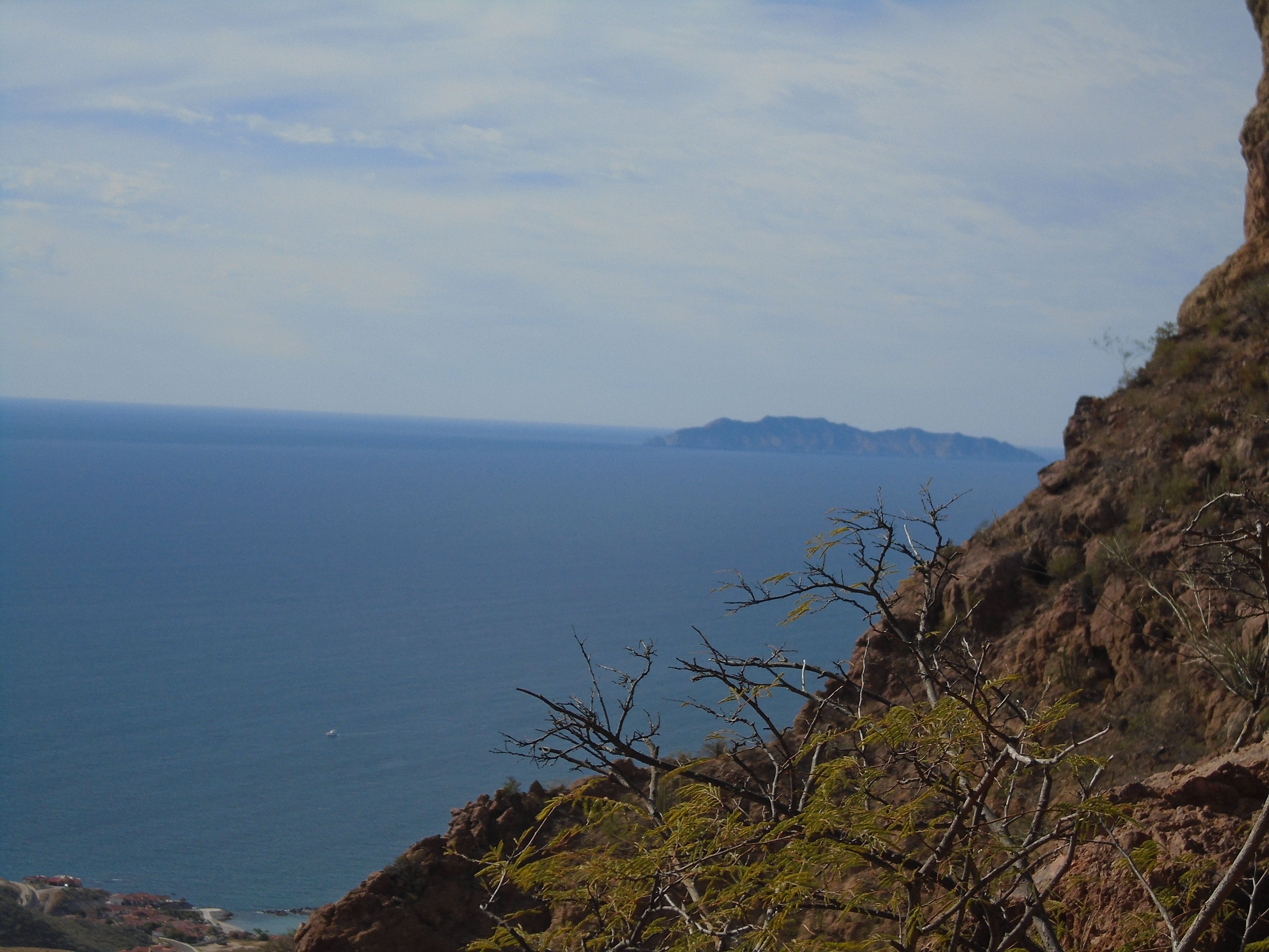
The hazy peaks to the right in this photo (above) is an island, possibly Isla Tortuga that is some 60 miles from the mainland, looking west towards the Baja Peninsula. However, there is a thin ridge of mountains on the horizon. These I believe to be the Baja Peninsula some 90 miles away.
![DSC00205.JPG]
( )
)
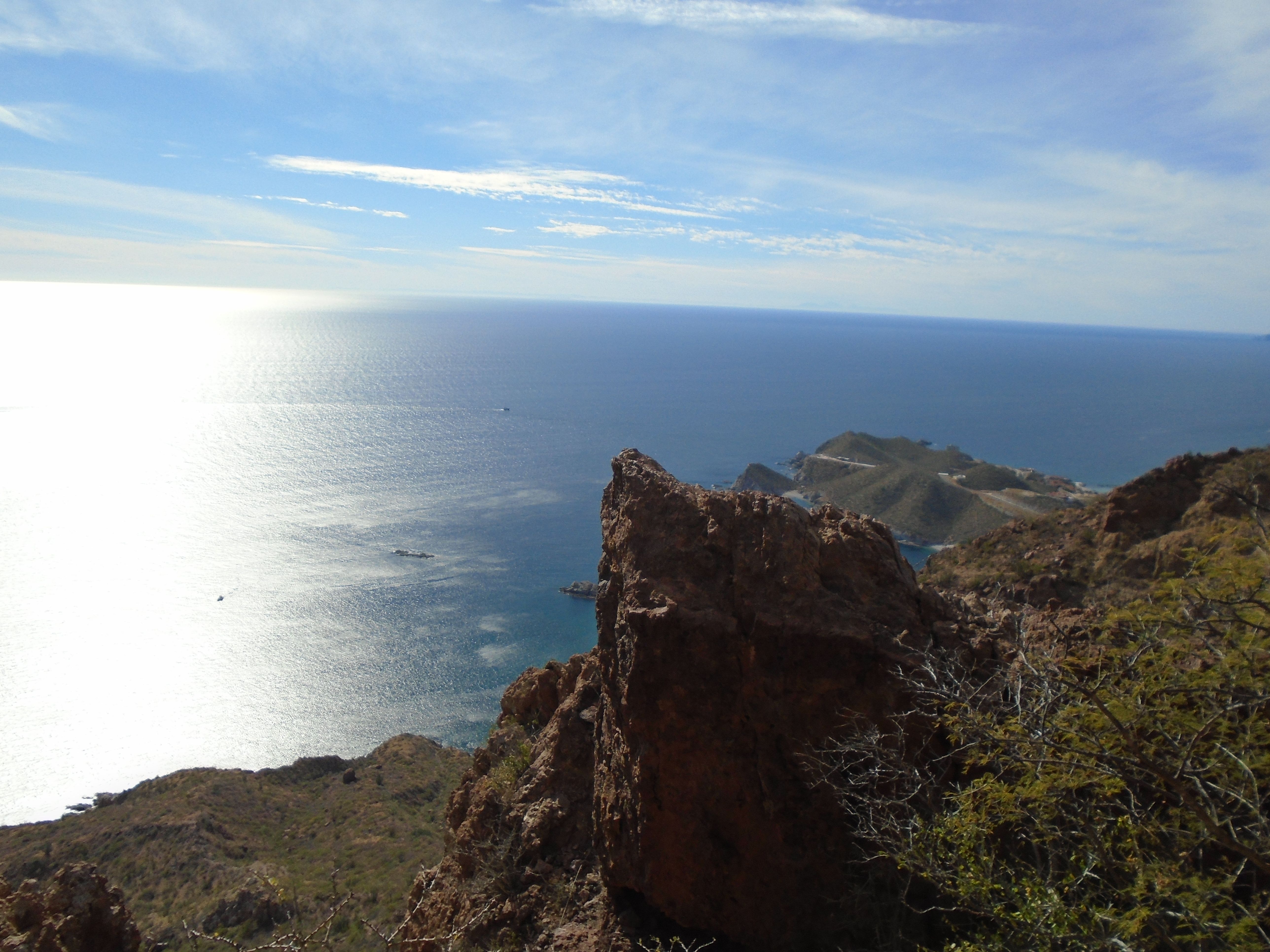
The photo above is a shot of the peninsula that was in the previous photo, magnified quite a bit. The overlook is to the left of the photo.
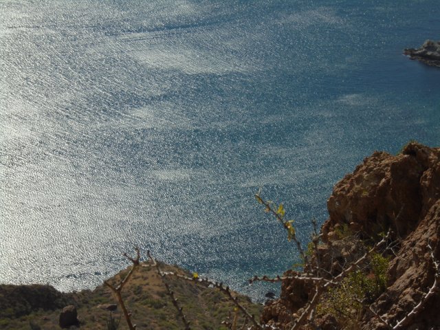
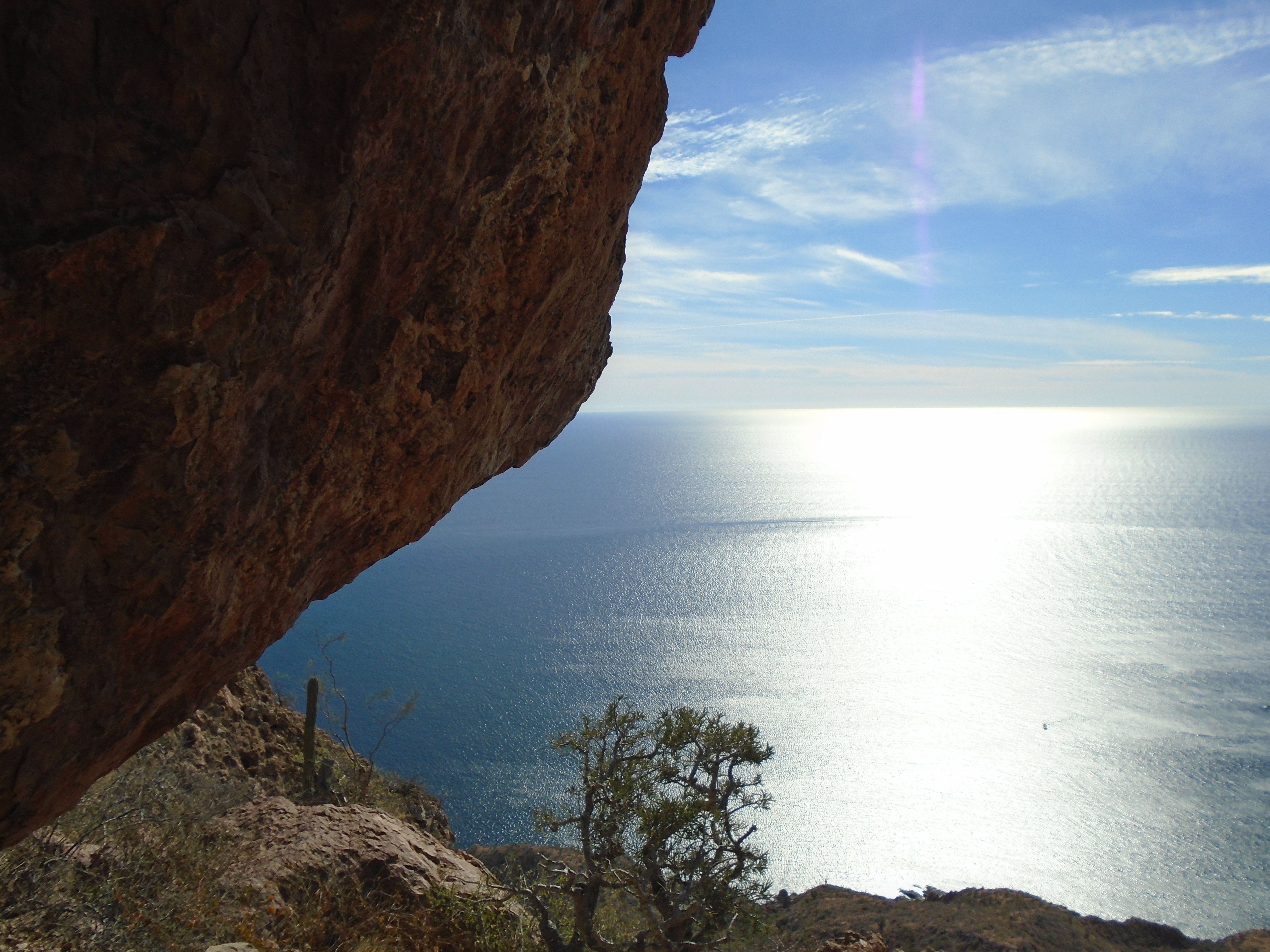
The shot above is looking straight down the South face of Tetakawi into the sea of Cortez.
And above, one final shot to the Southwest.
![DSC00208.JPG]
( )
)
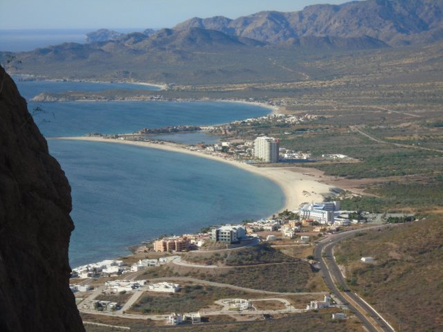
Above is the first photo taken from my descent. It is looking Northwest towards the far West bays of San Carlos.
Again looking at the Western Bays of San Carlos. It had only taken me about an hour to get to the top of Tetakawi. However, at this point I'm probably about an hour into the descent and nowhere near the parking lot at the trailhead. I think by this time I had twisted my ankle after sliding on some loose rock, and while I was still able to walk on it it had slowed me down. I was really getting low on water as I had only a few swallows left. Based on my current rate of descent, I could see that this hike was going to turn into about a 5-hour hike. The sun would be setting by the time I made it to the parking lot. I had my phone to use as a flashlight as a last resort if it got too dark. There was a young couple that had passed me on the way down, so I was the last hiker for the day.
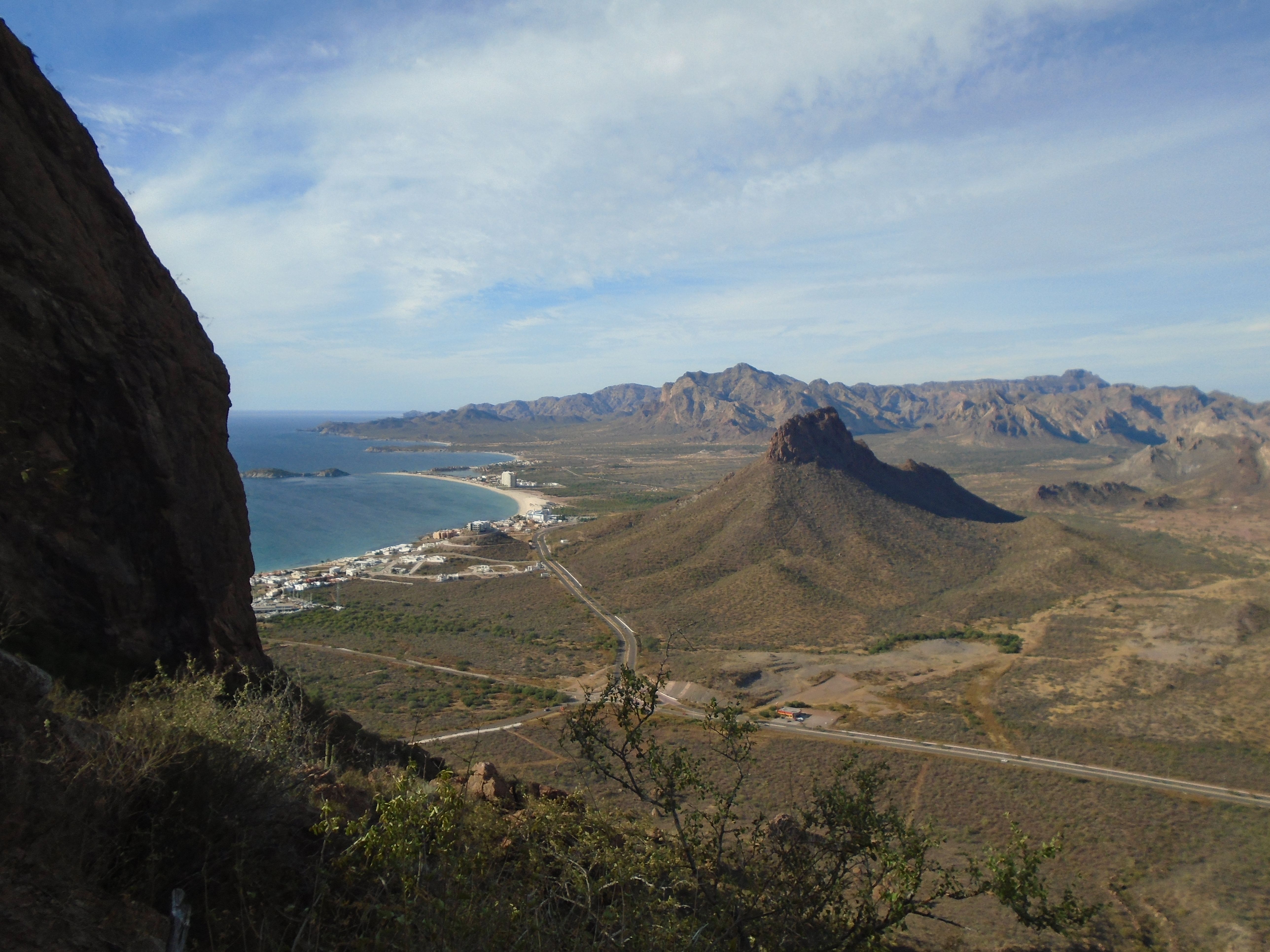
The photo above is the last photo taken of the hike. At this point I was probably less than half way down the face of the mountain and I had at least two more hours to go. All of my muscles are starting to ache as it wasn't just my legs that I was using during the climb. I was using both my arms even on the descent, and probably even more on the descent than I was on the ascent as I was constantly having to keep check on my momentum and balance on the steep grade.
By the time that I got down to the trailhead at the highway parking lot I was totally exhausted. I hardly had the energy to get into the car and drive it away, an just swinging my legs into the drivers side seat was a major effort.
I had run out of water about an hour before I got down to the bottom so the first thing that I did was head to the bar at the marina on the Eastside of Bahia San Carlos. The name of the bar is the Hammerhead. After two or three beers I limped back to the car and my Airbnb and went to sleep. The next day I was so sore that I could barely get out of bed. I hardly move for a day after that.
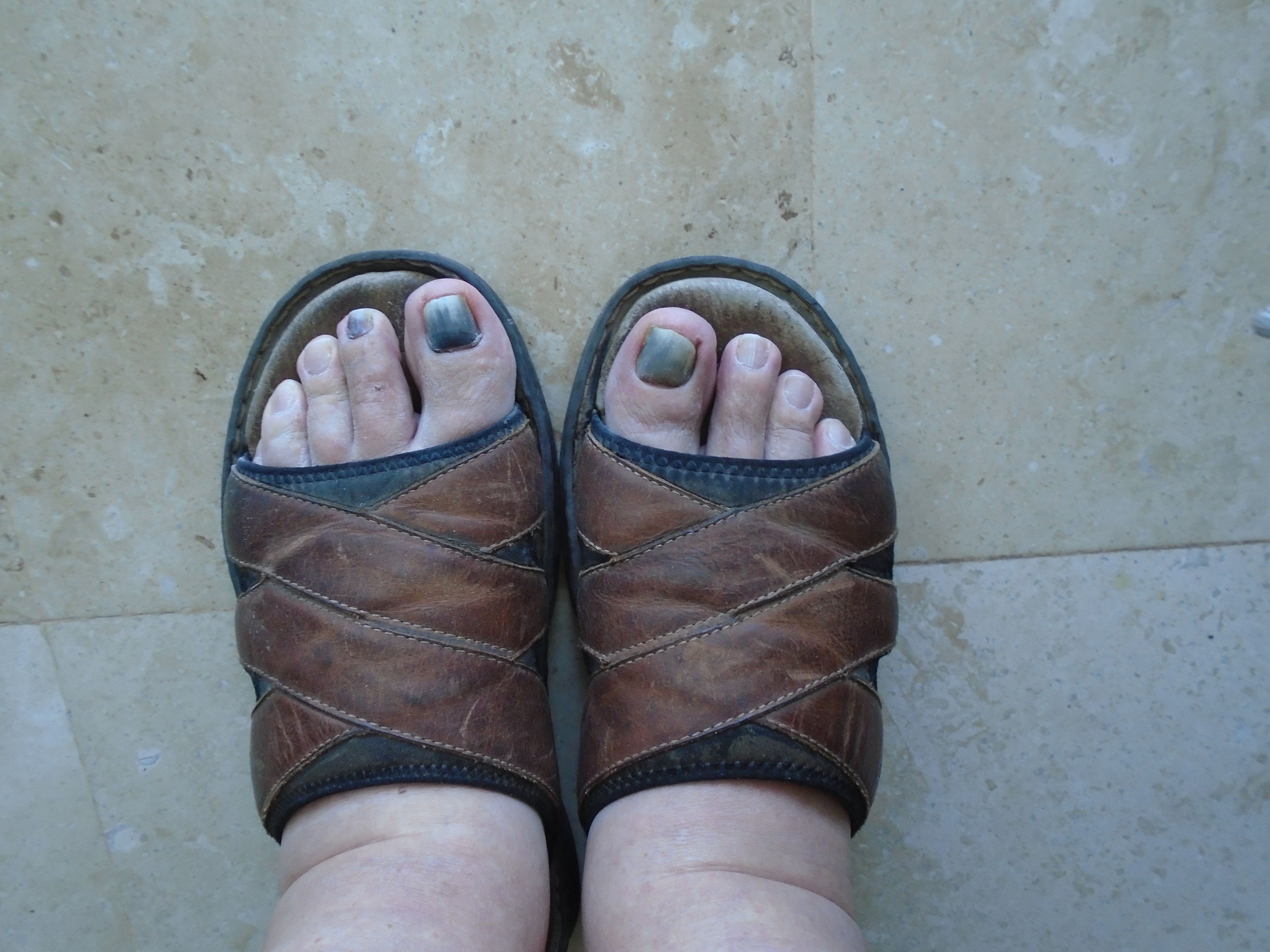
Another casualty of the hike besides my sore muscles were the nails on my big toes. I had let them grow out too long for hiking, and on the descent they were getting shoved into the toes of my hiking shoes. While I didn't notice any pain on the hike, about 2 days afterward, they turned black. As I write this in the middle of March of 2018, I've lost one of them and the other one seems to be ready to fall off as well.
In hindsight I probably should have left Tetakawi for the young people. There were several that we're climbing the mountain at the same time that I was, and they were bounding and bouncing off the rocks and the trail like billy goats. Nevertheless, I'm kind of proud of the accomplishment, in spite of the risk that I took at my age.
Congratulations @cactusclef! You have completed some achievement on Steemit and have been rewarded with new badge(s) :
Click on any badge to view your own Board of Honor on SteemitBoard.
For more information about SteemitBoard, click here
If you no longer want to receive notifications, reply to this comment with the word
STOP