Random Notes on "Analysis of the Traditional Chinese Medicine Planting Belt along the Belt and Road via Satellite Maps"
Recently, while browsing some materials, I stumbled upon an intriguing topic: “The Traditional Chinese Medicine (TCM) Planting Belt along the Belt and Road,” paired with a satellite map analysis angle. It instantly struck me as both practical and imaginative. TCM, a vital part of Chinese culture, is riding the wave of the Belt and Road Initiative (BRI) to go global—not just an economic expansion but a fusion of culture and technology. The addition of satellite maps gives this ancient industry a modern twist. So, I decided to jot down some thoughts on this.
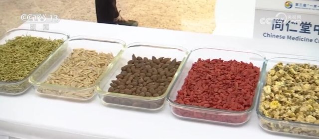
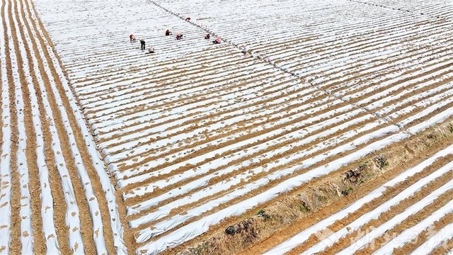
Since the BRI kicked off, countries and regions along its routes have become key partners in China’s global cooperation. Looking at satellite maps, from Gansu and Ningxia in Northwest China to Vietnam and Laos in Southeast Asia, then to Kazakhstan in Central Asia and Egypt in Africa, the landscapes and climates vary wildly, yet they’ve all emerged as potential hubs for TCM planting. Take Dingxi in Gansu, for instance—known as the “hometown of Longyao (Gansu medicine)” since ancient times. Satellite images reveal sprawling yellow loess plateaus covered with fields of angelica and astragalus. In Southeast Asia, the tropical rainforest climate suits herbs like notoginseng and amomum. On the maps, these green patches feel like the global “chess pieces” of the TCM planting belt.
I couldn’t help but wonder: how do satellites pinpoint these planting zones? After digging a bit, I learned that high-resolution remote sensing can identify vegetation types and distributions, even assessing crop health via spectral analysis. It hit me—TCM planting isn’t just farming anymore; it’s deeply tied to modern tech. Along the BRI routes, the TCM planting belt is like a green thread, linking China’s ecology and economy with those of other nations.
This train of thought led me to see the TCM planting belt along the BRI as more than a geographic concept—it’s a testing ground for economy and culture. Take Gansu’s angelica again: satellite maps show its planting area has grown significantly in recent years, thanks to export demand from the BRI. Reports say it’s not just hitting Southeast Asia but also reaching Europe, becoming a “new favorite” in the wellness market. Yet, behind the opportunities lurk challenges—soil degradation, water shortages—especially stark in arid Central Asia. On satellite maps, some green areas are fading, perhaps a sign of ecological strain.
Then there’s Egypt in Africa, with its hot, dry climate—hardly ideal for most TCM herbs. But I read online that they’re experimenting with aloe and monk fruit, paired with modern irrigation tech, and seeing some success. On satellite views, the green planting strips along the Nile stand out vividly. It’s a reminder that globalizing TCM planting isn’t just about scattering seeds—it demands tailored tech solutions.
Beyond economics, the TCM planting belt carries cultural dissemination. Along the BRI, planting TCM herbs often comes with the spread of Chinese medicine principles. In Kazakhstan, locals are starting to embrace astragalus stew for wellness, a nod to the TCM idea of “medicine and food from the same source.” Satellite maps can’t capture these cultural nuances, but they show the expanding scale of planting—the foundation for cultural outreach.
I also thought of a fun trend: in some Southeast Asian countries, TCM planting has sparked a “mix-and-match” culture. Vietnamese farmers, for example, grow amomum alongside local herbs, creating unique medicinal cuisines. This blending mirrors the economic cooperation of the BRI and adds a lively footnote to cultural exchange.
Writing this, I’ve gained a deeper appreciation for satellite map analysis. It’s not just a tech product—it’s a window into the world. Through this lens, we see how the TCM planting belt “branches out” along the BRI, while spotting issues like ecological imbalance from over-reclamation. It makes me think that the future of TCM development can’t just chase profits—it needs sustainability too. Maybe satellite tech could even monitor soil quality or predict climate shifts, guiding planting more scientifically.
A Random Daydream
Finally, I let my mind wander: what if one day, satellite maps could label every TCM planting plot worldwide with its specific herb, even showing real-time growth stats? From Gansu’s astragalus to Egypt’s aloe, Southeast Asia’s amomum to Central Asia’s licorice, the TCM planting belt would become a dynamic “herb map”—a marvel of tech and a legacy of culture. Thinking about it, this topic just keeps getting more fascinating. The satellite map angle gave me a clearer view of TCM planting along the BRI, and I’m excited about the vitality of this ancient industry in the modern world.
References
- “Dingxi, Gansu: TCM Planting Boosts Rural Revitalization,” China News Service, 2023.
- “Analysis of Ecological Resources and TCM Planting Potential in BRI Countries,” Journal of Chinese Medicinal Materials, Vol. 45, 2022.
- “Applications of Satellite Remote Sensing in Agricultural Monitoring,” Journal of Remote Sensing, 2021.