The Origin of the Largest Island In The World According to Marco Polo Is the Island of Java
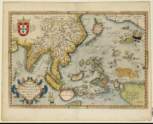
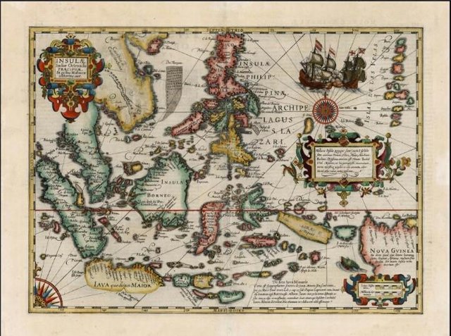
Abraham Ortellius, cartographer and geographer from Belgium, once published a map titled Indiæ Orientalis in 1570.
The map illustrates the region of Southeast Asia with the breaking of the islands.
He was the first cartographer to argue that at first the continent became one and then split up to meet its present form.
Because of the lack of information from explorers, Ortellius displays a round Java island with a convex south. Even on the map the island of Java is about twice as wide as Borneo
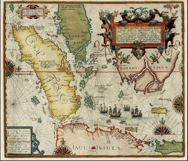
While the map of Southeast Asia by cartographer Willem Lodewijcksz, published in 1598, displays an incomplete Java because its southern side is cut by the bottom frame border. It appears that Lodewijcksz deliberately concealed the mystery of Java.
The question of what kind of southern Javanese appears on ancient maps can not be answered by cartographers because of the insufficient information available at the time.
They are cartographers who only hear the stories of adventurers who once pioneered the exploration into the East.
One of Venice's famous adventurers and often a reference to cartographers is Marco Polo. He tells of his journey to Southeast Asia in the 13th century.
Although many doubt the story of his journey, some of the 16th and 17th century cartographers continue to use toponimi from Marco Polo.
Unfortunately, Marco Polo also gives an absurd description of Java. Popularly known as Java Major "The largest island in the world," the Javanese form according to Marco Polo is based on "testimonials of sailors who know a lot about it."
The Portuguese explorers who visited the archipelago before the arrival of the Netherlands, had their own perception of Java.
Based on the story of the inhabitants of the island they get informai that in the middle of the island there is a cluster of mountains that stretch from West to East.
The geography has stopped communication between the North and South coasts. As a result, the Portuguese sailors abandoned the intention to immediately explore the southern coast of Java.
The mystery of the Southern coast of Java was solved in 1580. Francis Drake, a British sailor and politician who circled the world from 1577 to 1580, stood on the southern coast of Java.
After exploring the Maluku archipelago and through the Timor gap, Drake and his crew follow the Southern line and land somewhere on the southern coast of Java-apparently Cilacap.
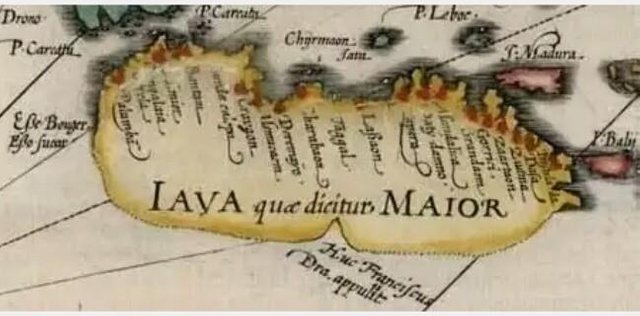
Then a map titled Insulæ Indiæ Orientalis by cartographer Jodocus Hondius appeared in 1606. He drew the southern coast of Java with only a dashed line, but left a firm line that formed the bay for its port area.
Hondius incised a small note at that point, "Huc Franciscus Dra. Appulit, "which marked where Drake had dumped anchor.
Since the rising of Hondius map, the mystery of South coast of Java began to unfold. The subsequent maps provide a complete picture of an island once popular among oceanic explorers under the name Java Major.
The Southeast Asia map of Insulæ Indiæ Orientalis by cartographer Jodocus Hondius appeared in 1606. In this map Hondius records Francis Drake in Cilacap marking the end of the southern coastal conjunction of Java, as well as the island's true form.
Overview of Java Island as the Biggest Island