Sat Nav
Navigating the Old Way
It has been almost ten years since I lost my grandpa, Adimoha. He was active even in his late eighties. However, my parents insisted that he should come live with us and that was when I started enjoying his stories about the days he spent hunting with his father and grandfather.
According to the stories, they would walk up to 50 miles on very narrow foot-beaten roads as they attempted to get to the heart of the forest. "In the deepest parts of the forest, there were no roads at all," he would say.
To my little, curious mind, I always wondered how they still managed to find their way home from such expeditions.
He would explain how they used landmarks such as Anthills, big trees, Reserved forest, Rivers, Hills and some marks that they created themselves for ease of navigation. The ongoing is what Satellite Navigation is all about: helping us find our way when in unfamiliar surroundings.
Satellites

When we speak of satellites, the mind goes to shiny objects in space that serves as mirrors for microwave communication towers and as cameras taking photographs of space and relaying to earth. Even though this is an accurate description of satellites, it only describes artificial, human-made satellites. There are other natural satellites like the moon is a satellite to our earth.
Satellite is a machine, moon or planet that rotates around another object. For example, our Earth is a satellite to the sun because it orbits the sun. But for this post, we will define satellite as a machine that is launched into space that orbits around the earth or another planet.
Classification of Satellites.
Satellites are classified according to the orbits they are placed. The orbits determine the function and the application of the satellites.

. Low Earth Orbit Satellites: Satellites at this orbit (180km to 2000Km) have low altitude compared to other satellites, but they are above the altitude for any conventional aeroplane. They have fewer path losses, and less round trip time RTT since the satellites are closer to the earth than other orbits. Earth monitoring satellites, military reconnaissance satellites and some communication satellites are found in LEO
. Medium Earth Orbit: Is the space region above the Low Earth Orbit (LEO) and below the Geostationary orbit. MEO is mostly used for Navigation and Communication satellites.
. Geostationary Orbit: Satellites in this orbit remain in position throughout the day and antennas can be directed towards it. This has a great advantage in direct to home broadcasting. At the altitude of 35790 km, it takes 24 hours for a satellite to orbit the Earth, this is also known as geosynchronous orbit because it synchronises with the Earth. Direct Broadcasting, Communication and Relay satellites are in this orbit.
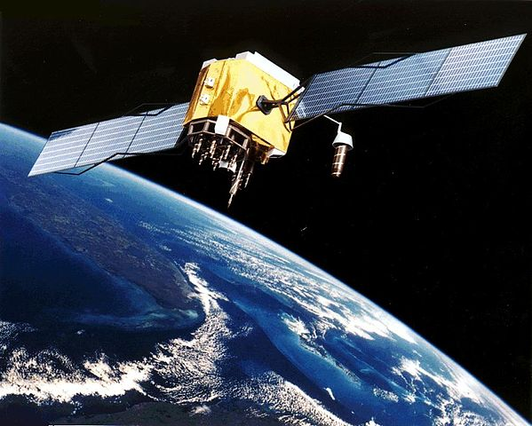
Sat Nav
Satellite Navigation (Sat Nav) consists of orbital satellites that allow electronic receivers to determine their position or location with a high degree of precision (within Meters). The system can determine longitude, latitude, altitude/elevation and set accurate time of the receiver. This System has been beneficial in providing location, navigation and tracking of anything fitted with the receiver. Satellite Navigation has a wide range of applications; many countries/regions are working very hard to provide their own Satellite Navigation System. Some countries/regions have operational Sat Navigation or working hard to have.
The following Satellite Navigation are operational or under development;
i. Global Position System GPS (USA)
ii. Galileo (European Union)
iii. GLONASS (Russia)
iv. BeiDou-2 (China)
Let's look at Global Position System GPS as a Satelite Navigation System.
Global Positioning System consists of three segments;
i. Space Segment
ii. Ground Segment
iii. Receiver Segment
Space Segment
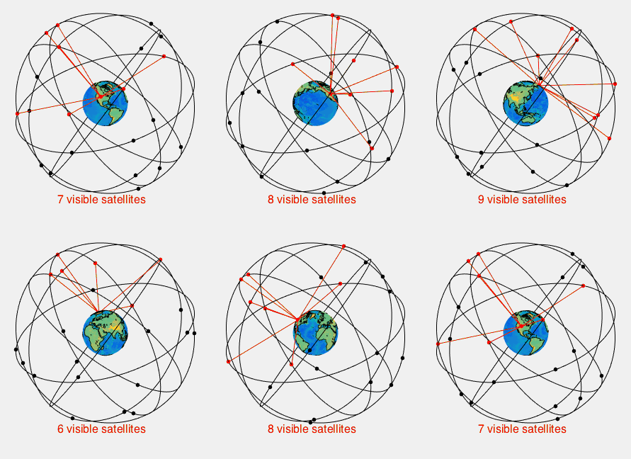
The Space Segment of GPS has a constellation of 24 satellites at a minimum in medium-term orbit (MEO). Each GPS Satellite circles the Earth twice a day, and it is approximately placed at an altitude of 20,200KM. The 24 GPS satellites are placed into six equally-spaced orbital planes with four satellites in a slot. This arrangement ensures that a user can view at least four satellites from any point on the Earth, that is, direct line of sight. As at February 2016, there are a total of 32 GPS satellites; some are used as spare and also to enhance GPS precision, but, only 24 satellites are considered in GPS constellation.
Onboard a GPS satellite is an atomic clock that synchronises with one another and ground stations; the satellites send out radio signals providing location, status and time. The radio signals travel at the speed of light (more than 299,792 km/s). GPS device uses a geometrical concept known as Trilateration to find its location.
Trilateration is a process of determining a position from three distances.
But wait, let us look more closely at how the GPS works.
Let's find the distance using the equation;
D = T * V
where;
D= Distance
T= Time (is the time difference between the time broadcast by the satellite and when it was received )
V= Speed (Speed of light)
Determining Distances (D) from at least three satellites, a GPS device performs Trilateration calculations, to find the interception of at least three circles to determine its location. Explaining trilateration further, since a GPS satellite sends signals to a GPS receiver and we have known the distance, and the distance represents a circle equal in all directions while the GPS satellite is at the centre of the circle. If a circle represents the signal picked by the GPS receiver from the first satellite, and a second circle represents the second signal from the second satellite, then, because we need at least three GPS satellites to complete trilateration calculation. Let the third circle represents the signal from the third GPS satellite. Then, the location of the GPS receiver is the intersection of the three circles.
A signal from the fourth satellite is used to confirm the first calculation, i.e. if position calculated from satellites "X-Y-Z" do not match the position from "A-B-C.", other combinations are tested to get a consistent result.
Control Segment
GPS control segment consists of the Master control, Ground Antennas and monitor station. The Master Control is used for command and control of the GPS constellation, checks for system integrity and health status. It has a backup of an alternate MC. The Ground Antennas consist of four GPS antenna and seven Airforce control antennas. It collects telemetry and sends GPS commands and navigation program upload. The Monitor stations track the satellites as they orbit the Earth. It has sophisticated GPS receivers and feeds the master control.
User Segment
The User Segment is the electronic gadgets equipped with a GPS receiver. They are of two types, Military grade and Civilian. Military use secure GPS Precise Positioning Service. GPS receivers are tuned to the frequencies transmitted by the satellites. Some GPS receivers can receive signals from (4-12) GPS Satellites, and this improves the accuracy of the receiver.
GPS Applications
GPS has created a multi-billion industry both for Civilians and the Military, and GPS is felt in almost every industry.
Navigation
Moving from one place to another has never been this easy, we have a plethora of GPS receivers today. Apps developers have built applications that rely on GPS to aid our movement. Apps like Google Maps, Uber, Taxify use GPS to provide location and route information. Airplanes use GPS to stay within centimetres of their intended flight paths, and the information is presented to pilots on the flight deck. GPS transmitting device sends speed, altitude and bearing to air traffic controllers. In the USA, the FAA has announced that by January 1, 2020. An aeroplane must be equipped with Automatic Dependent Surveillance-Broadcast (ADS-B) to fly in controlled airspace. ADS-B Out relies on GPS to broadcast aircraft altitude, position and velocity to a network of ground stations that sends the information to other aircraft equipped to receive it, Air traffic controllers and even cockpit displays for the pilot. ADB-S will enhance the safety of aviation industry, reduce operating cost for the industry etc.
We are witnessing the arrival of autonomous cars; these cars cannot function with the GPS receivers.
Military.
Global Position system was designed for the military and still being managed by them. GPS was opened up for Civilian use after a USSR fighter jet shot than a Korean commercial airline that strayed to their restricted airspace in 1983.
The US military uses GPS for navigation, Asset tracking, and to identify targets.
Military uses GPS to track assets, determine the position of enemies, and also send coordinates to fighter jets. Precision-guided munitions have been developed to reduce collateral damage during the war.
GPS has changed the way we live today and will continue to do so.
Thank you.
References:
. How GPS Works
. Global Positioning System

Being A SteemStem Member
Sat Navigation technology has created a big industry both for civillian and military use. Thanks for sharing. Insightful post.
Thanks for reading my Post.
I like how you introduced the post. We often take things like satellite navigation for granted until we get lost. Thanks for sharing.
Thanks. Satellite navigation is an interesting technology.
Thanks for reading my post