WingtraOne surveying drone - The all in one mapping device for high precision
WingtraOne surveying drone
The all in one mapping device for high precision
Screenshots
 View Image |  View Image | 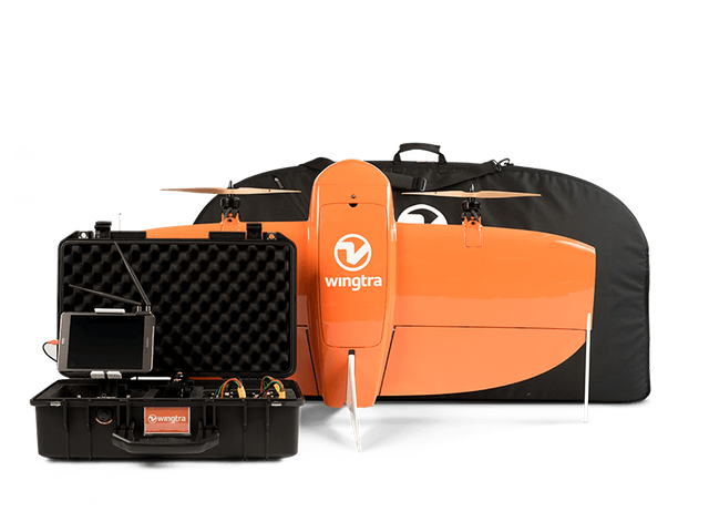 View Image |
|---|---|---|
Hunter's comment
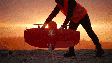
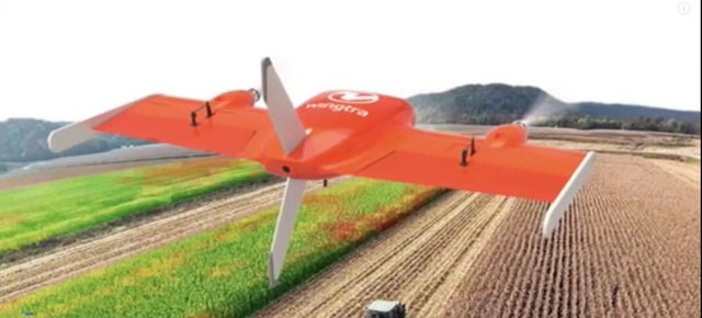
WingtraOne is a vertical take-off and landing (VTOL) drone used for high precision mapping and surveying.
It offers high resolution and accuracy up to as low as 1cm. A truly safe & easy to use a drone. It is controlled through the WingtraPilot software specially designed for WingtraOne.
The payload options include different cameras which are versatile with respect to specs and functions. You can swap in less than 2min on the field.
RGB Cameras Sony RX1RII, Sony QX1 20mm, Sony QX1 15mm
Specialty Cameras Micasense Rededge-M, Flir Duo Pro R
The Vertical Take-Off and Landing capability allows the VTOL drone WingtraOne to ascend and move like a helicopter. For the mapping mission, it transitions into forward cruise flight and matches the endurance and speed of fixed-wing airplanes. In order to land, the WingtraOne switches back to hover flight and descends vertically.
Source
Videos
Link
Contributors
Hunter: @aamirijaz

This is posted on Steemhunt - A place where you can dig products and earn STEEM.
View on Steemhunt.com
Hi @aamirijaz,
Thanks for your hunt. I’ve reviewed and approved it. The hunt is on.
Please read our posting guidelines. If you have any questions, please join our Discord Group.
Another wonderful drone i am seeing on Steemhunt in two weeks. This high qulity drone with good precision will go a long way in helping field surveyors. Nice hunt!
Pros.
Cons.
Not found any.
This drone is likely to be purchased from a company rather than used by the public. It has the advantage of being able to make a vertical takeoff, and the picture taken from the sky looks clear. Nice Hunt.
It looks like a cargo plane. A plane used for high-precision mapping and measurement. The most important capability is vertical take off and landing ability. I review the site and shoot with cameras with great resolution.
wow I just saw a product like this, I think it's really cool. because I can enjoy the advanced features, which has a takeoff feature like an airplane.
This is a really great drone because it incorporates the feature of allowing a fully vertical takeoff, besides being a drone that offers a long period of flight at really great speeds. Another feature is that it is an easy drone to control and maneuver and with a camera that offers a very high capture resolution.
Awesome drone looking at this cool features this has everything working under critical environment with camera which operates with great resolution is awesome