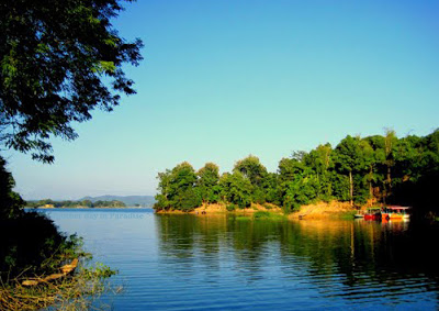
Rangamati,Bangladesh
Rangamati District (Chakma) is an administrative division of the Chittagong Division of south-eastern Bangladesh. Betubuniya Geo satellite station is located here.
The natural beauty of Lilabhumi Rangamati Hill District is located between 220- 27 and 230-44 north latitudes and 910- 56 and 920- 33 east longitude. Rangamati north of India Tripura, Mizoram, Bandarban in the south, Mizoram in the east and Chittagong and Khagrachari in the west. The largest district of the country in terms of district area. The city is one of the only rickshaw cities, surrounded by lakes and tourist cities. In this district, 14 people including Chakma, Marma, Tanchanga, Tripura, Murong, Bom, Khumi, Khayang, Chuck, Pankhwa, Lussai, Sujesaatal, Rakhain, and Aboriginal Bengali are living in this district.
Rangamati, Khagrachari and Bandarban - along with the three mountainous regions, the name of the Chittagong Hill Tracts was formerly the Krupas Mahal. After the formation of Bandarban in 1981 and Khagrachari separate zones from the Chittagong Hill Tracts district, the main part of the Chittagong Hill Tracts (Chittagong Hill Tracts) district became Rangamati Hill District. Chakma Circle Chief in the Rangamati Hill District under the traditional revenue collection system. Chakma King is the systematic Chakma Circle Chief.
Geographic borders
The total area of Rangamati is 6116.3 sq km. It is the largest district of Bangladesh. This district is surrounded by Tripura in India, Bandarban district on the south, Mizoram province of India, and China Province of Myanmar on the south and Khagrachari district and Chittagong district on the west.
Main river
Karnafuli, Thega, Harina, Kasalong, Shuvalong, Chingri, Kaptai.
Karnafuli is the main river of this district. This river originated from the Lusai hills of India, and entered the region on the north-eastern border of Rangamati through the mouth of the river Thaga. The tributaries of Karnaphuli are: Kanchalong, Chengi, Thiga, Barhariana, Salok, Reinkhang and Kaptai. Though there is considerable fertility in these tributaries during the dry season, the amount of water in the dry season is negligible.
Administrative areas
Rangamati Municipality consists of 9 wards and 35 mahallas. The total area of the city is 64.75 sq km. Rangamati was declared a full district in 1983. There are 10 upazilas, 50 union parishads, 162 mouzas and 1347 villages in this district. 10 upazilas of Rangamati district are:
Kaukhali,
Kaptai,
Jurachharhi,
Naniarchar,
Barkal,
Baghaichhari,
Bilihari,
Rangamati Sadar,
The royal palace and
Langdoo
Impressive place
1.Kaptai lake,
2.King Jung Basak Khan's Dighi and Mosque,
3.The ruins of Raja Harish Chandra Rai, #
4.Hanging bridge,
5.Pagoda of Buddha,
6.Rajban Bihar,
7.Shuvalong Fountain
8.Sajake