3D Mapping abandoned Donner Summit Train Tunnels with my drone.
NOTE: Links at the bottom of the text for the 3d models.
A while back I was working on a project to map the The abandoned Donner Summit Train Tunnels with my drone.
This was a test to see if flying inside w/o gps would work well and provide me good enough results to generate a 3d data set. Most of the work I do with 3d mapping has the drone fly in a grid pattern and take pictures down at the landscape. I had to manually fly the drone inside in a grid pattern flying up moving over a bit, back down and repeated.
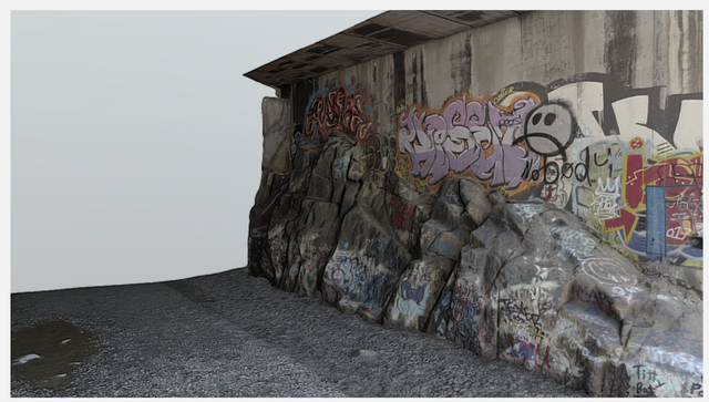
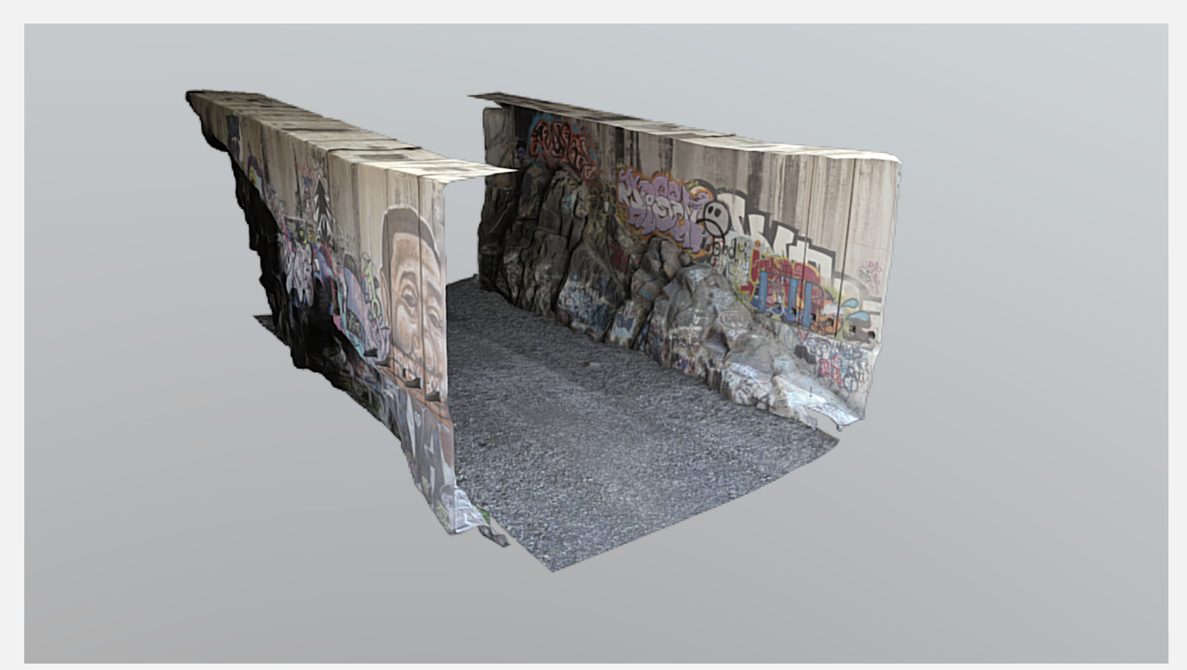
The results are not to bad.. You can see the models at links below. I broke them up into 3 separate models. One that has both walls and a ground (I cut out the top so you could zoom in), and then each separate wall.
This was a tedious process to do and also took over 2 days to generate all the data, properly clean up the model, do poly reduction and make sure the texture maps popped.
Anyhow rambling.. I'll do a blog post about this soon on my website! Cheers and let me know if you like these or have questions.
Combined:
https://sketchfab.com/models/432b1cd4e06b44039869349e7e7eefa5
Section 1:
https://skfb.ly/68RTr
Section 2:
https://skfb.ly/68RTv
Hello @ibareitall. Thank you for sharing your photos.
Friendly Reminder:
1. If you shoot this photo yourself but share at other web site before post on Steemit, please remember to link back to the web site because Cheetah is very clever.
2. If you share someone else photos, please remember to link back the sources of the photos and add some value by adding your own thought or comment.
Photography Slogan: A camera that puts a world of possibilities at your fingertips. Literally.
these are not photos taken, these are screen shots taken of work I did with 3d mapping.