Hurricane Jose is now a major Category 4 storm with 150-mph winds

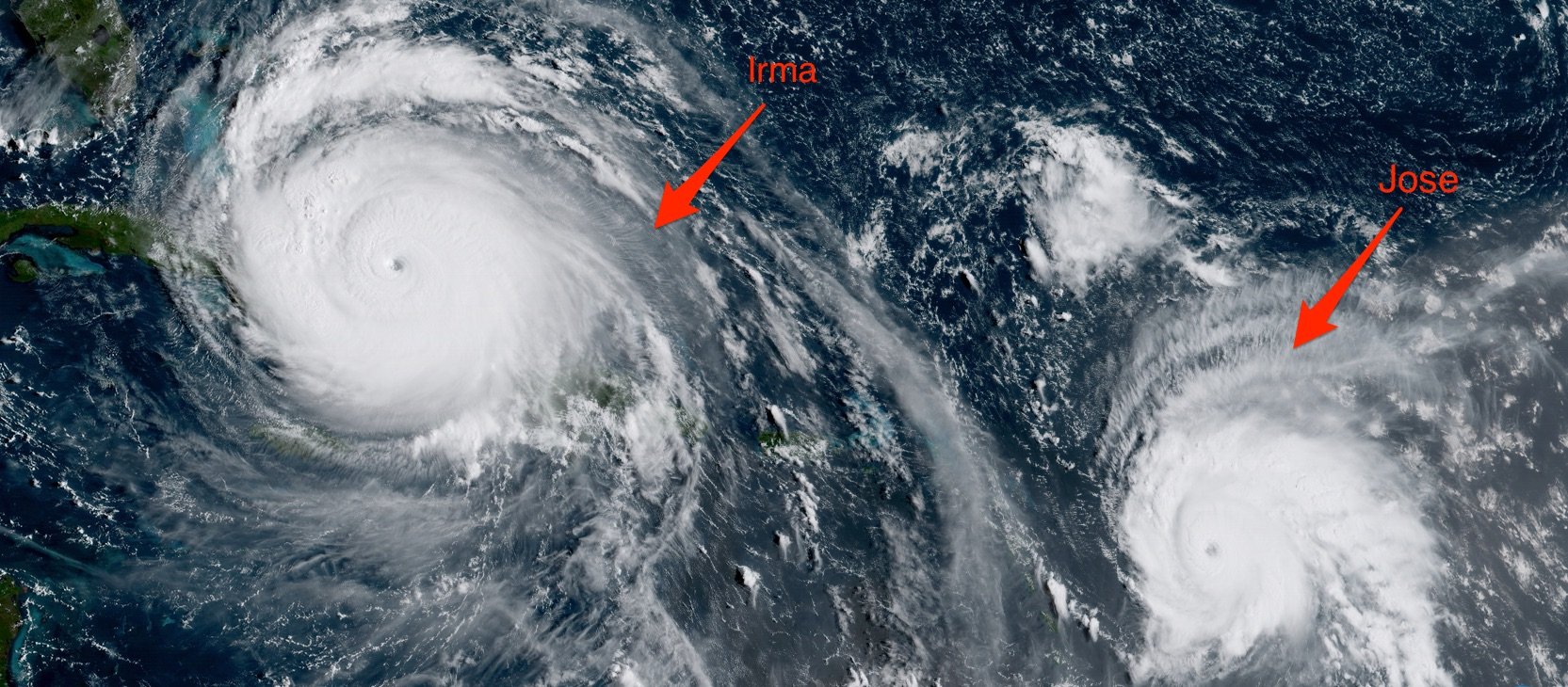
Hurricane Jose is gaining strength as it moves through the Atlantic and has become a major hurricane — defined as Category 3 or above.
The tropical storm was named on Tuesday and became a hurricane on Wednesday afternoon when its maximum sustained winds hit 75 mph. An Air Force hurricane-hunter plane flew through the storm Friday morning and measured its maximum sustained winds at 150 mph, making it a Category 4 hurricane.
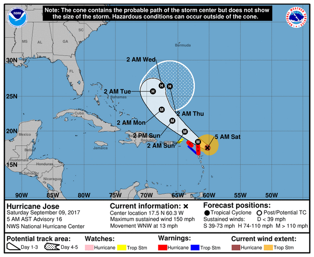
Jose is about 190 miles southeast of the Leeward Islands, a collection of islands in the Caribbean Sea that includes Puerto Rico and the US Virgin Islands. It's moving northwest at 13 mph.
A hurricane warning is in effect for the islands of Barbuda, Anguilla, St. Martin, and St. Barthelemy. Nearly all of those places have already been devastated by Hurricane Irma, which first made landfall early Wednesday. Barbuda has been attempting to evacuate its entire population of 1,800 ahead of Jose's arrival. Estimates suggest that roughly 90% of the buildings in Barbuda and St. Martin have already been destroyed.
A hurricane watch and a tropical-storm warning have been issued for Antigua, and the warning extends to Saba and St. Eustatius as well.
Jose's path is not forecast to follow Irma's for too much longer, however. The National Hurricane Center suggests it's likely to curve north, which means the brunt of the storm's force would miss Puerto Rico, the Dominican Republic, Haiti, Cuba, and the US — though it's too early to know for sure what the storm will do.

Although forecasters are closely watching Jose, Irma remains the most pressing concern, since the Category 4 storm is heading for Florida. Many parts of the state could be hit by the storm's winds as early as Saturday. Many parts of Florida, including the Keys and Miami area, are already being evacuated.
Meanwhile, the US is still recovering from the devastating effects of Hurricane Harvey, which made landfall on August 25 and severely flooded parts of Texas and Louisiana. The storm dumped as much as 51.88 inches of rain in some spots and caused at least 60 deaths.
The peak of the Atlantic hurricane season is around September 10, so it's not uncommon for storms to form during this time of year. However, 2017 has been an unusually active year for hurricanes. Another hurricane, Katia, is nearing the coast of Mexico and is forecast to make landfall early Saturday morning. Katia is already the season's sixth hurricane, though we don't typically see the fourth until around September 21.