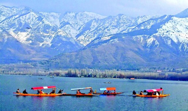
Kashmir the paradise on earth
Kashmir is the northernmost geographical region of the Indian subcontinent. Until the mid-19th century, the term "Kashmir" denoted only the Kashmir Valley between the Great Himalayas and the Pir Panjal Range. Today, it denotes a larger area that includes the Indian-administered territory of Jammu and Kashmir (which includes the region of Jammu, Kashmir Valley, Ladakh and Siachen), the Pakistani-administered territories of Azad Kashmir and Gilgit-Baltistan, and Chinese-administered territories of Aksai Chin and the Trans-Karakoram Tract.
In the first half of the 1st millennium, the Kashmir region became an important centre of Hinduism and later of Buddhism; later still, in the ninth century, Kashmir Shaivism arose. In 1339, Shah Mir became the first Muslim ruler of Kashmir, inaugurating the Salatin-i-Kashmir or Shah Mir dynasty. Kashmir was part of the Mughal Empire from 1586 to 1751,and thereafter, until 1820, of the Afghan Durrani Empire. That year, the Sikhs, under Ranjit Singh, annexed Kashmir. In 1846, after the Sikh defeat in the First Anglo-Sikh War, and upon the purchase of the region from the British under the Treaty of Amritsar, the Raja of Jammu, Gulab Singh, became the new ruler of Kashmir. The rule of his descendants, under the paramountcy (or tutelage) of the British Crown, lasted until the partition of India in 1947, when the former princely state of the British Raj was claimed by both Pakistan and India.
Since 1947, the greater region of Jammu and Kashmir has been embroiled in a territorial dispute between India, Pakistan and China — with India controlling approximately 43% of the region and 70% of its population. Pakistan controls roughly 37% of the region while China controls the remaining 20%. Kashmir is widely regarded as the world's most militarized zone — the region has witnessed three major wars between India and Pakistan, another limited war between India and China, numerous border skirmishes, high mountainous warfare, an ongoing insurgency, a mass Hindu exodus and internal civilian unrest.
The Kashmir Valley, also known as the Vale of Kashmir, is a valley in the portion of the Kashmir region administered by India. The valley is bounded on the southwest by the Pir Panjal Range and on the northeast by the main Himalayas range. It is approximately 135 km long and 32 km wide, and is drained by the Jhelum River.
Kashmir Valley
Geographical feature, Division
Kashmir valley seen from a satellite. Snow-capped peaks of the Pir Panjal Range (left in the image; southwest in compass) and the Himalayas (right in image; northeast in compass) flank the valley
Kashmir valley seen from a satellite. Snow-capped peaks of the Pir Panjal Range (left in the image; southwest in compass) and the Himalayas (right in image; northeast in compass) flank the valley
Nickname(s): Peer Waer (Garden of saints) Paradise on Earth,
Resh Waer
Country India
State Jammu and Kashmir
Districts Anantnag, Baramulla, Budgam, Bandipore, Ganderbal, Kupwara, Kulgam, Pulwama, Shopian and Srinagar.
Headquarters Srinagar
Historical divisions
List
Kamraz (North Kashmir)
Yamraz (Central Kashmir)
Maraz ( South Kashmir)
Area
• Total 15,948 km2 (6,158 sq mi)
Dimensions
• Length 135km (83.885 mi)
• Width 32 km (19.884 mi)
Elevation 1,620m (5,314 ft)
Population (2011)
• Total 6,907,622
• Density 450.06/km2 (1,165.7/sq mi)
Demonym(s) Kashmiri, Koshur (کوٗشُر in Kashmiri)
Languages
• Main spoken language Kashmiri
• Other spoken languages Urdu{as second language}, Pahari (Uri, Karnah), Gojri, Shina (Gurez)
Ethnic groups, Religion
• Main ethnic group Kashmiri
• Other ethnic groups Pahari, Gujar, Shina etc
• Main religion 97.16% Islam
• Other Religions 1.84% Hinduism, 0.88% Sikhism, 0.11% Buddhism
Time zone IST (UTC+5:30)
Vehicle registration JK
Highest peak Machoi Peak (5458 meters)
Largest lake Wular lake(260 square kilometers)
Longest river Jhelum river(725 kilometers)
Kashmir division is one of the three administrative divisions of the Indian state of Jammu and Kashmir. The Kashmir division borders Jammu Division to the south and Ladakh to the east while Line of Control forms its northern and the western border. The division consists of the following districts: Anantnag, Baramulla, Budgam, Bandipore, Ganderbal, Kupwara, Kulgam, Pulwama, Shopian and Srinagar.Other important areas are Sopore, Langate, Handwara, D.H.Pora, Tral and many other
