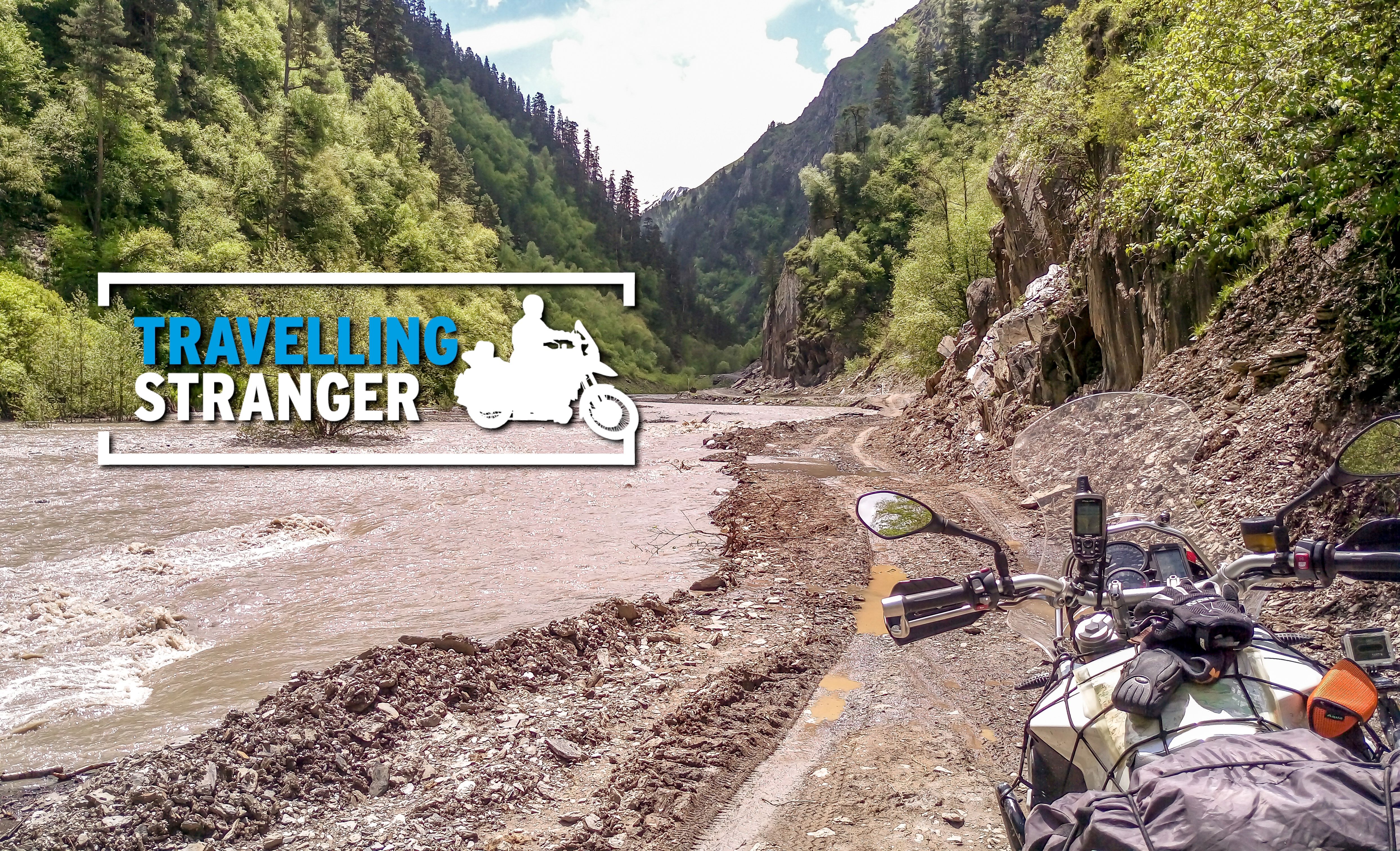
Maps or GPS?
All pics by author unless otherwise specified
Hello my Steeming Pals!
Italiano
I motivi di discordia tra motociclisti di certo non mancano. Uno scambio di opinioni può spesso sfociare in diverbi fuori misura (soprattutto se gli scontri avvengono on line) tra chi la pensa in un modo e chi in un altro. Borse rigide, borse morbide, parafango alto oppure basso, abbigliamento in pelle anziché sintetico, la lista delle divergenza è assai lunga.
Qualche anno fa, con la comparsa dei primi dispositivi GPS portatili scoppiò l’ennesima polemica. Alcuni “nostalgici” del moto-viaggio videro i nuovi gadget con sospetto, molti li considerarono addirittura con sdegno. A parer loro i navigatori GPS avrebbero smorzato la componente avventuroso-romantica di un “road trip” sia in sella ad una motocicletta che con qualsiasi altro mezzo.
Essi sostennero infatti che i GPS avrebbero senza dubbio eliminato la possibilità di “perdersi” in terra straniera, tolto la possibilità di arrendersi ad una auspicabile “vulnerabilità” e ridotto il bisogno di interagire con i locali. Tutte accuse piuttosto pesanti.
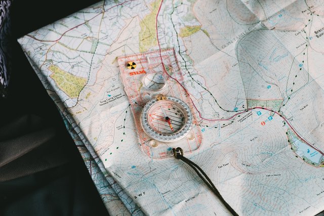
Per loro l’unica ausilio consentito al moto viaggiatore era la cara carta geografica. Secondo i nostalgici non v’era nulla di più qualificante che sapersela cavare bene con una mappa topografica, magari con sfoggio di apposita bussola. Erano questi gli strumenti di un vero moto avventuriero. I navigatori GPS invece andavano bene per i pigri e gli insolenti!
Ebbene, di mappe geografiche tematiche ne ho viste e studiate molte. Qualcuna l'ho pure creata. C’ho mai trovato qualcosa di entusiasmante e dilettevole? Senz’alcun dubbio dico di si: le mappe sono degli strumenti utilissimi per tante applicazioni in molti campi diversi. Tuttavia, sostengo che esse non sono assolutamente degli strumenti pratici per chi sceglie di viaggiare in moto, anzi proprio in moto, no!
Chi non ha mai perso la pazienza tentando di ripiegare una carta geografica con vento o brezza a sfavore? Oppure tentato di consultare una carta stradale sotto alla pioggia o durante una nevicata inaspettata, magari al freddo od al buio di notte? È una vera e propria disperazione e talvolta un esercizio del tutto futile.
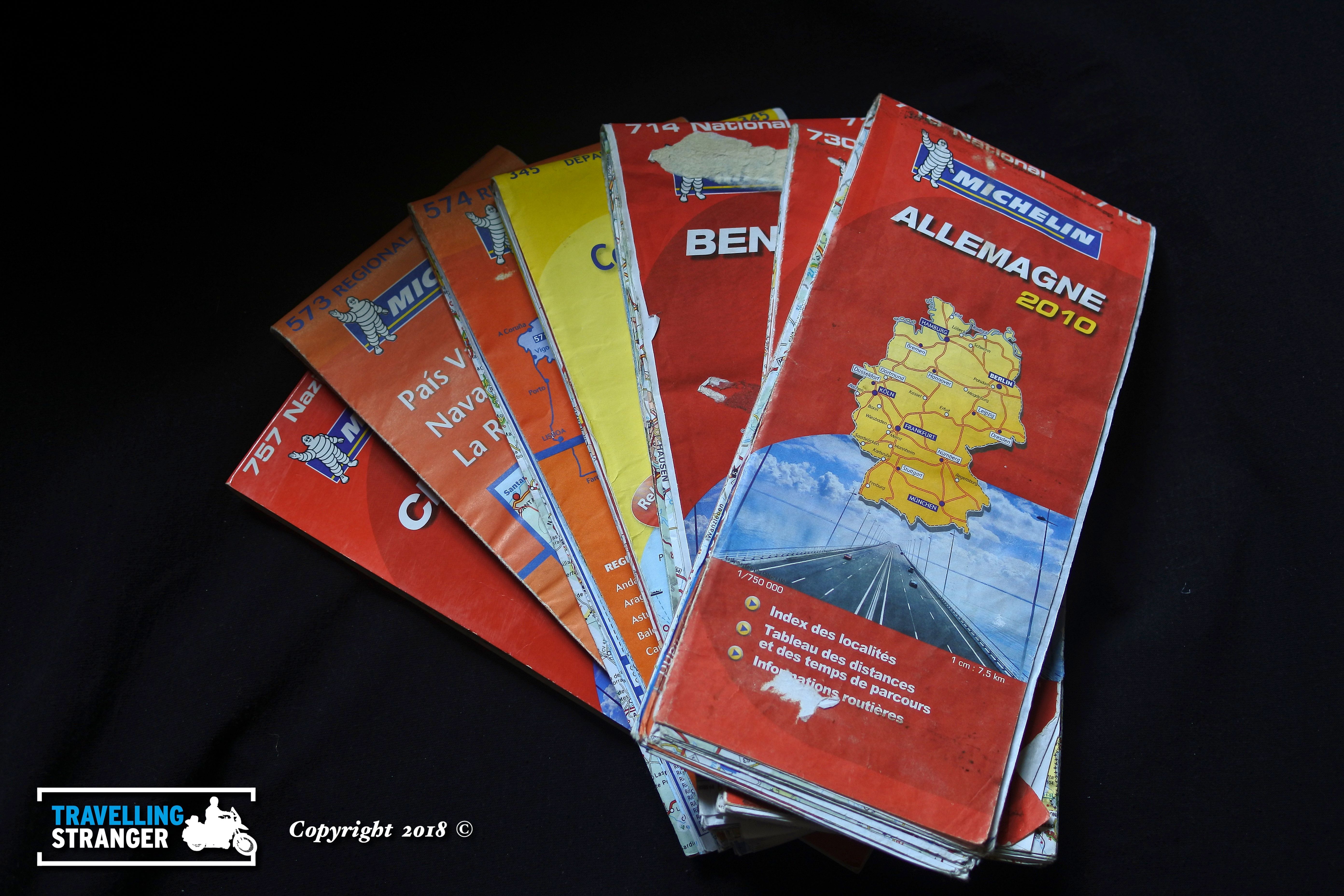
Inoltre, un moto viaggio lungo che magari implica attraversare un continente (dal nord al sud Europa) abbisogna di più cartine stradali se si intende seguire un itinerario preciso. Servono per lo meno 5 o 6 mappe con scala non più piccola di 1:750 000 da portare con se. Le cartine geografiche sono ingombranti, delicate, pesanti, ed in genere piuttosto costose. Ne vale la pena?
Qualche anno fa acquistai il mio primo navigatore gps: uno splendido Garmin 60 CSX. Ci misi qualche giorno per capire come funzionasse, cosa aspettarmi pigiando i vari tasti e come inserire i “Way Points”. Trovai un telaio per fissare il mio gadget al manubrio della moto e prolungai qualche filo dalla batteria per alimentarlo.
English
There are many disagreements amongst bikers in the biker community and some can occasionally turn into amusing confrontations, especially when conducted online. Every motorcycle rider has his/her views on things such as hard bags, soft bags, tank bags, leather outfits and synthetic clothing. The reasons for discord can be many indeed.
Just over ten years ago when the first GPS navigators made an appearance on the market there was a new stir in the community. There were motorbike tourers that welcomed the new gadgets with glee whilst others, the “nostalgics”, viewed the devices with scorn. According to the later, navigators were a threat, the sort of gizmo that would lessen the thrills of a road trip and not just on a motorbike, either.
To the nostalgics the idea of a navigator meant an end to “losing yourself” in a foreign land and making yourself “vulnerable” to the environment. It meant fewer opportunities to engage with the locals in conversation and a loss in exposure to local culture. A pretty tall call!
To them, map reading was the only acceptable means for pinpointing your position and there was no greater virtue than knowing how use map and a compass. These were the tools of a “seasoned adventurer” while GPS navigators were for the lazy and the insolent.
Well, I’ve spent a lot of time peering at maps of various kinds and descriptions in my time and have even contributed to the making of one or two myself. Have I ever found maps fun, useful, worthy of any special consideration? For sure, maps are valuable and important tools in a variety of fields. One thing though that is clear to me however, is that they are poor travel companions for motorcycle tourers anywhere in the world.
Who hasn’t battled with an obstinate map billowing in the wind or even a simple breeze? What about trying to read a map in the rain or after dark, in the cold or any combination of these together? It’s simply frustrating, no fun and often futile.
Furthermore any touring trip on a bike that involves crossing a continent (say from northern to southern Europe) involves the use of several maps if you intend to follow some sort of specific itinerary. At least 5 o 6 maps to a scale no smaller than 1:750 000 are needed for this. Maps take up space, they need care, they’re heavy, and are often expensive as well. Why bother?
 Maps take up space, need care, heavy, and are often expensive as well.
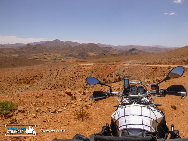
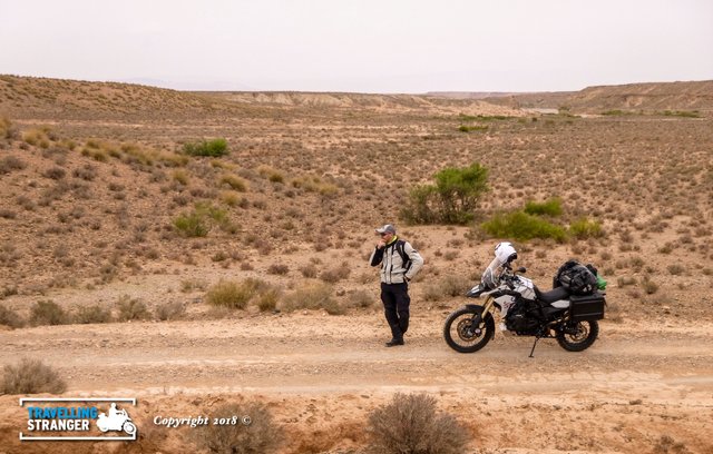
A few years ago, just before a bike trip to north Africa, I bought my first GPS navigator; a new Garmin 60CSX. It took me a few days to figure out how to use it with it's various buttons and functions. Altimiter, trip computer, way points, itineraries, digital maps, all these things were there in my device. I fixed it to the bars of my bike and extended some cables for power.
 Pleased I had a my GPS in North Africa
Mi ci vollero poche ore in sella per apprezzare pienamente il mio nuovo "assistente" satellitare. All'improvviso mi bastò solo dare uno sguardo allo schermo del GPS per cogliere suggerimenti sulla la direzione da seguire per la mia destinazione finale. Non dovetti più fermarmi per fare il punto della situazione sulla cartina stradale ne spremermi le meningi in cocuzzari linguistici per tradurre segnaletiche scritte in Tedesco, Polacco, Russo, Serbo, Arabo e via discorrendo. Il navigatore mi donò subito serenità ed una maggiore continuità alla guida della mia moto. Potei serenamente godermi paesaggi, natura e qualche scatto con la macchina fotografica in più. Il mio gadget satellitare mi permise subito un risparmiare tempo, energia e stress.
Ma i commenti dei nostalgici?
In parte li condivido. Viaggiare all’estero per molti significa entrare in contatto con la gente del posto, assaporare la loro cultura, aprirsi, e quindi in qualche modo rendersi “vulnerabili” all’ospitalità altrui, al cibo, ecc. Secondo l’esperienza di alcuni è dalle relazioni interpersonali che nascono le storie più memorabili di un viaggio. Si possono creare nuove amicizie ed in alcuni casi ci può scapare qualche avventura. Il navigatore GPS in qualche modo ridimensiona queste possibilità in quanto ci impedisce di "perderci" e così facendo riduce il bisogno di cercare un dialogo con i locali. Chi fa uso di un GPS è di fatto più autonomo.
Ma quale vantaggio mantiene una carta geografica sul navigatore?
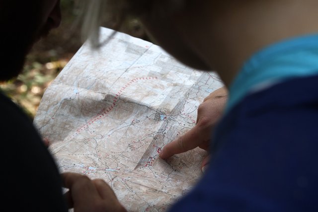
Uno solo a mio avviso. La superficie del territorio rappresentato su una mappa geografica è nel suo insieme maggiore di quella che si può cogliere con chiarezza sullo schermo di un navigatore GPS. Le carte geografiche forniscono una migliore consapevolezza della propria posizione relativa: relativa, ad esempio, alla costa, alla città, al porto, al confine nazionale più prossimo alla nostra posizione. Una mappa, a colpo d’occhio, ci permette di capire quanto dista un punto d’interesse e di valutare il tipo di terreno che occorre attraversare per raggiungerlo.
Ormai il navigatore non è più una novità per nessuno tant’è vero che ogni smart phone ne è dotato. Mi capitò una volta di fermarmi in India per chiedere informazioni:
“Which way to Agra from here?”, chiesi.
“You have Google maps?”, mi sentii rispondere.
È inutile opporsi: l’età dei nostalgici è finita. Non escludo che a breve le uniche carte geografiche disponibili saranno quelle in formato digitale e che le cartine stradali su carta diverranno meri oggetti da collezionismo.
It only took me a couple of hours to appreciate what remarkable tool the navigator was especially on a motorbike! No more stopping to check my position on a paper map, no more doubts about which direction to choose at intersections. There was also no more need to decipherer words in German, Polish, Russian, Serb or even Arabic from dubious road signs abroad. Gone was the need to worry about getting lost as my new satellite friend would take care of this issue and always kept me on track.
My new GPS gave me the freedom to enjoy my surroundings more. Nature, landscapes, towns and villages I could take more of this stuff in and could even dedicate more time to tacking pictures. The navigator saved me time, frustration, energy.
What about the views from the nostalgics?
I agree with some of their points as well. Part of travelling abroad involves experiencing new cultures, mingling with the locals. This can be thought of as making yourself “vulnerable” and your first approach to anyone in a foreign land typically involves asking for information of some kind. Dealing with locals often leads to greater things: new friends and some pretty wild adventures as well.
A navigator prevents you from getting lost and diminishes the need to talk to the locals, for sure. However, it certainly does not transform us into antisocial beings with no will to talk to anyone.
No more wondering which way to go
Is there anything that a map does better than a GPS system?
Only one as far as I can tell. A quick glance at an open map allows for better spatial awareness of territory. At a glance you immediately get a feel for how far the nearest town, border, port, or fuel stop might be from your current position. You can also understand what sort of terrain you need to cross to get to any of the points mentioned.
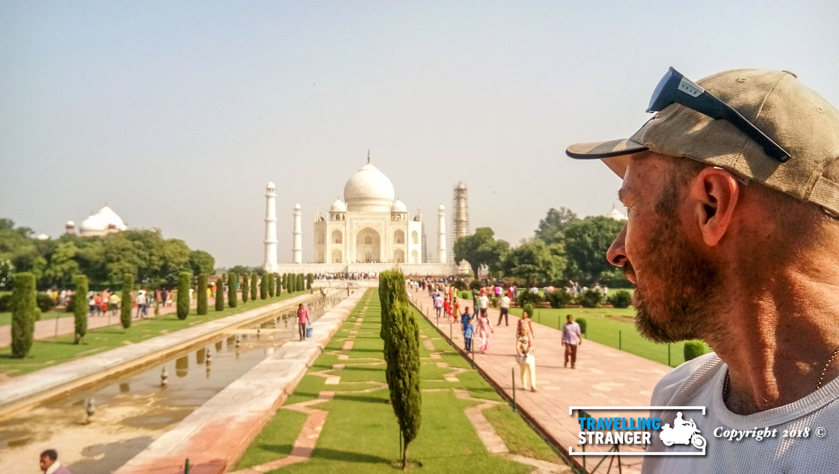
GPS navigators these days are very common, every Smart Phone has one. I remember once asking for directions in India:
“Which way to Agra from here?” I asked.
“You have Google maps?” came the reply.
It’s no use. The age of map loving nostalgia is over. In a very near future there will be only digital road maps available. Paper road maps will be something for collectors only.
 Which way to Agra?
As you said, the map is a nostalgia now. GPS is far better especially if you are a biker... You very nicely explained here. Thanks.
Yeah, I think there very few hardcore map enthusiasts left. However, sometimes I think that the ideal solution is generally to travel with both map and GPS....which of course is not very practical either 😂
Cavolo me l'ero perso il tuo post! Ovvio che sì, il navigatore è quasi d'obbligo.... all'inizio quando ancora non avevamo il gps ricordo che seguivamo queste mappe inserite nell'apposita borsa sul serbatoio, con il trasparente sopra... ma senza ombra di dubbio il navigatore dà una svolta positiva al viaggio... e poi perché mai dovrebbe piacermi perdere la strada? Hahah
Grazie Sara. A qualcuno piace inguaiarsi.....non vedo altra spiegazione 😀
Great Story , and photos man . I resteemed this more people should read of your adventures 🚀
Thanks for dropping by. I appreciate your comment 😀
Io non ho viaggiato molto in moto, ma adesso avrei sicuramente preferito il GPS, bella, romantica, nostalgica quanto vuoi, ma le cartine stradali le ho usate molto in auto o con il furgone, e quando c'è stato l'avvento del GPS, è stata tutta un'altra musica, post molto preciso, chiaro, interessanti e ricco di ottimi spunti e riflessioni, complimenti davvero per il brillante lavoro eseguito!!
Grazie runner. Mi sembra di capire che usi il gps anche per le tue corse 😃
Scusa, john-gpr, avevo una risposta in sospeso e non ricordavo quale, certo che uso un GPS, sai, noi podisti di vecchia data avevamo il pallino di quanta strada avevamo fatto, oppure a che velocità eravamo andati, per cui, anche se datato, ho ancora un vecchio Garmin Forerunner 305, che è ancora affidabile perché l'ho usato poco, le infornazioni che voglio conoscere me le fornisce senza problemi
La risposta a
è memorabile, ahhahahah!
Grazie per i tuoi articoli, ti seguo con gioia!
LAMPS!
Si..come dire: ehi amico comprati uno Smart Phone e non rompere... 😖
Mi è successo più di una volta.
Definetely maps for me!
Good article :)
Maps? Interesting 😀 Why?
I want to be able to find my way without electronics. ;)
I'm a bit old fashioned.
Why do I wanna spend tons of money on something that doesnt always work.
Same reasons why I ride a Yamaha XT 500! ;)
I see ....well, enjoy your map in the fog :-)))