Introduction My home Town to steemit (part 1)

မိုးကုတ္ၿမိဳ႕ တည္ေနရာ ႏွင့္ နယ္နိမိတ္
တည္ေနရာ
မိုးကုတ္ၿမိဳ႕သည္ ေျမာက္လတၱီက်ဳ႕ ၂၂-ဒီဂရီ ၅၀-မိနစ္ႏွင့္ ၂၃-ဒီဂရီ ၃၀-မိနစ္ၾကား၊ အေရွ႕ေလာင္ဂ်ီက်ဳ႕ ၉၆-ဒီဂရီ ၁၁-မိနစ္ႏွင့္ ၉၆-ဒီဂရီ ၄၅-မိနစ္ၾကားတြင္ တည္ရွိၿပီး အက်ယ္အ၀န္းမွာ အေရွ႕ႏွင့္အေနာက္ မိုင္(၃၀)၊ ေတာင္ႏွင့္ေျမာက္ (၁၅.၁၂)မိုင္ရွိၿပီး ဧရိယာစုစုေပါင္း (၄၅၀.၆၀) စတုရန္းမိုင္ ရွိပါသည္။ မိုးကုတ္ၿမိဳ႕သည္ ရွမ္းျပည္နယ္ေျမာက္ပိုင္း ရွမ္းကုန္းျပင္ျမင့္၏ အေနာက္ဖက္စြန္းတြင္ တည္ရွိၿပီး ယခုအခါ မႏၱေလးတိုင္း၊ ျပင္ဦးလြင္ခရိုင္အတြင္းတြင္ ပါ၀င္သည္။ မိုးကုတ္ၿမိဳ႕၏ အေရွ႕ဘက္ႏွင့္ ေျမာက္ဘက္တြင္ မိုးမိတ္ၿမိဳ႕နယ္၊ ေတာင္ဘက္တြင္ ေက်ာက္မဲၿမိဳ႕နယ္၊ အေနာက္ဘက္တြင္ သပိတ္က်င္းၿမိဳ႕နယ္တို႔ တည္ရွိသည္။ မိုးကုတ္ၿမိဳ႕သည္ ဧရာ၀တီျမစ္၏ အေရွ႕ဘက္ (၃၆)မိုင္ ကြာေ၀းၿပီး ပင္လယ္ေရမ်က္ႏွာျပင္အထက္ အျမင့္ေပ (၃၈၀၀)တြင္ တည္ရွိေသာ ေတာင္ေပၚၿမိဳ႕တစ္ၿမိဳ႕ ျဖစ္သည္။
ရာသီဥတု
အပူပိုင္းေဒသအတြင္း က်ေရာက္ေသာ္လည္း ျမင့္မားေသာ ေတာင္တန္းႀကီးမ်ား ရွိေသာေၾကာင့္ သမေႏြးစြတ္စိုေသာ ရာသီဥတုကို ခံစားရပါသည္။ မိုးကုတ္ၿမိဳ႕မွာ ေတာင္ေပၚေဒသျဖစ္၍ ေအးျမေသာ ရာသီဥတုရွိကာ အျမင့္ဆံုးအပူခ်ိန္ ၉၅.၄ဒီဂရီ ဖာရင္ဟိုက္ႏွင့္ အနိမ့္ဆံုးအပူခ်ိန္ ၃၀.၂ဒီဂရီ ဖာရင္ဟိုက္ ရွိပါသည္။ ပံုမွန္မိုးေရခ်ိန္မွာ (၁၀၇.၅၈)လက္မ ျဖစ္ၿပီး ပံုမွန္မိုးရြာရက္မွာ (၁၃၅.၇)ရက္ ျဖစ္ပါသည္။ ေလတိုက္ႏွဳန္းမွာ ပံုမွန္အားျဖင့္ အေနာက္ေတာင္ဘက္မွ တစ္နာရီလွ်င္ တစ္မိုင္မွ ငါးမိုင္ခန္႔အထိ တိုက္ခတ္ေလ့ရွိၿပီး ရာသီဥတုဆိုးရြားေသာ အခ်ိန္မ်ား၌ ေျမာက္ဘက္၊ အေရွ႕ေျမာက္ဘက္ႏွင့္ အေနာက္ေတာင္ဘက္မ်ားမွ တစ္နာရီလွ်င္ (၂၅)မိုင္ထိ တိုက္ခတ္ေလ့ရွိပါသည္။
ေျမမ်က္ႏွာသြင္ျပင္ႏွင့္ေရဆင္း
ဘူမိေဗဒပညာရွင္မ်ား၏ ခန္႔မွန္းတြက္ခ်က္မွဳအရ မိုးကုတ္ေဒသ ေအာက္ခံေက်ာက္ဖ်ာထုသည္ ျမန္မာနိဳင္ငံ၏ သက္တမ္းအရင့္ဆံုး ေက်ာက္ဖ်ာထုမ်ားတြင္ တစ္ခုအပါအ၀င္ျဖစ္သည္။ မိုးကုတ္ေဒသသည္ ေတာင္ကုန္း ေတာင္တန္းမ်ား ထူထပ္ၿပီး ေျမျပန္႔လြင္ျပင္မ်ား နည္းပါးသည္။ ေရနီေခ်ာင္းသည္ ေက်းနီေတာင္မွ စိမ့္ေရ၊ စမ္းေရမ်ားကို အေျချပဳ၍ ၿမိဳ႕လယ္ရွိ ရပ္ကြက္မ်ားကို ျဖတ္သန္းစီးဆင္းလာၿပီး တပ္သားေတာင္မွ စိမ့္ေရ၊ စမ္းေရတို႕ကို အေျချပဳ၍ စီးဆင္းလာေသာ ေရပူေခ်ာင္းႏွင့္ ေတာင္ကခ်င္ရပ္ကြက္အနီးတြင္ ေပါင္းဆံုကာ နမ့္ပယ္ေခ်ာင္းအတြင္းသို႔ စီး၀င္သည္။ မိုးကုတ္ေဒသတစ္၀ိုက္ရွိ အျမင့္ဆံုးေတာင္မ်ားမွာ …
ေတာင္မင္းေတာင္(ေတာင္မဲေတာင္) – ၇၅၄၄ ေပ
ေက်းနီေတာင္ – ၆၇၃၃ ေပ
ေတာင္ေတာ္ – ၆၂၂၃ ေပ
ၿမိဳ႕ျမင္ေတာင္ – ၅၉၅၅ ေပ
ထင္းရွဴးေတာင္ – ၅၆၀၆ ေပ
ပင့္ကူေတာင္ – ၅၃၄၅ ေပ
ေဒၚနန္းၾကည့္ေတာင္ – ၅၂၇၇ ေပ
လူဦးေရ
မိုးကုတ္ၿမိဳ႕တြင္ ၿမိဳ႕ေပၚရပ္ကြက္အုပ္စု (၅)အုပ္စု၊ ေက်းရြာအုပ္စု (၃၀)၊ ေက်းရြာေပါင္း (၁၃၂)ရြာရွိ၍ လူဦးေရမွာ ၂၀၀၅-ခုႏွစ္ စာရင္းအရ (၁၈၀၄၀၈)ဦး ရွိပါသည္။ လူဦးေရသိပ္သည္းမွဳမွာ တစ္စတုရန္းမိုင္တြင္ (၃၉၈)ဦး ရွိပါသည္။ ၿမိဳ႕ျပႏွင့္ ေက်းလက္လူဦးေရ အခ်ိဳးမွာ(၁း၁.၈၁)ျဖစ္ပါသည္။ က်ား-မ လူဦးေရ အခ်ိဳးမွာ (၁း၀.၉၁)ျဖစ္ပါသည္။ အမ်ားဆံုး ေနထိုင္ၾကေသာ လူမ်ိဳးမွာ ဗမာ၊ ရွမ္း၊ လီဆူ၊ ပေလာင္၊ ေဂၚရခါးႏွင့္ တရုတ္တို႔ ျဖစ္ၾကသည္။
သစ္ေတာ
တစ္ၿမိဳ႕နယ္လံုးရွိ ေျမဧရိယာမွာ (၂၉၀၃၀၅)ဧကရွိၿပီး သစ္ေတာႀကိဳး၀ိုင္းအေနျဖင့္ မိုးကုတ္ႀကိဳး၀ိုင္း (၇၅၉)ဧက၊ က်ပ္ျပင္ႀကိဳး၀ိုင္း (၁၂၈၆)ဧက၊ အုန္းကိုင္းႀကိဳး၀ိုင္း (၄၈၁၅)ဧက၊ ကသည္းႀကိဳး၀ိုင္း (၁၉၈၇)ဧက၊ ရြာသာယာႀကိဳး၀ိုင္း (၆၁၄၄)ဧက၊ ေရႊဥေဒါင္းေဘးမဲ့ႀကိဳး၀ိုင္း (၁၀၈၅၂)ဧက၊ နမ့္ပန္သဲနီ တိုးခ်ဲ႕ႀကိဳး၀ိုင္း (၂၁၁၂၀)ဧက၊ နန္း၀ တိုးခ်ဲ႕ႀကိဳး၀ိုင္း (၁၀၄၄၀)ဧကႏွင့္ ႀကိဳးျပင္ေတာ (၂၅၃၄၀)ဧက ျဖစ္သည္။ သတၳဳတြင္းေျမမွာ (၆၁၂)ဧက ျဖစ္သည္။
လမ္းပန္းဆက္သြယ္ေရး
အဓိက လမ္းပန္းဆက္သြယ္ေရးမွာ ကားလမ္းျဖစ္ၿပီး ေရလမ္း၊ မီးရထားလမ္း၊ ေလေၾကာင္းလမ္းမ်ား မရွိေပ။ မိုးကုတ္ၿမိဳ႕သည္ ကားလမ္းျဖင့္ အေရွ႕ဘက္တြင္ မိုင္းလံုၿမိဳ႕ႏွင့္ (၂၁)မိုင္၊ ေျမာက္ဘက္တြင္ မိုးမိတ္ၿမိဳ႕ႏွင့္ (၂၈)မိုင္၊ အေနာက္ဖက္တြင္ သပိတ္က်င္းၿမိဳ႕ႏွင့္ (၆၀)မိုင္၊ မႏၱေလးၿမိဳ႕ႏွင့္ (၁၂၈)မိုင္ အသီးသီး ကြာေ၀းပါသည္။ မိုးကုတ္-ေက်ာက္မဲလမ္းသည္ မိုးကုတ္မွ အေရွ႕ေတာင္ဘက္ (၇၉)မိုင္ ကြာေ၀းၿပီး ဒုတိယကမၻာစစ္ မတိုင္မွီက အထူးအသံုးျပဳခဲ့ေလသည္။
စီးပြားေရး
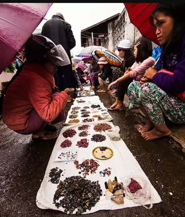
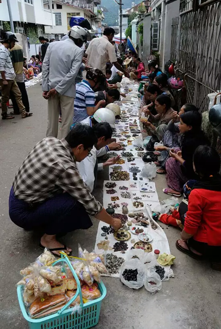
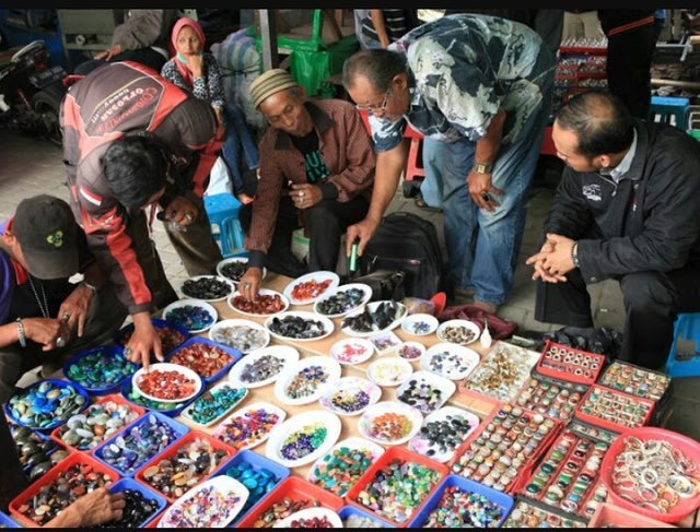
မိုးကုတ္ၿမိဳ႕၏ အဓိကစီးပြားေရးလုပ္ငန္းမွာ ေက်ာက္မ်က္တူးေဖာ္ျခင္း ျဖစ္ပါသည္။ မိုးကုတ္ၿမိဳ႕သည္ ေတာင္ေပၚေဒသျဖစ္၍ လယ္ယာေျမကြက္မ်ား ေျပာပေလာက္ေအာင္ မရွိျခင္းေၾကာင့္ ဆန္စပါးမ်ား မထြက္လွေပ။ ၿမိဳ႕ေနလူထုစားသံုးရန္အတြက္ မိုးမိတ္နယ္ႏွင့္ ေအာက္အရပ္ေဒသမွ ဆန္မ်ားကို မွီခိုအားထားရသည္။ လက္ဖက္စိုက္ပ်ိဳးေရးႏွင့္ ေကာ္ဖီစိုက္ပ်ိဳးေရးလုပ္ငန္းမ်ား အနည္းငယ္ရွိသည္။
လူမွဳေရး
မိုးကုတ္ၿမိဳ႕တြင္ သာေရး-နာေရး လူမွဳကိစၥမ်ားအတြက္ ရပ္ကြက္တိုင္းတြင္ ဧည့္ခံအဖြဲ႕၊ ထမင္းေကၽြးအဖြဲ႕၊ လူပ်ိဳ၊ အပ်ိဳ စသျဖင့္အဖြဲ႕မ်ား ဖြဲ႔ကာ တက္ညီလက္ညီ ၀ိုင္း၀န္းကူညီ ေဆာင္ရြက္ၾကပါသည္။ တစ္ဦးႏွင့္တစ္ဦး ေတြ႕သည့္အခါ စားၿပီးၿပီလား ဟု ႏွဳတ္ဆက္ေလ့ရွိၾကသည္။ တစ္ဦးက ထြက္ခြာသြားသည့္အခါတြင္ က်န္ တစ္ဦးက ေျဖးေျဖးေနာ္ ဟု ႏွဳတ္ဆက္ေလ့ရွိၾကသည္။
ဘာသာေရး
မိုးကုတ္ၿမိဳ႕တြင္ ေနထိုင္ၾကေသာ ဗမာ၊ ရွမ္းႏွင့္ ပေလာင္လူမ်ိဳး အမ်ားစုမွာ ဗုဒၶဘာသာ၀င္မ်ား ျဖစ္ၾကသည္။ မိုးကုတ္ၿမိဳ႕နယ္အတြင္းတြင္ ဗုဒၶဘာသာ ဘုန္းႀကီးေက်ာင္းေပါင္း (၂၅၀)ခန္႔ ရွိရာ လူဦးေရႏွင့္ ႏွိဳင္းယွဥ္လွ်င္ လူ(၈၀၀)တြင္ ဘုန္းႀကီးေက်ာင္း (၁)ေက်ာင္းႏွဳန္း ရွိသည္။ မိုးကုတ္ၿမိဳ႕ရွိ ခရစ္ယာန္ဘုရားရွိခိုးေက်ာင္း အမ်ားစုမွာ လီဆူဘုရားရွိခိုးေက်ာင္းမ်ား ျဖစ္ၾကသည္။ ေဂၚရခါးလူမ်ိဳးမ်ားမွာ ဗုဒၶဘာသာႏွင့္ဟိႏၵဴဘာသာ မ်ားကို ကိုးကြယ္ၾကပါသည္။ မိုးကုတ္ၿမိဳ႕တြင္ မြတ္စလင္ဗလီ သံုးခု ရွိပါသည္။ တရုတ္ဘုရားေက်ာင္းမ်ားလည္း သီးသန္႔ရွိသည္။
Mogok
For instance the location and boundaries
location
Honestly north latitude 22 degrees, 50 minutes and 23 degrees 30 minutes YouTube, Longituto 96 degrees 11 minutes and 96 degrees YouTube width located between the 45- minute, 30 miles to the east and west North and South (15.12 miles), while the total area (450.60 square miles). Mogok is located at the end of the west of the the northern Shan Shan plateau, now Mandalay Pyin Oo Lwin District . Mogok Township to the north and east of the city, Kyaukme, south Thabeikkyin Township located west. For instance 0 (36 miles) away from the east of the Nile (3800 feet) above sea level, a city located on the hills.
weather
Came in tropical high mountain regions, as unions felt warm wet weather. For instance, in the mountains and cool climate regions, the highest temperature of 95.4 degrees Fahrenheit and minimum temperature of 30.2 degrees Fahrenheit. Normal rainfall (107.58) in the normal rainy days (135.7 inches). Normally, the southwest winds up to a mile to five miles per hour winds and adverse weather in the north, From the northeast and southwest (25 miles) per hour winds.
Topographical and drainage
According to geological experts estimates Mogok region underneath the stone mat most of the country's oldest stone mat in one of the 0. Mogok region is densely hills plains in the lower plains. Even the creek looks up to him, Based on the test ride through the downtown area, even boosting soldiers leak Based on the water flow from the hot springs and streams near the Kachin territory to meet and ride off into the creek 0. Mogok region are the highest mountains around the ...
(Black Mountain) - 7544
Rural-6733
- 6223 ft mountain
- 5955 saw the city
Pine-5606
Spider-5345
Nan-5277
Population
For instance, a group of urban groups (5) Village (30) (132) villages in villages having population figures in 2005 (180408). The population density is (398 square miles). The proportion of urban and rural population (1 1.81). The gender proportion of the population (1 0.91). There are people who live in the most Shan, Fat, Palaung, Chayote and China.
forest
The township land area of the entire (290305 acres) surrounded by a forest Mogok (759 acres) reserves (1286 acres) Acres surrounded by coconut tree (4815) Thongs (1987 acres), under siege The village, quiet acres of reserved (6144) Sayagyi Shwe Oo Down protected reserves (10852 acres) Extended Nam Pan red sand reserves acres (21120) Palace 0 expand reserves acres (10440) (25340 acres). Mine in the ground (612 acres).
transportation
The main transport roads and waterways, railway, Aviation There are no roads. Honestly enough mines to the east and by road (21 miles) Momake city and in the north (28 miles) Thabeikkyin (60 miles) of the city, on the west Mandalay and distance (128 miles) respectively. Mogok - Sorry Mogok (79 miles) southeast of the time before World War II was used.
economic
Mogok is the city's main business at gem mining. For instance in mountain areas and farmland, leaving the lack of riots Rice. For use in urban Momake reliance and rice from the lower parts. A few tea and coffee plantations.
social
For instance on social issues in each ward, reception Heck, Single Female teams to help 0 circle in unison. When a person is ready to eat often greeted. When a departure often greeted my a rest slowly.
religious
Honestly, who live on Shan and Palaung people are mostly Buddhist 0. For instance, where nearly all the Buddhist monasteries in the circuit (250) compared to the population and the monastery (800) (1) per school. Honestly Cathedral Church of mostly fat. Chayote are of Buddhist and Hindu worship. Honestly, there are three Muslim mosque. China also have private church.
Welcome to Steemit, @mgmgaung!
Hope you enjoy being here!
This message was written by my
introduceyourselfbot, but I'm a real user :)Shall you have any questions, feel free to reply to me. I'll gladly answer your questions :)
You can also go to https://steemit.chat and chat with the Steemit Community over there!
thanks for sharing
Please vote and follow me bro