"SEC | S20W6: "The Use of Drones in Agriculture"
Hello Everyone. I am @shiftitamanna
From #Bangladesh
Welcome to the new week everyone. Agriculture Based Our educational discussion on agriculture in Bangladesh is very interesting to me in all aspects as I am interested in gaining knowledge about the use of advanced technology for the improvement of agriculture. Another means of improving agricultural technology is advanced technology drones used in agricultural work which are helping to increase the production of agriculture by several steps. Anyway, I'm starting my homework on the benefits of drones now.

The role of drones in modernizing agriculture is immense. Because by launching short-term drones in agricultural fields, various information of agricultural land can be collected, as a result of which farmers can understand their errors in the field of agriculture, as a result of which it is possible to increase the rate of agricultural production. If we want to cultivate some new crops in agricultural fallow land produced by flying drones in agricultural fields, drones can help us through a georeferenced aerial image of the fallow land. This makes it easier for us to understand how much seed and fertilizer we can use to produce new crops in each of our plots.
Also, using drones, it is possible to know very easily whether the water in the agricultural land and the crop plants are getting the right amount of nutrients. In addition, unmanned aerial drone images are synced with other data, such as yield maps and soil sampling results that can help us identify and map these areas. Moreover, with the help of parameters of drone technology, it is very easy to know the amount of fertilizer to be applied to crops or to irrigate the land.
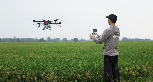
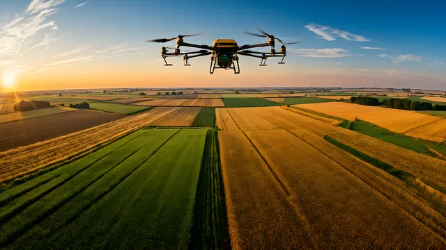
Moreover, if the agricultural land is very large, in that case it is possible to monitor the agricultural land by flying a drone. In this case, whether there has been any damage to the crops or whether there has been an attack by any wild animals, these things can be easily caught through the drone camera and it is possible to cure all these damages to the crops very quickly. There are also many other unique ways in which drones can improve agricultural systems.
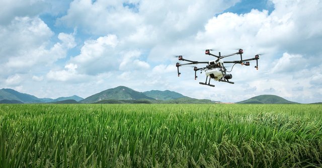
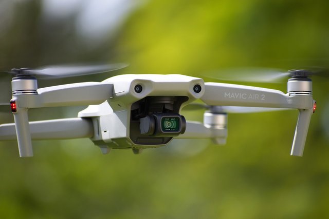
An agricultural drone is an unmanned aerial vehicle used in agriculture mostly for yield optimization and for monitoring crop growth and crop production. Agricultural drones provide accurate and precise information about crop growth stages, crop health, and soil diversity. Agricultural drones use multispectral sensors to image electromagnetic radiation beyond the visible spectrum, including near-infrared and short-wave infrared, a new innovation in agriculture. Considering all these aspects, it is already understood how much the role of drones in the field of agriculture is.
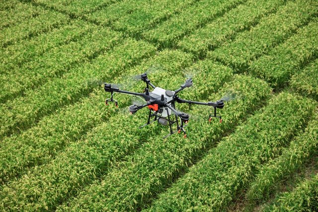
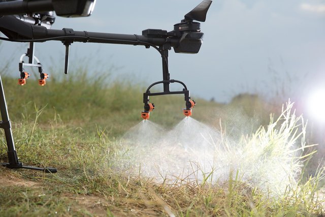
The main advantage of using drones in agriculture is that they are able to accurately monitor and control the use of pesticides. Advanced sensors on drones allow for minimizing the environmental impact of pesticides. Permission is not required to fly drones over other people's property at altitudes below 400 feet, allowing drones to fly independently and collect accurate data. Due to the use of drones, a land owner is able to improve the agricultural field with the data collected from the drone without any effort.
Using advanced technology, drones can determine soil moisture, check the presence of various elements, design crops according to the amount of land. The thermal technology used in the drone is capable of collecting all the information including soil temperature from all sides of the crop field. By analyzing all these data, it can be known if there is a shortage of water in the soil of a place and also based on the presence of water it can be understood whether the crops are receiving the right amount of water or not. As a result, water wastage will be prevented to a large extent in later periods and crops will not be damaged due to excess water intake.
Also, through visible light and infrared technology, the presence of bacterial or fungal attack on each plant and crop is known separately. If the farmer wants, he can focus on that specific crop separately or assign the responsibility to the drone, which will protect the crop from attack throughout the growing period and the farmer can also take the desired crop home.
In the modern world, modern technology including various machines are being used to improve agriculture and we can see the success of all these modern technologies. One of these is multispectral and hyperspectral sensors used for drones. Multispectral images do not produce the spectrum of an object, but Landsat is a prominent practical example of multispectral imaging. Hyperspectral imaging works with narrow spectral bands in a continuous spectral range, producing spectra of all pixels in the scene, revolutionizing modern agricultural technology. We have already known various information about drones and drones where clearly I have mentioned that all these sensors are very effective in modern agricultural technology. Moreover, it is possible to improve the agricultural sector by using all these sensors because these sensors always transfer the information about the benefits and harms of the crops to the owner of the crop land, so that the farmers can easily find the means of getting rid of the diseases of their crops.

Drones help in soil mapping very easily as it is an advanced technology agricultural tool. The drone should be flown over the area we want to model in such a way that each zone of the area has overlapping images. Then yellow lines show the center of the trajectory and the overlapping white circles show the area taken by the camera in a given frame. Then there are two slightly different images of each point on the surface of the lot, and in the same way that our eyes can determine the distance of an object when the two images match, the software overlaps the common areas and measures the distance from each point on the surface to a center point and each from the drone Determines the distance of the segment. Thus drones help in mapping agricultural land through some further processing.
Since drones are equipped with high-quality components, they collect relevant data of the land and create a crop-friendly map on their own, which is beneficial for crop cultivation. Modern Technology Six This drone works as a precision farming system for crop cultivation.
%20(500%20x%2050%20px)%20(1).gif)
I would like to invite my friends @mdkamran99, @hotspotitaly and @o1eh to participate in this contest.

I invite you to support @pennsif and @pennsif.witness to grow across the whole platform through robust communication at all levels and targeted high-yield developments with the resources available.

Click Here
%20(2).gif)
Upvoted. Thank You for sending some of your rewards to @null. It will make Steem stronger.
Pengerjaan menggunakan drone di era modern seperti sangat menarik, dan sangat meringankan beban para petani khususnya. Menurut saya drone mampu bekerja di atas udara untuk mengatasi segala perihal pertanian yang dibutuhkan ☺️
Semoga sukses teman 🤝
Welcome to the agro-learning challenge season 20.
Observations and suggestions:
. We can all testify that drone has aided modernization of agricultural activities. Farmers now find solace in carrying out some of their vital farm practices. Thank you for nicely explaining some of the key incdices.
. For drone efficiency, issues of time savings has become better, making decision alot efficient, and reduction in the use of chemicals through precision practices. We would definitely benefit from it given crop monitoring, pests and diseases control, and labour cost reduction, etc. Needed you to be alittle more elaborate here.
. Generally, you have made a good post. Thank you for your participation.