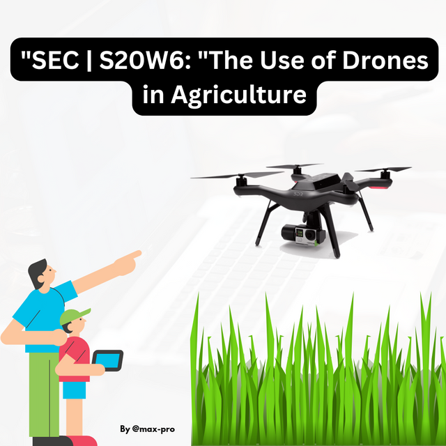
"SEC | S20W6: "The Use of Drones in Agriculture
Hello Everyone
This is @max-pro from, #Bangladesh
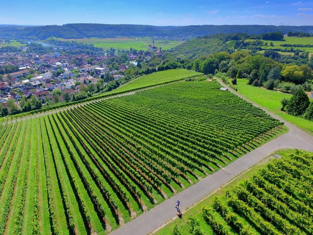
 Thumbnail image Thumbnail image |
|---|
Hello friends I wish you all good health. Hope you all are well. By God's grace I am fine too. So here I am to participate in the 6th weekly engagement contest of this season organized by this community. This week's topic is "SEC | S20W6: "The Use of Drones in Agriculture. So let's get started as I will answer a few questions correctly and discuss this topic in detail.
| What role have drones (unmanned aerial vehicles) played in modernizing agriculture? Use your country as an example if applicable. |
|---|
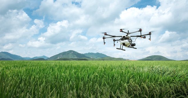
Our world has gradually become very modern. That is why drones or unmanned aerial vehicles have emerged as a revolutionary technology in agriculture. It has brought radical changes in the way crops are produced and managed. The use of drones to modernize agriculture has recently become very popular in Bangladesh as well as around the world. Especially in crop monitoring, spraying and data collection. Drones have played many roles in modernizing agriculture. Details are given below.
- In terms of crop health monitoring :-
Drones are equipped with high-quality cameras and sensors that can monitor crop health. They fly over crops using various imaging technologies such as thermal imaging, multispectral imaging, to detect crop problems such as pests, diseases or waterlogging early. In our Bangladesh too, farmers using drones in rice, wheat and other crops can quickly diagnose crop problems and take necessary action.
- In case of fertilizer and pesticide sprays :-
Another major role of drones is the automated spraying of fertilizers, pesticides and other chemicals. It is much faster and efficient than manual work. Pesticides are being sprayed using drones in various areas of Bangladesh, especially in the northern region. Which is saving both labor and time. As a result, agriculture is not disrupted even during the labor crisis.
- In terms of data collection and analysis :-
Drones map land from the air and provide data on crop productivity and soil fertility. By analyzing this data, farmers can know which fields need more fertilizer, where to water more or which areas are doing well. Some startups and NGOs in Bangladesh are providing this data to farmers through drones that are helping them improve their farming techniques.
- In terms of time and cost savings :-
Carrying out work through drones can save both time and money. In different regions of Bangladesh, especially small and medium farmers are completing land work with low cost drones. As a result, agricultural production is becoming more profitable. Hence the use of drone technology in agriculture sector in Bangladesh is increasing rapidly which is making agriculture more modern and efficient.
| How do drones contribute to precision and efficiency in agricultural practices? What are the key benefits of using drones in agriculture? |
|---|
Yes, I think drones make a significant contribution to precision and efficiency in agriculture. Drones can be used to take time-lapse images from above the ground to help determine crop growth, health, soil moisture and disease status. This technology helps farmers precisely deliver pesticides, fertilizers and water thereby reducing both cost and effort. High-resolution images captured by drones can create an accurate map of agricultural land, which is helpful for better planning and management.

- The main advantages of using drones in agriculture are :-
| Crop health monitoring | Drones can regularly monitor crop diseases and surfaces with high-resolution images or videos and detect insect infestations or other problems at an early stage. |
|---|---|
| Water management | Soil moisture and water level can be monitored with the help of drones. It can ensure the supply of water at the right place and in the right amount to reduce water wastage. |
| Effective use of fertilizers | Drones are used to spread and spray fertilizers in specific areas. It prevents wastage of fertilizers and ensures better crop growth by spreading required amount of fertilizers at specific locations. |
| Crop Mapping | 3D mapping can be done using drones which provide information on land level, slope, soil type etc. |
| Fast and cost-effective solution | Drone crop monitoring and analysis makes work fast and cost-effective, reducing time and labor costs. Besides, it is possible to spray pesticides or seeds on specific land through drones, which is a very simple and effective solution for farmers. |
| How do drones help manage soil moisture and nutrient levels in crops? |
|---|

Drones play a very effective role in determining and managing soil moisture and nutrient levels. It uses various sensors and technologies to collect accurate data that gives farmers an idea of key factors affecting soil health and crop growth. Using soil moisture data obtained through drones, we can determine how much water is needed in different parts of the land.
This makes it easier to identify dry or over-wet areas of the land and provide the right amount of water. It helps in water conservation and ensures ideal humidity for crops. Drones can monitor the entire field and identify areas with water problems or nutrient deficiencies.
Thermal sensors attached to the drone can determine changes in soil temperature and moisture. It helps in determining the dryness or wetness of the soil according to the climate. Multi-spectral imaging technology is used to determine nutrient levels such as nitrogen, phosphorus through drones. In this we can identify where there is any nutrient deficiency in the land.
| Explain the significance of multispectral and hyperspectral imaging sensors in agricultural drones. |
|---|
Significance of multispectral and hyperspectral imaging sensors in agricultural drones play an important role in monitoring crop health, soil nutrition and moisture. These sensors provide detailed information about ground conditions using different wavelengths of light.
| Multispectral Imaging | 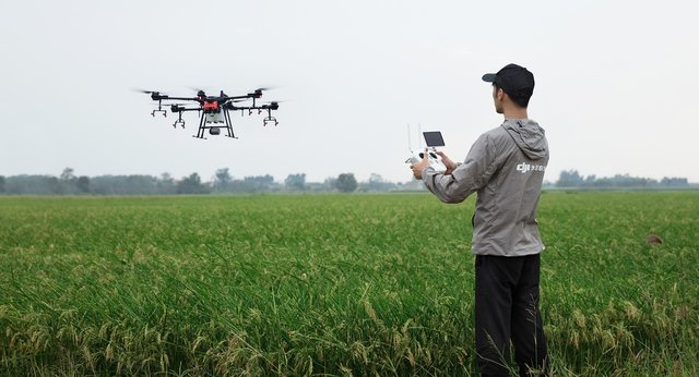 Pixabay Pixabay |
|---|
Multispectral sensors detect several specific bands of light, typically between 3 and 10 bands. These bands make it easy to analyze crop and soil health. Multispectral sensors can determine crop health by determining how green or healthy the crop's leaves are in the field. Multispectral imaging helps determine the need for irrigation by seeing differences in soil moisture. Multispectral data indicates where nutrient deficiencies occur in the soil. As a result, we can determine the right place when applying fertilizer.
| Hyperspectral Imaging | 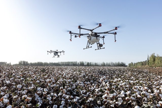 Pixabay Pixabay |
|---|
Hyperspectral sensors use a much larger number of wavelength bands than multispectral sensors. This allows very accurate analysis of land and crops. Hyperspectral sensors can accurately detect the color and composition of different areas of land, providing more detailed information on soil nutrient levels and moisture. Hyperspectral imaging can distinguish diseased or malnourished crops from healthy crops. Hyperspectral sensors accurately determine every element on the ground. This makes it easier to apply fertilizer, irrigation or other necessary measures to specific areas. So these sensors help farmers to take action at right time and place. thereby increasing productivity and crop quality.
| How drones help in soil mapping and why is it important for precision farming? |
|---|
Drone technology is a very effective means of soil mapping. However, it has gradually become active in our Bangladesh as well. It is more applied in northern regions. Because it helps the farmers to determine the exact condition of the land which helps in implementing precision farming. Below is a detailed explanation of how drones map soil and why it is important.
- How drones map soil :-
| Data collection using sensors | Drones are equipped with multispectral, hyperspectral and thermal sensors that fly over land to collect data on soil moisture, temperature, nutrient levels and other characteristics. |
|---|---|
| Capturing high resolution images | Drones are capable of capturing high resolution images and videos that provide detailed information of even small areas of land. Any change or variation in soil properties can be easily detected in this. |
| Data analysis and mapping | Data and images collected from drones are processed in specialized software. These softwares identify different zones and layers based on soil properties and create a detailed map. It helps distinguish different areas based on soil nutrients, moisture and other characteristics. |
- Why soil mapping is important for precision farming :-

| Guidance for proper irrigation | Information obtained from drones about soil moisture and its variability helps farmers determine which parts of the land need more irrigation. As a result water wastage is reduced and crop growth is ensured through proper irrigation. |
|---|---|
| Determining Nutrient Needs | Soil maps created with the help of drones show differences in nutrients in different parts of the land and determine which parts of the land are prone to disease or damage. It guides the farmers in proper application of fertilizers to fill the nutrient deficiency of the soil and increase the crop yield. |
| Reduction in Agricultural Costs | Proper use of irrigation, fertilizers and other inputs as per land characteristics reduces costs. Applying materials at the right place and in the right amount does not waste resources and also reduces production costs. |
| Increased Productivity | Data obtained from drones can be used for precision farming management, thereby increasing crop productivity. Management according to soil characteristics improves both quality and quantity of crops. |
So we can say that soil mapping through drones plays an important role for proper land management and precision farming. It helps farmers to balance yield and cost which leads to more efficient and sustainable farming system in the long run. So you may have got the answers to all the above questions. Hope you all understand. This contest has been very beneficial for everyone. Thanks to the organizers for this.

So I am Inviting my lovely Steemian friends @shohana1, @kouba01, @wilmer1988, to Participate in this Competition.
Congratulations on bringing a quality content. You have earned a positive vote from team 2, and it is delivered by @ashkhan.
Many Blessings...🙏🏻
0.00 SBD,
0.01 STEEM,
0.01 SP
Welcome to the agro-learning challenge season 20.
Observations and suggestions:
. You have nicely explained the roles, efficiency, and benefits of drones in agriculture. Drones is seen as an additional layer in advancing agricultural sustainability. Its impacts seen in crop monitoring, reduced laborn costs and wastages (precison use of materials) improved yield, pest and disease management, etc. It has been of benefit other than demerit in the sector. We can also attribute its premium efficiency in handling concerns on moisture and nutrient level on thermal/multispectral and hyperspectral sensors.
. Thank you for your participation. We hope to continue in the next season.
0.00 SBD,
0.01 STEEM,
0.01 SP
https://x.com/Maxpro51412/status/1846510825202450576?s=19
Upvoted. Thank You for sending some of your rewards to @null. It will make Steem stronger.