SLC S22W1 / Digital Cartography Basics
Hi Teacher,
It feels good to learn a lot from you in course of this lecture. I never liked Geography as a course but from your teachings it seem very interesting and educating. I know there is so much in stock for me here.
I have presented my homework below!
Make a freehand map of your country (It can be on paper, a computer or on your cell phone, the only condition is that it should not be traced. That is to say: The map does not have to be perfect)
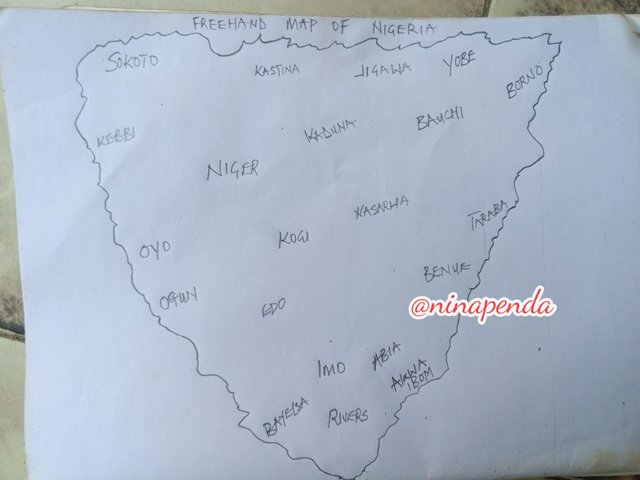
Here, I present a freehand map of Nigeria on a paper. All states are not indicated since it's a freehand drawing.
Inside the freehand map you made, locate where the capital of your country is and where the state / department / province where you live is.
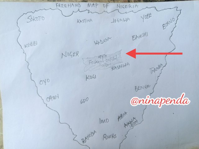
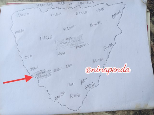
Locate within the map you made, some states / departments / provinces you know by heart (Only those you know / remember at the time, don't fool yourself by cheating)
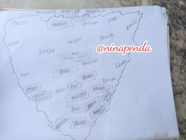
From the map, I have located about 15 States that I know and have being to. I have in one occasion or two visited these states in my country.
The shaded states in the map are the states I know by heart and have visited. They included; Abuja, Lagos, Enugu, Imo, Abia, Kogi, Ebonyi, Anambra, Akwa-Ibom, Cross River, Rivers, Edo, Ogun, Bayelsa, Kastina.
Mention 3 places that you do not yet know about your country and that you would love to know and why.
There are many states in my country that I haven't visited or learned about yet. I would really like to explore them if I get the chance.
Three of the states I don't know are Sokoto, Kaduna, and Jigsaw. These are in the northern part of Nigeria. I want to learn about these states because I've heard that living costs, like housing and food, are quite low there.
I hope to visit these states one day to experience their lifestyle, see how people greet each other, and maybe learn some interesting cultural practices. I also want to buy some jewelry since it's much cheaper there.
I won't miss the chance to do all of this when I can travel. I enjoy traveling and plan to create my tour list soon.
what is a map?

A map is a visual tool that represents certain features of a location, typically on a flat surface. Maps provide information about the world in an easy-to-understand format. Maps can illustrate how things are spread out across the Earth, like where people live. They can also pinpoint specific locations of homes and streets in a city area.
Cartographers are the people who make or design maps for various reasons. Weather scientists, known as meteorologists, rely on weather maps to make forecasts. City planners use maps to determine where to place hospitals and parks by showing land features and current land use. Scale, symbols and grids are some common features of a map
In your opinion what are the most relevant elements to understand a map and why?
Maps play a crucial role in our daily lives as they assist us in finding our way, understanding, and describing the world around us. To create an effective map that communicates well, certain elements must be properly included throughout the map development process.
The Map Title
The title of the map indicates its main topic. It is typically found at the top of the map page, often in large letters for easy reading.
The Map Legend
A map legend, also known as the Key, is a complete list of all the symbols and their names used in a map. When making a legend, we often use symbols to represent features on the map, like a blue wavy line for a water stream or a dot for an electric pole. A map without a legend would be so difficult to understand because of the ambiguity of what each symbols stands for
The Map Scale
Scale shows as a fraction or ratio. Map scale helps us understand how much information or features are included on the map. The scale affects how much of the map's content we can see, whether on a screen or in print.
The Map Compass
The compass is a symbol that indicates the direction of north and south on a map. When the map is turned or shifted, the north arrow should also turn or shift with it.
Neatline and Frameline
It can be tricky to tell the difference between a Neatline and a Frameline and how they connect to a data frame on a map. Depending on the map maker's style, these terms can sometimes be used in place of each other.
In simple terms, a Neatline is the border that outlines and defines the edges of the mapped areas on the finished map while a Frameline is the border that surrounds all other elements on a map, including the Neatline.
With these elements available on a map, a traveler/ a reader is ble to communicate effectively with lasting with lasting impressions. These simple elements directs, instructs and helps a reader get a clearer view of whatever the map says. This way, the information is effectively communicated.
In your opinion: Is cartography important or is it not that important? Why?
Cartography is both an art and a science focused on creating maps. It is important for several reasons:
Understanding locations
Maps allow people to see where things are and how they relate to each other. This is crucial for areas like economic growth, land management, and disaster response.
Visualizing data
Maps can make complex information easier to understand. They use colors and symbols to show ideas and data clearly.
Finding directions
Maps assist people in navigating their surroundings. For instance, they can help find the nearest store or the best route between two points.
Presenting information
Maps can illustrate detailed data, such as population statistics, economic trends, and urban development.
Cartographers gather and analyze geographic and physical information about an area, then create visual maps. They also revise existing maps with new information.
I invite @mariami @pandora2010 @tripple-a
I really love your exposition on the importance of maps, locations, and finding directions.
As a bolt rider, we somehow face several challenges in terms of reading map but your explanation had shed light on the subject matter, opening me to understand the basics of map reading and information gathering while using a map.
I also wanted to apologize about the previous comment I made before now, teasing you with the drawing. I guess, I must have overstepped my boundaries. Don’t be upset.
At @goodybest, I’ve made my corrections on my comment, I was only kidding with her. I won’t do it again.
0.00 SBD,
0.23 STEEM,
0.23 SP
why? is the map really that terrible?
Should a map really be drawn from memory?
How will I draw my Ukraine tomorrow? I guess I should draw and not redraw, because I drew Africa the first time it seemed better. As for your country, I thought it was somewhere in the center of Africa... I just looked up where Port Harcourt city is)))
Did I draw correctly?
0.00 SBD,
0.15 STEEM,
0.15 SP
But you actually did a great job with the map of Africa and you know exactly where to place Nigeria in the map.
0.00 SBD,
0.22 STEEM,
0.22 SP
Hi, Sammy; I just wanted to share my thoughts on your comment. I don’t find it funny, to be honest. While it’s important to provide criticism, it should be constructive rather than dismissive of the effort she put into creating this beautiful entry. We’re all learning every day, so it would have been better to acknowledge her work first and then suggest areas for improvement.
0.00 SBD,
0.06 STEEM,
0.06 SP
I’ve done my corrections.. apologies!
0.00 SBD,
0.16 STEEM,
0.16 SP
Oh, this is beautiful! I know you were joking, but the context doesn't fit, which is why I called your attention to it. Keep up with the later 😊
0.00 SBD,
0.04 STEEM,
0.04 SP
Hola querida dama.
Qué bueno que a pesar que no le gustaba la geografía se animó para la primera clase del curso, porque así conoce más de su país.
Éxito en el curso.
Muchas Bendiciones..🙏🏻
Northern state is the most beautiful place to stay but house accommodation is very expensive compare to other state like Kwara, Osun and the rest like that. Some food is cheaper such as beans, pepper and sweet potatoes. Through this your write up I really understand some basic knowledge about how to read Nigeria map and the information it contain. This will show the whole world that Nigeria have 33 state and is the largest black nation in the world with over 200 millions people. I wish you success
Me encanta como describiste cada detalle, definitivamente has entendido toda la clase amiga @ninapenda. Te felicito en verdad. Exito ☺️