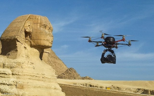
5 Secrets Of Drone Archaeology

5 Ancient Apennine Alpiners
Photo credit: A. Hamel
Archaeologists have long known of the ancient Samnites who once occupied Italy’s Apennine Mountains. However, the rugged terrain made excavations and aerial photography nearly impossible, and much of their culture remained a mystery—until recently. In September 2016, researchers reported traces of a Samnite community discovered through the use of drones.Archaeologists focused their aerial survey on Le Pianelle in Southern Italy’s Tappino Valley. According to Leiden University’s Tesse Stek, “We have a very complete overview of the internal organization of this settlement, including its disposition against the road, storage spaces, domestic areas, and so on.” Researchers were surprised to discover how densely settled and organized the Samnites were.Previously discovered during construction, Samnite “temples” continue to stump archaeologists. Some theorize these ancient sites were mere road stations and places where goods and information were bartered. Others speculate that they marked the boundary of the Samnite territory.[6]4 Mapping The Moche
Featured image credit: Ernesto Benavides
Peru’s vice minister of cultural heritage, Luis Jaime Castillo, believes drones represent a “before and after moment in archaeology.” Castillo is pioneering aerial excavations in his country. He has used drones to map evidence of the 1,300-year-old Moche civilization along the Pacific coast from San Idelfonso to San Jose del Moro.[7] The two-dimensional images provided by drones allow researchers to construct highly detailed three-dimensional models. Castillo notes, “We can see walls, patios, the fabric of the city.” The use of drones to map these vanishing remains is critical. These sites are “threatened on every side.” Castillo uses drones not only to map but also monitor and guard his sites. Drone surveillance can detect new looting pits and other disturbances. Land traffickers and squatters are a constant danger. Fraud and political corruption are rife in an era with escalating real estate values—particularly around Lima and Cuzco.3 Secrets Of The Shakers
Photo credit: Dartmouth College
“It feels like cheating a little,” noted Dartmouth’s Jesse Casana. The archaeology professor has been using drones to reveal the secrets of a Shaker village in Enfield, New Hampshire. The Shakers were an extreme Protestant sect with a lifestyle based on celibacy and communal living. Their name derives from the “shaking” that accompanied expressions of ecstasy that would occasionally overwhelm believers.Casana first experimented with drones in 2012. However, advancements and increased popularity in recent years have made the equipment “way better, more reliable, cheaper, and easy to fly.” Despite being combed over by Dartmouth students, the Shaker village at Enfield has many secrets waiting to be revealed. The location of the settlement’s buildings had been unknown—until the drone era. “Now we can see the foundations of buildings, along with other features like old historic pathways and roadways through the village, and a couple of underground water pipes.”[8] 2 Castle Of The Sealand Kings
Photo credit: Ur Region Archaeology Project
In March 2017, a British-Iraqi team of archaeologists discovered the ancient city of Tell Khaiber using drones. Until recently, the Sealand Kings, who ruled large territories of Bronze Age Iraq between 1730 and 1460 BC, were known only through scant written records composed by other rulers. Despite these enigmatic rulers’ domination over the swampy head of the Persian Gulf, researchers have never found archaeological evidence of them on the ground—until now.[9]Tell Khaiber remains virtually undetectable from the ground. Centuries of sediment have left the settlement little more than a “imperceptible bulge” in flat, brown mud. However, drone photographs revealed the outline of the ancient settlements as well as a massive, mysterious structure at its core. A defensive wall ringed with close-set watchtowers enclosed the over 4,400-square-meter (47,000 ft2) structure. Tell Khaiber does not fit the model of a temple, barracks, or palace. Its purpose remains a mystery.1 Idumean Idolators
Photo credit: Dane Christensen
In November 2017, researchers discovered a mysterious structure in the Negev desert of Southern Israel using drones. Located in a former military training zone, the structure dates back 2,200 years to the Hellenistic period. Excavations uncovered walls, enclosed rooms, and underground baths. Many of the artifacts within bear images of bulls—a sacred symbol to the Idumean civilization.[10]“If this was indeed an Idumean palace or temple, it would be a rare and exciting find. Similar structures in this country can be counted on the fingers of one hand,” noted the excavation codirectors. The Idumeans were a Semitic people from Southern Jordan who settled in the Shephelah foothills. When the Hasmoneans conquered this territory in 112 BC, the Idumeans were assimilated into the Judean population. Curiously, there is evidence of fire and intentional dismantling of the structure. Experts hypothesize it might have occurred during the Hasmonean conquest of the region.