Maniac Roadtrip, Part 3: From Cottage Country To The Border Of The North
From "Entry" Town To "Exit" Town
In Part 2 of this roadtrip-journal, I exposed a hidden gem in the otherwise poky town of Bala, Ontario. Leaving aside that gem, The KEE To Bala, the town serves as a hub to the Muskoka Lakes area: "Cottage Country" for Toronto. Suffice it to say that the cottagers therein make up a desirable demographic.
My destination was different: much farther north. But after zipping along some highways, I did make a detour to another town like Gravenhurst: another unofficial sort-of border town to Cottage Country. Gravenhurst is southish; the northish town is Bracebridge. Like Gravenhurst, Bracebridge has seen a lot of growth over the last few decades. There's even a local utility that's building up fiber-quality Internet access for the local consumers, at a pace that's slightly ahead of Toronto's.
I really don't know why the border towns are experiencing such rapid growth whilst the hub towns - Bala and Port Carling - are still poky. You'd think that the skyrocketing cottage prices in Muskoka, plus the affluence of the folks who have cottages there, would have kickstarted the entire region. But it hasn't; the most visible beneficiaries are in the border regions.
A Stop At Bracebridge
Bracebridge's major attraction is the Muskoka-Lake waterfall. A picture of it appears on Bracebridge's Wikipedia page. Here's one of mine:
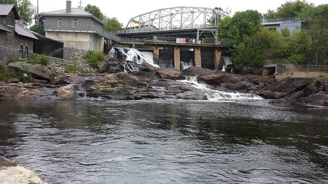
To the left and somewhat below the covered bridge for the main drag is an old pump house:
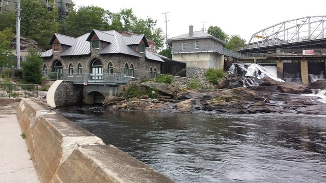
as taken by yours truly from a public dock. The house did contain a generator that had been installed about a hundred years ago, which makes it a pioneer of sorts.
I not only stopped for the scenery but also to take a test taste of the water. Because the Muskokas are in the Canadain Shield, the lake water does taste different from the big-city variety. There's a subtle bitterness to it. I only took a taste because Lake Muskoka has had a lot of boating, etc. over the decades. Consequently, it is...recommended that you sink a well for your drinkin' water. I had hopes that I could find exotic-tasting water in a more exotic locale in Northern Ontario.
Despite its rapid growth, Bracebridge's town worthies try to keep up the old-fashioned hominess of the town:

This "Welcome" sign and three-way intersection greets folks who come in from a northish direction. It's located a short walk from the falls.
Zipping And Obstacles
There's a story about the major highways that claims the engineers designed them to be traveled on at a speed of 85 mph or ~135 km/h. It may be urban legend, but I believe it. North of Bracebridge on HIghway 11, the traffic is light and I found myself automatically adjusting to a "natural" speed of over 120 km/h. Since I didn't want to get my first-ever speeding ticket, and since the speed limit is 100 km/h (62 mph), I had to remind myself to slow down a little. Others were driving at about 120 km/h (75 mph), but there were some slower-moving folks.
I also faced an obstacle that tole me plainly that I was driving away from sheltered Southern Ontario. At a curvy part of the highway, where I had slowed down anyway, I saw a family of spruce grouses headed up by Mom nonchalantly hiking across the highway. Highway-wise, these birds are pretty dumb. They kept their walking speed, apparently unaware that they would be roadkill had I not braked. Which I did, along with hugging the horn and muttering something rude. It's funny how we anthropomorphize when we're behind the wheel and some birds or animals get in the way.
Another obstacle I faced made the 100 km/h limit...self-enforcing. As Murphy's Luck would have it, most of the central part of Ontario was blanketed by rain. After Huntsville I was driving through rain that was somewhere between "drench" and "monsoon." Another funny part of driving: when the rain is light to nonexistent, the wipers at top speed look zippity-fast. But during a downpour, they look slow. Oh, I adjusted to the weather conditions! During the near-monsoon part, 100 km/h - the speed limit - was too scary-fast.
No wonder. This pic, which I took after turning off subsequent to the rain tailing off, gives a mild idea as to what I was driving through:
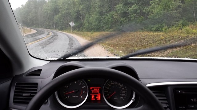
Had my phone not blotted out the rain a'fallin, you would have had a somewhat better idea.
Gateway To The North
Speaking of unofficial borders, North Bay serves as the unofficial border town to Northern Ontario. It's much bigger than the towns I've introduced to you: for one, it's not a one-highway town but a three-highway town. It's on the shore of Lake Nippising, which is huge. If you go to the shoreline at North Bay and look into the lake, all you'll see is water; it looks as if you were oceanside. The other shoreline is too far away to show at all.
I didn't stop for pics of it; instead, I stopped for a fill-up because gas in Northern Ontario is much more expensive than southernly gas. Or so I thought at the time. This image I took from the gas station's small parking lot shows the progress of my manic road trip thus far:
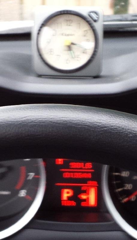
True, it's blurry, which I could ineffectually blame on the weather still rainy. At that point I had put in seven hours and had racked up 455 km (~285 miles). With a long way still to go...
- A Necessary Errand...
- Followed By Another Errand
- From Cottage Country To The Border Of The North (You're Here!)
- Tourists And Traps
- Night Driving And Peculiar Hazards
- The Long Journey Home, With Barrenness And Wake-ups