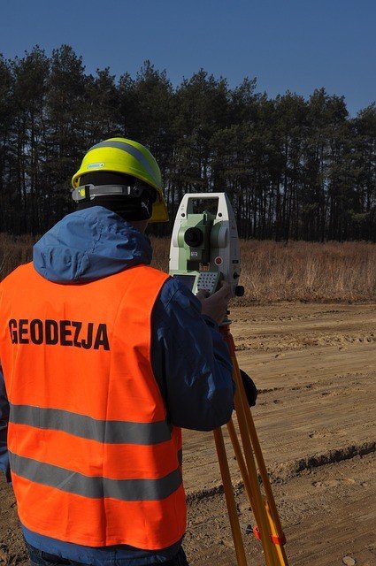
What is Geodesy?
Geodesy is a science that deals with the measurements of the world. All processes related to measurements, points and locations in the world are related fields of geodesy.
What is Geodesy? (Definition, Types)
Geodesy is a science that deals with the shape and dimensions of the world. In general, it is interested in deciding the shape of the world and measuring the world. Includes topography and mapping principles. Geodesy; It examines subjects such as the rotation of the earth, tides varying according to the region, gravity and poles. It is a branch of science that is interested in measuring the magnitude and shape of the world by mathematical calculations in order to ensure the correctness of the Earth's size and shape.
Defines the modeling of earth and four dimensional precision coordinate systems in space. It is a branch of science that connects spatial information that constitutes the world's reference networks to these networks and systems and monitors its time-dependent changes. The physical form of the world is called the geoit in the form of modeling closest to its origin. This modeling surface is uneven and cannot be used mathematically. Therefore, the surface called olarak ellipsoid “is considered to be the right surface instead of this surface. Geodesy science is used for the positioning of this surface in space and for coordinate systems. In fact, we are talking about an unknown science among the public. From military activities to tunnels and bridges, from land or parcel to navigation systems, we need to put geodesy on the table.
history
Throughout history, scientists and philosophers have sought to shape the world. Aristotle, the first person to calculate the size of the world is known. Therefore, it is considered the oldest geodist. The Greek philosopher Eratosthenes described the world as a bit different from the size of the world today. The greatest contribution to geodetic science was made by Muslim scientists in the Middle Ages. A well-known Islamic scholar, Al-Biruni, is known as the founder of geodesy. He started his scientific studies at the age of 17 and wrote 15 volumes of books on geodesy and geography. El-Biruni calculates the 40,000 km length of the earth's environment and has various studies on elevation and ellipsoid. El-Biruni was influenced by the works of Aristotle, Archimedes and Democritus, one of the Greek philosophers. Calculating the height of the sun and the longitude of the city, El-Biruni determines the time of the sun when the seasons start and finds the diameter of the world very close to its present value. Muslim scientists tried to measure the diameter of the world, the height of the mountains, latitudes and longitudes of settlements and developed various tools in this direction.
The foundation of modern geodesy was laid in 1880 by the German geodetic expert Friedrich Robert Helmert. Helmert's book s Geodäsie Theorieen der höheren Geodäsie, ”which he wrote as a professor at the Technical University of Aachen, is considered as the basis of modern geodesy. Helmert's book on geodesy; The mathematical aspects of geodesy include geodetic solutions on an ellipsoid. Helmert's definition of geodesy is still valid today.

Definition
Geodesy is a word that means to measure or divide the area. Adır Geo ölç means measuring ”dezi Ad. It is defined as the science of measurement of the whole world Tüm. The science of defining or measuring the Earth in three-dimensional time-dependent variable space. This definition includes the determination of the earth's gravitational field. According to geodesy, gravitation and the shape of the earth and other celestial bodies from the observations made to the outside world and the earth can also be done as a function of time. Modern geodesy; geometric, physical, astronomical and satellite geodesy. Geometric, astronomical and physical branches are defined as “classical geodesy Ge Ge.
The earth is flattened by the effect of centrifugal force caused by its rotation around its own axis and shows a tendency to deviate. This view is called a geoid. The average diameter of this figure is 12 thousand 742 kilometers. This results in a reduction of about 3 percent between the equator diameter and the distance between the poles. The effect of centrifugal force is 43 km. The semi-large axis of the 6.3 Geodetic Reference System 1980 (GRS80) düz which is considered the most suitable geometric shape for the shape of the world is 6.378.137 meters and the flatness is 1 / 298.25722. This ellipsoid is considered to be a reference in soil measurements.
Posted from my blog with SteemPress : https://blueblogs.000webhostapp.com/2018/09/what-is-geodesy