Parsing data form Nominatim API
The Nominatim API is an OpenStreetMap project. It helps developers get location information about POI (Points of Interest) on a given geographic area .
Here you find more about it : http://wiki.openstreetmap.org/wiki/Nominatim
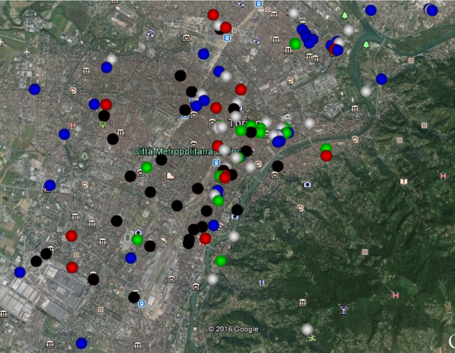
This Java project does just that. Connects to Nominatim API and gets location data about POI such as attractions, museums, cinemas and much more on a geographic area of Northern Italy.
The data can then be analysed and or visualized as below :
I plan to extend this project in the future with more clasess that analyse the data and visualize it in different ways so stay tuned.
Open Source Contribution posted via https://utopian.io
@originalworks
The @OriginalWorks bot has determined this post by @datatreemap to be original material and upvoted(2%) it!
To call @OriginalWorks, simply reply to any post with @originalworks or !originalworks in your message!
@datatreemap I think you were trying to document the use and merits of Nominatim API.
Or is it a suggestion to utopian to adapt?
Please be clear on your contribution.
Pending for further review.
[utopian-moderator]
Should I have posted it under "Development" instead of "Ideas" ?
Yes use development
ok, thanks.