Oceania at the Royal Academy
I recently had a day in London wandering around the Royal Academy and the British Museum. A great way to spend a day!
Oceania was an exhibition covering 500 years of history of the large expanse of sea stretching from Australia to America, otherwise known as the Pacific Ocean.
There were items which had been collected by James Cook and other early European explorers tot he region alongside more recent objects. All through the exhibition were flags and plants left by islanders who had come with the exhibits or been invited to attend. There's a lot of interesting material on the R A web site.
For me, most of the good stuff was in the first room: Voyaging!
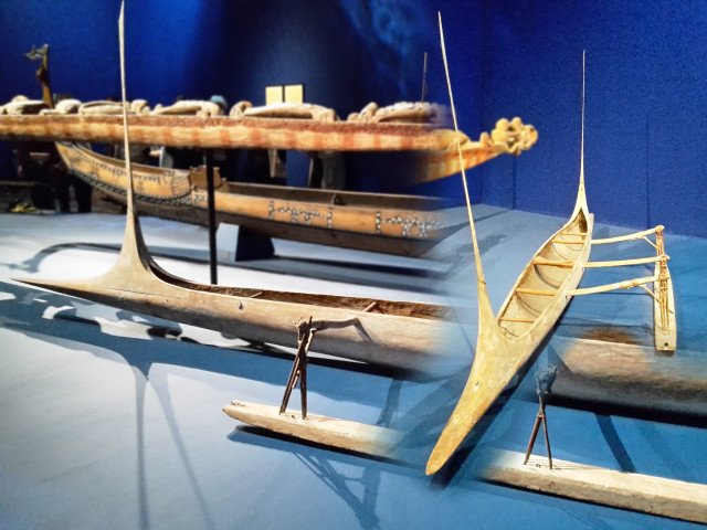
This canoe is over 120 years old from Wuvulu in the Bismarck Archipelago of Papua New Guinea. I love the sleek lines that could be a modern design for an aircraft or spaceship, but stretch back to a 'primitive' people several generations ago.
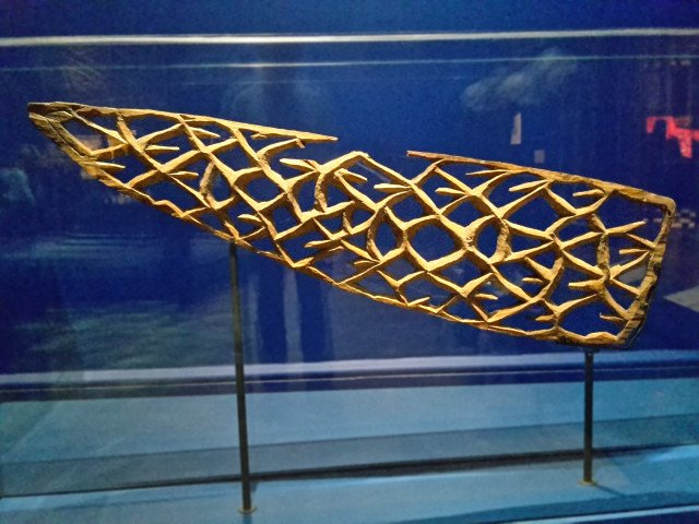
This could be the leading on a stained glass window but is the prow of a canoe from the Wakde-Yamna area of West Papua, and is early-mid 20th century.
Then we have the navigation charts.
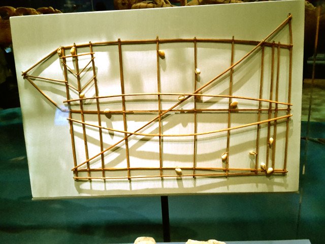
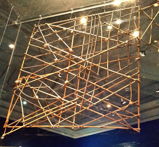
This is a 19th-century navigation chart from the Marshall Islands, made of wood and seashells (20181207_110831). It's not a geometric map of the region but a navigational aid. Like the difference between the map of the London Underground system and a map of the surface. The shells are islands and the grid of wood is just a support - the curved and angled pieces are the important bits, showing winds, tides and currents. Apparently these charts are known as Rebbelib. The information in the charts would have been memorised, as the charts were too valuable to take to see. Maybe as they paddled their outrigger canoes between islands, the makers told each other Tales of Topographic Oceans?
In the next room, the focus went to domestic arrangements, and well, posts:
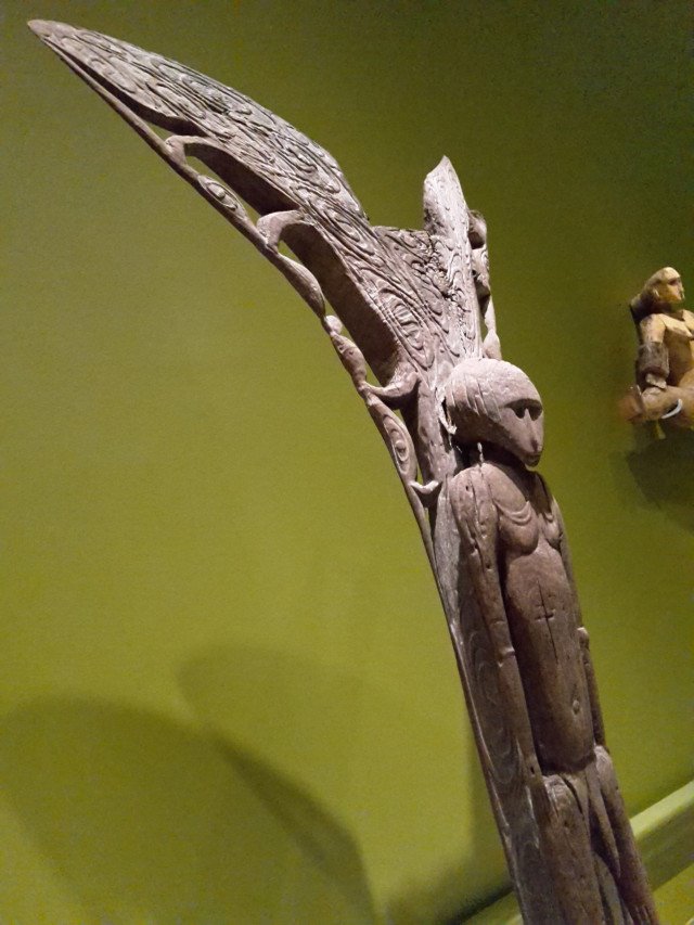
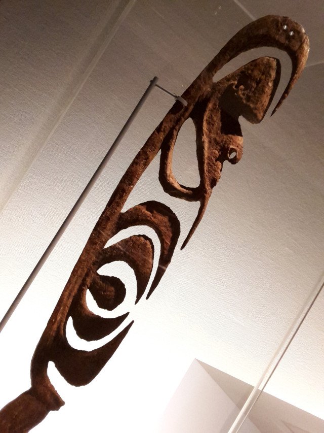
This is a Yipwon figure, again from West Papua. There were artefacts from all over the region, but for some reason, most of my photos are of Papuan objects. This probably goes back to the project I did in junior school about Papua New Guinea - memories embedded in my subconscious. Anyway, Yipwon figures were ceremonial figures, bringing good luck to the hunt.
Nearby there was a bit of Maori carving demonstrating the cultural links between islands, as a similar iconography appears in a carving made in Tahiti on the other side of the Ocean. My first thought: "Ooh, it's a batleth!"
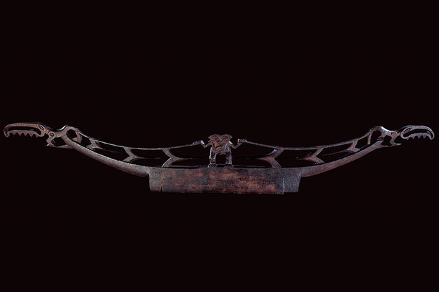
Kataia Lintel - Photo source
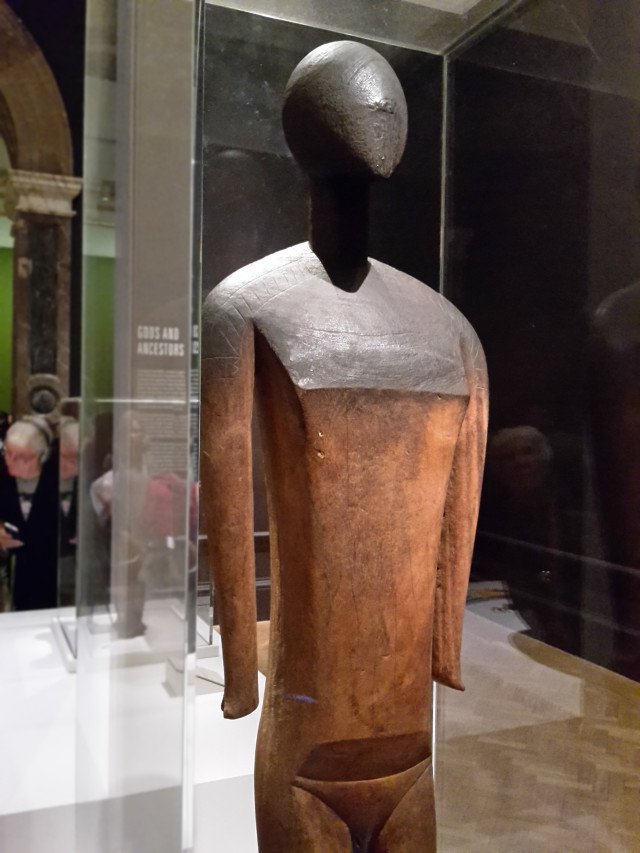
This lad is Ko Kawe, a nineteenth century Tino Aitu male deity figure from the Caroline Islands. It looks like something Henry Moore would have sculpted in the 1950s.
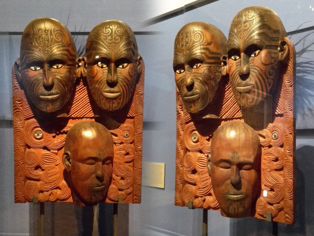
Here's a stonking bit of Maori carving from the end of the nineteenth century. According to the caption: "In 1896 this panel was commissioned from Tene Waitere to illustrate male and female ta moko (facial tattoos)." I love how the lower face is turned away - it gives all three faces personalities.
Lastly, one for the comic fans:
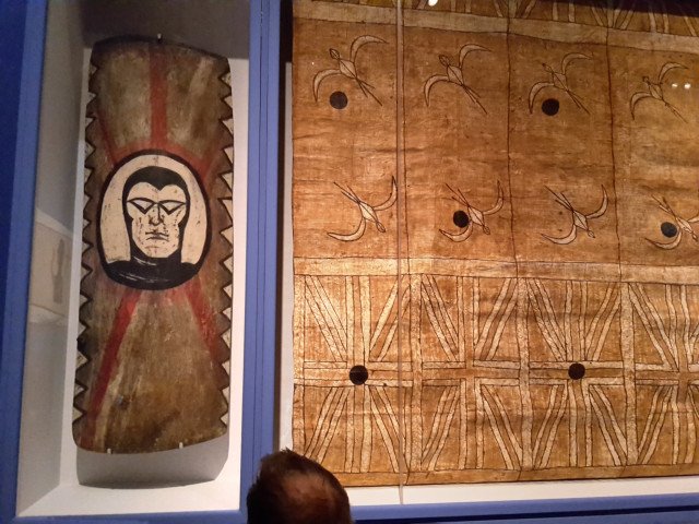
A shield from Wahgi Valley in Papua New Guinea (where else?). In the 1980s the Wahgi were at war and appropriated in their shields images from the colonial powers they had encountered. Thus this excellent rendering of The Ghost Who Walks. No-one wants to risk combat with The Man Who Cannot Die.
The fabric on the right is from nineteenth century Tonga and evokes the same idea - the white men were powerful and therefore their flags and sigils would equally confer power on those who displayed them. I'd put my money on the The Phantom.
All photos mine, except for the Kataia Lintel - Auckland Musuem
[//]:# (!steemitworldmap 51.509346 lat -0.139810 long Oceania d3scr)
Congratulations, Your Post Has Been Added To The Steemit Worldmap!
Author link: http://steemitworldmap.com?author=hockney
Post link: http://steemitworldmap.com?post=oceania-at-the-royal-academy
Want to have your post on the map too?